 |
|
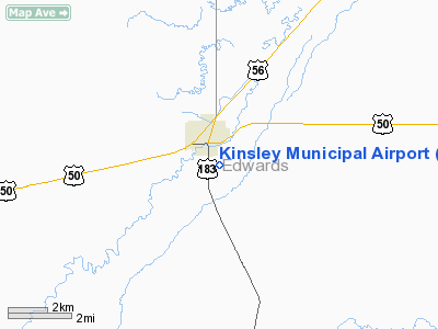
Kinsley Municipal Airport |
|
|
|
Location &
QuickFacts
|
FAA
Information Effective: |
2008-09-25 |
|
Airport
Identifier: |
33K |
|
Airport
Status: |
Operational |
|
Longitude/Latitude: |
099-24-11.1800W/37-54-32.3800N
-99.403106/37.908994 (Estimated) |
|
Elevation: |
2171 ft / 661.72 m (Surveyed) |
|
Land: |
100 acres |
|
From
nearest city: |
0 nautical miles SE of Kinsley, KS |
|
Location: |
Edwards County, KS |
|
Magnetic Variation: |
08E (1990) |
Owner & Manager
|
Ownership: |
Publicly owned |
|
Owner: |
City Of Kinsley |
|
Address: |
Po Box 7
Kinsley, KS 67547 |
|
Phone number: |
620-659-3611 |
|
Manager: |
Jay Dill
CONTACT CITY 620-659-3611 |
|
Address: |
Po Box 7
Kinsley, KS 67547 |
|
Phone number: |
620-659-3611 |
Airport
Operations and Facilities
|
Airport
Use: |
Open to public |
|
Wind
indicator: |
Yes |
|
Segmented Circle: |
No |
|
Control
Tower: |
No |
|
Lighting
Schedule: |
DUSK-DAWN |
|
Beacon
Color: |
Clear-Green (lighted land airport) |
|
Landing
fee charge: |
No |
|
Sectional chart: |
Wichita |
|
Region: |
ACE - Central |
|
Boundary
ARTCC: |
ZKC - Kansas City |
|
Tie-in
FSS: |
ICT - Wichita |
|
FSS on
Airport: |
No |
|
FSS Toll
Free: |
1-800-WX-BRIEF |
|
NOTAMs
Facility: |
ICT (NOTAM-d service avaliable) |
|
Federal Agreements: |
1 |
Airport Communications
|
Runway Information
Runway 18/36
|
Dimension: |
3290 x 56 ft / 1002.8 x 17.1 m |
|
Surface: |
ASPH, Poor Condition
ALLIGATOR CRACKING. |
|
Edge Lights: |
Low
NSTD LIRL; FIRST 180 FT RY 18 UNLGTD; FIRST 385 FT RY 36 UNLGTD . |
|
|
Runway 18
|
Runway 36
|
|
Longitude: |
099-24-08.7210W |
099-24-13.6470W |
|
Latitude: |
37-54-48.5340N |
37-54-16.2220N |
|
Elevation: |
2168.00 ft |
2171.00 ft |
|
Alignment: |
127 |
7 |
|
Traffic
Pattern: |
Left |
Left |
|
Markings: |
Basic, Fair Condition |
Basic, Good Condition |
|
Obstruction: |
45 ft trees, 1700.0 ft from runway, 33:1 slope to clear |
, 50:1 slope to clear |
|
Radio Navigation Aids
|
ID |
Type |
Name |
Ch |
Freq |
Var |
Dist |
|
LQR |
NDB |
Larned |
|
296.00 |
08E |
23.2 nm |
|
PTT |
NDB |
Pratt |
|
356.00 |
07E |
33.1 nm |
|
HIL |
NDB |
Hilyn |
|
338.00 |
08E |
35.9 nm |
|
DDC |
VORTAC |
Dodge City |
019X |
108.20 |
08E |
28.8 nm |
Remarks
-
165' TWR 4000' N
AND 1000' W OF AER 18.
Based Aircraft
|
Aircraft based
on field: |
3 |
|
Single Engine
Airplanes: |
2 |
|
Multi Engine
Airplanes: |
1 |
Operational Statistics
Time Period: 2007-08-08 - 2008-08-06
|
Aircraft
Operations: |
45/Week |
|
General
Aviation Local: |
65.2% |
|
General
Aviation Itinerant: |
34.8% |
Kinsley Municipal Airport
Address:
Edwards County, KS
Tel:
620-659-3611
Images
and information placed above are from
http://www.airport-data.com/airport/33K/
We
thank them for the data!
|
General Info |
| Country |
United
States |
| State |
KANSAS
|
| FAA ID |
33K
|
| Latitude |
37-54-32.380N |
|
Longitude |
099-24-11.180W |
|
Elevation |
2171
feet |
| Near
City |
KINSLEY
|
We don't guarantee the information is fresh and accurate. The data may
be wrong or outdated.
For more up-to-date information please refer to other sources.
|
|


