 |
|
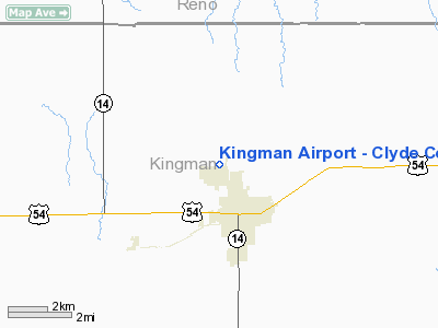
Kingman Airport - Clyde Cessna Field Airport |
|
|
|
Location &
QuickFacts
|
FAA
Information Effective: |
2008-09-25 |
|
Airport
Identifier: |
9K8 |
|
Airport
Status: |
Operational |
|
Longitude/Latitude: |
098-07-25.9860W/37-40-08.4450N
-98.123885/37.669013 (Estimated) |
|
Elevation: |
1605 ft / 489.20 m (Surveyed) |
|
Land: |
305 acres |
|
From
nearest city: |
1 nautical miles NW of Kingman, KS |
|
Location: |
Kingman County, KS |
|
Magnetic Variation: |
06E (2005) |
Owner & Manager
|
Ownership: |
Publicly owned |
|
Owner: |
City Of Kingman |
|
Address: |
Rt 1, Box 162
Kingman, KS 67068 |
|
Phone number: |
620-532-3111 |
|
Manager: |
Allen Kerschen |
|
Address: |
Box 23
Kingman, KS 67068 |
|
Phone number: |
620-532-3574 |
Airport
Operations and Facilities
|
Airport
Use: |
Open to public |
|
Wind
indicator: |
Yes |
|
Segmented Circle: |
Yes |
|
Control
Tower: |
No |
|
Lighting
Schedule: |
DUSK-DAWN
ACTVT HIRL RY 18/36; PAPI RYS 18 & 36; REIL RYS 18 & 36 - CTAF. |
|
Beacon
Color: |
Clear-Green (lighted land airport) |
|
Landing
fee charge: |
No |
|
Sectional chart: |
Wichita |
|
Region: |
ACE - Central |
|
Boundary
ARTCC: |
ZKC - Kansas City |
|
Tie-in
FSS: |
ICT - Wichita |
|
FSS on
Airport: |
No |
|
FSS Toll
Free: |
1-800-WX-BRIEF |
|
NOTAMs
Facility: |
ICT (NOTAM-d service avaliable) |
|
Federal Agreements: |
N |
Airport Communications
|
CTAF: |
122.800 |
|
Unicom: |
122.800 |
Airport Services
|
Fuel
available: |
100LL |
|
Airframe
Repair: |
MAJOR |
|
Power
Plant Repair: |
MAJOR |
|
Bottled
Oxygen: |
NONE |
|
Bulk
Oxygen: |
NONE |
|
Runway Information
Runway 11/29
|
Dimension: |
3400 x 60 ft / 1036.3 x 18.3 m |
|
Surface: |
CONC, Good Condition |
|
Weight Limit: |
Single wheel: 30000 lbs.
Dual wheel: 30000 lbs. |
|
|
Runway 11
|
Runway 29
|
|
Longitude: |
098-07-51.7500W |
098-07-13.9200W |
|
Latitude: |
37-40-20.2400N |
37-40-05.2100N |
|
Elevation: |
1607.00 ft |
1591.00 ft |
|
Alignment: |
117 |
127 |
|
Traffic
Pattern: |
Left |
Right |
|
Markings: |
Non-precision instrument, Good Condition |
Non-precision instrument, Good Condition |
|
Obstruction: |
|
25 ft pline, 1000.0 ft from runway, 32:1 slope to clear |
|
Runway 18/36
|
Dimension: |
4300 x 75 ft / 1310.6 x 22.9 m |
|
Surface: |
CONC, Good Condition |
|
Weight Limit: |
Single wheel: 30000 lbs.
Dual wheel: 30000 lbs. |
|
Edge Lights: |
High |
|
|
Runway 18
|
Runway 36
|
|
Longitude: |
098-07-16.7600W |
098-07-24.3800W |
|
Latitude: |
37-40-26.1000N |
37-39-44.0200N |
|
Elevation: |
1599.00 ft |
1597.00 ft |
|
Alignment: |
127 |
8 |
|
Traffic
Pattern: |
Right |
Left |
|
Markings: |
Non-precision instrument, Good Condition |
Non-precision instrument, Good Condition |
|
Crossing
Height: |
36.00 ft |
36.00 ft |
|
VASI: |
4-light PAPI on left side |
4-light PAPI on left side |
|
Visual
Glide Angle: |
3.00° |
3.00° |
|
Runway End
Identifier: |
Yes |
Yes |
|
Obstruction: |
13 ft road, 550.0 ft from runway, 26:1 slope to clear |
40 ft trees, 1600.0 ft from runway, 35:1 slope to clear |
|
Radio Navigation Aids
|
ID |
Type |
Name |
Ch |
Freq |
Var |
Dist |
|
PTT |
NDB |
Pratt |
|
356.00 |
07E |
29.8 nm |
|
IC |
NDB |
Piche |
|
332.00 |
07E |
32.3 nm |
|
EGT |
NDB |
Wellington |
|
414.00 |
07E |
40.7 nm |
|
LYO |
NDB |
Lyons |
|
386.00 |
06E |
41.1 nm |
|
MPR |
NDB |
Mc Pherson |
|
227.00 |
06E |
45.8 nm |
|
EWK |
NDB |
Newton |
|
281.00 |
06E |
46.8 nm |
|
IAB |
TACAN |
Mc Connell |
112X |
|
07E |
40.8 nm |
|
HUT |
VOR/DME |
Hutchinson |
115X |
116.80 |
09E |
21.7 nm |
|
ICT |
VORTAC |
Wichita |
085X |
113.80 |
07E |
26.1 nm |
|
ANY |
VORTAC |
Anthony |
076X |
112.90 |
07E |
30.7 nm |
|
ICT |
VOT |
Wichita |
|
114.00 |
|
32.9 nm |
Based Aircraft
|
Aircraft based
on field: |
17 |
|
Single Engine
Airplanes: |
17 |
Operational Statistics
Time Period: 2006-01-19 - 2007-01-18
|
Aircraft
Operations: |
185/Week |
|
General
Aviation Local: |
60.4% |
|
General
Aviation Itinerant: |
39.6% |
Kingman Airport - Clyde Cessna Field
Airport
Address:
Kingman County, KS
Tel:
620-532-3111, 620-532-3574
Images
and information placed above are from
http://www.airport-data.com/airport/9K8/
We
thank them for the data!
|
General Info |
| Country |
United
States |
| State |
KANSAS
|
| FAA ID |
9K8
|
| Latitude |
37-40-08.445N |
|
Longitude |
098-07-25.986W |
|
Elevation |
1605
feet |
| Near
City |
KINGMAN
|
We don't guarantee the information is fresh and accurate. The data may
be wrong or outdated.
For more up-to-date information please refer to other sources.
|
|


