 |
|
|
Location & QuickFacts
|
FAA Information Effective: |
2008-09-25 |
|
Airport Identifier: |
1KS5 |
|
Airport Status: |
Operational |
|
Longitude/Latitude: |
096-05-46.9750W/39-09-44.9910N
-96.096382/39.162498 (Estimated) |
|
Elevation: |
950 ft / 289.56 m (Estimated) |
|
Land: |
0 acres |
|
From nearest city: |
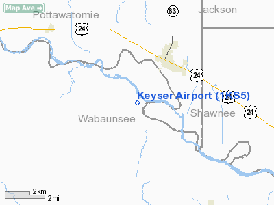
3 nautical miles SW of St Marys, KS |
|
Location: |
Wabaunsee County, KS |
|
Magnetic Variation: |
06E (1985) |
Owner & Manager
|
Ownership: |
Privately owned |
|
Owner: |
Royce A Keyser |
|
Address: |
38976 Turkey Creek Rd
Maple Hill, KS 66507 |
|
Phone number: |
785-437-6684 |
|
Manager: |
Royce A. Keyser |
|
Address: |
38976 Turkey Creek Rd
Maple Hill, KS 66507 |
|
Phone number: |
785-437-6684 |
Airport Operations and
Facilities
|
Airport Use: |
Private |
|
Wind indicator: |
No |
|
Segmented Circle: |
No |
|
Control Tower: |
No |
|
Landing fee charge: |
No |
|
Sectional chart: |
Kansas City |
|
Region: |
ACE - Central |
|
Boundary ARTCC: |
ZKC - Kansas City |
|
Tie-in FSS: |
ICT - Wichita |
|
FSS on Airport: |
No |
|
FSS Toll Free: |
1-800-WX-BRIEF |
|
Runway Information
Runway 18/36
|
Dimension: |
1500 x 50 ft / 457.2 x 15.2 m |
|
Surface: |
TURF, |
|
|
Runway 18
|
Runway 36
|
|
Traffic
Pattern: |
Left |
Left |
|
Radio Navigation Aids
|
ID |
Type |
Name |
Ch |
Freq |
Var |
Dist |
|
TO |
NDB |
Biloy |
|
521.00 |
05E |
19.2 nm |
|
MQD |
NDB |
Mc Dowell Creek |
|
391.00 |
06E |
25.0 nm |
|
CVY |
NDB |
Cavalry |
|
314.00 |
06E |
33.6 nm |
|
HRU |
NDB |
Herington |
|
407.00 |
06E |
43.8 nm |
|
MYZ |
NDB |
Marysville |
|
341.00 |
06E |
48.4 nm |
|
FOE |
TACAN |
Forbes |
053X |
|
05E |
24.1 nm |
|
FRI |
VOR |
Fort Riley |
|
109.40 |
06E |
37.5 nm |
|
MHK |
VOR/DME |
Manhattan |
039X |
110.20 |
06E |
26.7 nm |
|
TOP |
VORTAC |
Topeka |
125X |
117.80 |
05E |
25.6 nm |
|
FOE |
VOT |
Forbes |
|
111.00 |
|
23.7 nm |
Based Aircraft
|
Aircraft based
on field: |
1 |
|
Ultralights: |
1 |
Keyser Airport
Address:
Wabaunsee County, KS
Tel:
785-437-6684
Images
and information placed above are from
http://www.airport-data.com/airport/1KS5/
We
thank them for the data!
|
General Info |
| Country |
United
States |
| State |
KANSAS
|
| FAA ID |
1KS5
|
| Latitude |
39-09-44.991N |
|
Longitude |
096-05-46.975W |
|
Elevation |
950 feet
|
| Near
City |
ST MARYS
|
We don't guarantee the information is fresh and accurate. The data may
be wrong or outdated.
For more up-to-date information please refer to other sources.
|
|


