 |
|
|
Location &
QuickFacts
|
FAA
Information Effective: |
2008-09-25 |
|
Airport
Identifier: |
0KS6 |
|
Airport
Status: |
Operational |
|
Longitude/Latitude: |
097-19-04.1610W/37-27-08.0700N
-97.317823/37.452242 (Estimated) |
|
Elevation: |
1240 ft / 377.95 m (Estimated) |
|
Land: |
0 acres |
|
From
nearest city: |
3 nautical miles SE of Peck, KS |
|
Location: |
Sumner County, KS |
|
Magnetic Variation: |
07E (1985) |
Owner & Manager
|
Ownership: |
Privately owned |
|
Owner: |
Richard E & Ruth L Kendrigan |
|
Address: |
0.04 N Hydraulic Rd
Peck, KS 67120-9054 |
|
Phone number: |
316-524-1307 |
|
Address: |
|
Airport Operations and Facilities
|
Airport
Use: |
Private |
|
Wind
indicator: |
Yes |
|
Segmented Circle: |
No |
|
Control
Tower: |
No |
|
Landing
fee charge: |
No |
|
Sectional chart: |
Wichita |
|
Region: |
ACE - Central |
|
Boundary
ARTCC: |
ZKC - Kansas City |
|
Tie-in
FSS: |
ICT - Wichita |
|
FSS on
Airport: |
No |
|
FSS Toll
Free: |
1-800-WX-BRIEF |
|
Runway Information
Runway E/W
|
Dimension: |
2295 x 100 ft / 699.5 x 30.5 m |
|
Surface: |
TURF, |
|
|
Runway E
|
Runway W
|
|
Traffic
Pattern: |
Left |
Left |
|
Displaced
threshold: |
340.00 ft
DISPLACEMENT PROVIDES 17' CLNC OVER TURNPIKE. |
340.00 ft
DISPLCD THR PROVIDES 17' CLNC OVER ROAD. |
|
Radio Navigation Aids
|
ID |
Type |
Name |
Ch |
Freq |
Var |
Dist |
|
EGT |
NDB |
Wellington |
|
414.00 |
07E |
8.5 nm |
|
IC |
NDB |
Piche |
|
332.00 |
07E |
10.0 nm |
|
EQA |
NDB |
El Dorado |
|
383.00 |
05E |
30.9 nm |
|
EWK |
NDB |
Newton |
|
281.00 |
06E |
36.8 nm |
|
PN |
NDB |
Ponca |
|
515.00 |
05E |
39.1 nm |
|
IAB |
TACAN |
Mc Connell |
112X |
|
07E |
10.5 nm |
|
HUT |
VOR/DME |
Hutchinson |
115X |
116.80 |
09E |
43.9 nm |
|
ICT |
VORTAC |
Wichita |
085X |
113.80 |
07E |
21.7 nm |
|
PER |
VORTAC |
Pioneer |
079X |
113.20 |
06E |
43.1 nm |
|
ANY |
VORTAC |
Anthony |
076X |
112.90 |
07E |
44.4 nm |
|
ICT |
VOT |
Wichita |
|
114.00 |
|
12.4 nm |
Based Aircraft
|
Aircraft based
on field: |
1 |
|
Single Engine
Airplanes: |
1 |
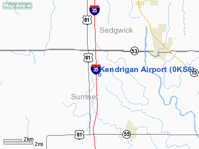
Kendrigan Airport
Address:
Sumner County, KS
Tel:
316-524-1307
Images
and information placed above are from
http://www.airport-data.com/airport/0KS6/
We
thank them for the data!
|
General Info |
| Country |
United
States |
| State |
KANSAS
|
| FAA ID |
0KS6
|
| Latitude |
37-27-08.070N |
|
Longitude |
097-19-04.161W |
|
Elevation |
1240
feet |
| Near
City |
PECK
|
We don't guarantee the information is fresh and accurate. The data may
be wrong or outdated.
For more up-to-date information please refer to other sources.
|
|


