 |
|
|
Location &
QuickFacts
|
FAA
Information Effective: |
2008-09-25 |
|
Airport
Identifier: |
SN70 |
|
Airport
Status: |
Operational |
|
Longitude/Latitude: |
097-57-16.2130W/37-15-05.0720N
-97.954504/37.251409 (Estimated) |
|
Elevation: |
1379 ft / 420.32 m (Estimated) |
|
Land: |
0 acres |
|
From
nearest city: |
4 nautical miles SE of Harper, KS |
|
Location: |
Harper County, KS |
|
Magnetic Variation: |
07E (1985) |
Owner & Manager
|
Ownership: |
Privately owned |
|
Owner: |
Delmar Hostetler |
|
Address: |
Rt 2, Box 134
Harper, KS 67058 |
|
Phone number: |
316-896-2428 |
|
Manager: |
Delmar Hostetler |
|
Address: |
Rt 2, Box 134
Harper, KS 67058 |
|
Phone number: |
316-896-2428 |
Airport Operations and Facilities
|
Airport Use: |
Private |
|
Wind indicator: |
Yes |
|
Segmented Circle: |
No |
|
Control Tower: |
No |
|
Landing fee charge: |
No |
|
Sectional chart: |
Wichita |
|
Region: |
ACE - Central |
|
Boundary ARTCC: |
ZKC - Kansas City |
|
Tie-in FSS: |
ICT - Wichita |
|
FSS on Airport: |
No |
|
FSS Toll Free: |
1-800-WX-BRIEF |
Airport Services
|
Airframe
Repair: |
MAJOR |
|
Power
Plant Repair: |
MAJOR |
|
Runway Information
Runway E/W
|
Dimension: |
1565 x 40 ft / 477.0 x 12.2 m |
|
Surface: |
TURF, |
|
|
Runway E
|
Runway W
|
|
Traffic
Pattern: |
Left |
Left |
|
Runway N/S
|
Dimension: |
2300 x 40 ft / 701.0 x 12.2 m |
|
Surface: |
TURF, |
|
|
Runway N
|
Runway S
|
|
Traffic
Pattern: |
Left |
Left |
|
Radio Navigation Aids
|
ID |
Type |
Name |
Ch |
Freq |
Var |
Dist |
|
EGT |
NDB |
Wellington |
|
414.00 |
07E |
27.3 nm |
|
IC |
NDB |
Piche |
|
332.00 |
07E |
30.9 nm |
|
AVK |
NDB |
Alva |
|
203.00 |
08E |
44.6 nm |
|
PTT |
NDB |
Pratt |
|
356.00 |
07E |
47.3 nm |
|
PN |
NDB |
Ponca |
|
515.00 |
05E |
48.3 nm |
|
IAB |
TACAN |
Mc Connell |
112X |
|
07E |
39.6 nm |
|
HUT |
VOR/DME |
Hutchinson |
115X |
116.80 |
09E |
44.8 nm |
|
ANY |
VORTAC |
Anthony |
076X |
112.90 |
07E |
11.8 nm |
|
ICT |
VORTAC |
Wichita |
085X |
113.80 |
07E |
34.5 nm |
|
PER |
VORTAC |
Pioneer |
079X |
113.20 |
06E |
48.7 nm |
|
ICT |
VOT |
Wichita |
|
114.00 |
|
34.0 nm |
Based Aircraft
|
Aircraft based
on field: |
4 |
|
Single Engine
Airplanes: |
4 |
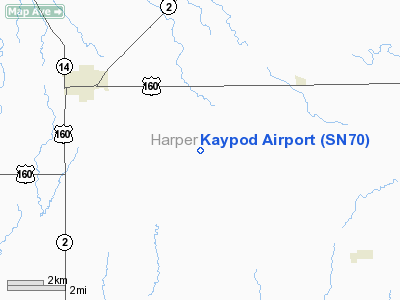
Kaypod Airport
Address:
Harper County, KS
Tel:
316-896-2428
Images
and information placed above are from
http://www.airport-data.com/airport/SN70/
We
thank them for the data!
|
General Info |
| Country |
United
States |
| State |
KANSAS
|
| FAA ID |
SN70
|
| Latitude |
37-15-05.072N |
|
Longitude |
097-57-16.213W |
|
Elevation |
1379
feet |
| Near
City |
HARPER
|
We don't guarantee the information is fresh and accurate. The data may
be wrong or outdated.
For more up-to-date information please refer to other sources.
|
|


