 |
|
|
|
|
Location &
QuickFacts
|
FAA
Information Effective: |
2008-09-25 |
|
Airport
Identifier: |
9KS3 |
|
Airport
Status: |
Operational |
|
Longitude/Latitude: |
097-23-18.1630W/37-42-37.0470N
-97.388379/37.710291 (Estimated) |
|
Elevation: |
1330 ft / 405.38 m (Estimated) |
|
Land: |
0 acres |
|
From
nearest city: |
0 nautical miles N of Wichita, KS |
|
Location: |
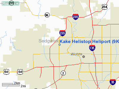
Sedgwick County, KS |
|
Magnetic Variation: |
07E (1985) |
Owner & Manager
|
Ownership: |
Privately owned |
|
Owner: |
Chronicle Broadcasting |
|
Address: |
1500 N. West St
Wichita, KS 67203 |
|
Phone
number: |
316-943-4221 |
|
Manager: |
Ron Collins |
|
Address: |
1500 N. West St
Wichita, KS 67203 |
|
Phone number: |
316-943-4221 |
Airport Operations and Facilities
|
Airport Use: |
Private |
|
Wind indicator: |
Yes |
|
Segmented Circle: |
No |
|
Control Tower: |
No |
|
Landing fee charge: |
No |
|
Sectional chart: |
Wichita |
|
Region: |
ACE - Central |
|
Boundary ARTCC: |
ZKC - Kansas City |
|
Tie-in FSS: |
ICT - Wichita |
|
FSS on Airport: |
No |
|
FSS Toll Free: |
1-800-WX-BRIEF |
Airport Services
|
Airframe
Repair: |
NONE |
|
Power
Plant Repair: |
NONE |
|
Bottled
Oxygen: |
NONE |
|
Bulk
Oxygen: |
NONE |
|
Runway Information
Helipad H1
|
Dimension: |
100 x 100 ft / 30.5 x 30.5 m |
|
Surface: |
TURF, |
|
|
Runway H1
|
Runway
|
|
Traffic
Pattern: |
Left |
Left |
|
Radio Navigation Aids
|
ID |
Type |
Name |
Ch |
Freq |
Var |
Dist |
|
IC |
NDB |
Piche |
|
332.00 |
07E |
8.6 nm |
|
EWK |
NDB |
Newton |
|
281.00 |
06E |
22.0 nm |
|
EGT |
NDB |
Wellington |
|
414.00 |
07E |
23.2 nm |
|
EQA |
NDB |
El Dorado |
|
383.00 |
05E |
27.5 nm |
|
MPR |
NDB |
Mc Pherson |
|
227.00 |
06E |
40.9 nm |
|
IAB |
TACAN |
Mc Connell |
112X |
|
07E |
7.8 nm |
|
HUT |
VOR/DME |
Hutchinson |
115X |
116.80 |
09E |
31.1 nm |
|
ICT |
VORTAC |
Wichita |
085X |
113.80 |
07E |
9.5 nm |
|
ANY |
VORTAC |
Anthony |
076X |
112.90 |
07E |
49.9 nm |
|
ICT |
VOT |
Wichita |
|
114.00 |
|
4.9 nm |
Remarks
-
HELISTOP WITHIN WICHITA MID CONT.
AIRPORT TRAFFIC AREA.
-
PRVDD APCH/DEP
PATHS TO THE LNDG AREA ARE MAINTD FOR A MIN 8:1 GLIDE SLOPE AND THE
TRANSITIONAL SFC BE MAINTD FOR A MIN 2:1 SLOPE.
Kake Helistop Heliport
Address:
Sedgwick County, KS
Tel:
316-943-4221
Images
and information placed above are from
http://www.airport-data.com/airport/9KS3/
We
thank them for the data!
|
General Info |
| Country |
United
States |
| State |
KANSAS
|
| FAA ID |
9KS3
|
| Latitude |
37-42-37.047N |
|
Longitude |
097-23-18.163W |
|
Elevation |
1330
feet |
| Near
City |
WICHITA
|
We don't guarantee the information is fresh and accurate. The data may
be wrong or outdated.
For more up-to-date information please refer to other sources.
|
|


