 |
|
|
Location &
QuickFacts
|
FAA
Information Effective: |
2008-09-25 |
|
Airport
Identifier: |
02KS |
|
Airport
Status: |
Operational |
|
Longitude/Latitude: |
096-03-18.9740W/39-13-19.9880N
-96.055271/39.222219 (Estimated) |
|
Elevation: |
1170 ft / 356.62 m (Estimated) |
|
Land: |
70 acres |
|
From
nearest city: |
2 nautical miles N of St Marys, KS |
|
Location: |
Pottawatomie County, KS |
|
Magnetic Variation: |
06E (1985) |
Owner & Manager
|
Ownership: |
Privately owned |
|
Owner: |
Bill & Pat Linn |
|
Address: |
28155 Ryan's Way Road
St Mary's, KS 66536-9763 |
|
Phone
number: |
785-437-3210 |
|
Manager: |
Bill & Pat Linn |
|
Address: |
28155 Ryan's Way Road
St Mary's, KS 66536-9763 |
|
Phone number: |
785-437-3210 |
Airport Operations and Facilities
|
Airport
Use: |
Private |
|
Wind
indicator: |
Yes |
|
Segmented Circle: |
Yes |
|
Control
Tower: |
No |
|
Sectional chart: |
Kansas City |
|
Region: |
ACE - Central |
|
Boundary
ARTCC: |
ZKC - Kansas City |
|
Tie-in
FSS: |
ICT - Wichita |
|
FSS Toll
Free: |
1-800-WX-BRIEF |
|
Runway Information
Runway 11/29
|
Dimension: |
1650 x 100 ft / 502.9 x 30.5 m |
|
Surface: |
TURF, |
|
|
Runway 11
|
Runway 29
|
|
Traffic
Pattern: |
Right |
Left |
|
Runway 18/36
|
Dimension: |
1950 x 150 ft / 594.4 x 45.7 m |
|
Surface: |
TURF, |
|
|
Runway 18
|
Runway 36
|
|
Traffic
Pattern: |
Left |
Left |
|
Radio Navigation Aids
|
ID |
Type |
Name |
Ch |
Freq |
Var |
Dist |
|
TO |
NDB |
Biloy |
|
521.00 |
05E |
18.2 nm |
|
MQD |
NDB |
Mc Dowell Creek |
|
391.00 |
06E |
27.5 nm |
|
CVY |
NDB |
Cavalry |
|
314.00 |
06E |
36.4 nm |
|
MYZ |
NDB |
Marysville |
|
341.00 |
06E |
46.4 nm |
|
HRU |
NDB |
Herington |
|
407.00 |
06E |
47.5 nm |
|
FOE |
TACAN |
Forbes |
053X |
|
05E |
24.7 nm |
|
FRI |
VOR |
Fort Riley |
|
109.40 |
06E |
40.5 nm |
|
MHK |
VOR/DME |
Manhattan |
039X |
110.20 |
06E |
29.0 nm |
|
RBA |
VOR/DME |
Robinson |
019X |
108.20 |
04E |
47.8 nm |
|
TOP |
VORTAC |
Topeka |
125X |
117.80 |
05E |
24.1 nm |
|
FOE |
VOT |
Forbes |
|
111.00 |
|
24.3 nm |
Remarks
-
ALL TRAFFIC
REMAIN SOUTH OF THE RYS.
-
PRVDD MAINT A
MINIMUM 20:1 GLIDE SLOPE; TRANSITIONAL SURFACE MAINT FOR A 7:1.
Based Aircraft
|
Aircraft based
on field: |
1 |
|
Single Engine
Airplanes: |
1 |
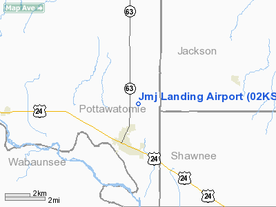
Jmj Landing Airport
Address:
Pottawatomie County, KS
Tel:
785-437-3210
Images
and information placed above are from
http://www.airport-data.com/airport/02KS/
We
thank them for the data!
|
General Info |
| Country |
United
States |
| State |
KANSAS
|
| FAA ID |
02KS
|
| Latitude |
39-13-19.988N |
|
Longitude |
096-03-18.974W |
|
Elevation |
1170
feet |
| Near
City |
ST MARYS
|
We don't guarantee the information is fresh and accurate. The data may
be wrong or outdated.
For more up-to-date information please refer to other sources.
|
|


