 |
|
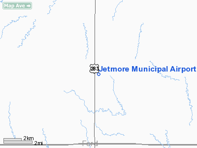
Jetmore Municipal Airport |
|
|
|
Location &
QuickFacts
|
FAA
Information Effective: |
2008-09-25 |
|
Airport
Identifier: |
K79 |
|
Airport
Status: |
Operational |
|
Longitude/Latitude: |
099-53-39.5800W/37-59-04.0400N
-99.894328/37.984456 (Estimated) |
|
Elevation: |
2466 ft / 751.64 m (Surveyed) |
|
Land: |
1181 acres |
|
From
nearest city: |
6 nautical miles S of Jetmore, KS |
|
Location: |
Hodgeman County, KS |
|
Magnetic Variation: |
08E (1990) |
Owner & Manager
|
Ownership: |
Publicly owned |
|
Owner: |
City Of Jetmore |
|
Address: |
Box 8
Jetmore, KS 67854 |
|
Phone number: |
620-357-8344 |
|
Manager: |
Ray Burns
CITY SUPERINTENDENT. |
|
Address: |
Box 8
Jetmore, KS 67854 |
|
Phone number: |
620-357-6112 |
Airport
Operations and Facilities
|
Airport
Use: |
Open to public |
|
Wind
indicator: |
Yes |
|
Segmented Circle: |
No |
|
Control
Tower: |
No |
|
Lighting
Schedule: |
DUSK-DAWN
ACTVT LIRL RY 17/35 - CTAF. |
|
Beacon
Color: |
Clear-Green (lighted land airport) |
|
Landing
fee charge: |
No |
|
Sectional chart: |
Wichita |
|
Region: |
ACE - Central |
|
Boundary
ARTCC: |
ZKC - Kansas City |
|
Tie-in
FSS: |
ICT - Wichita |
|
FSS on
Airport: |
No |
|
FSS Toll
Free: |
1-800-WX-BRIEF |
|
NOTAMs
Facility: |
ICT (NOTAM-d service avaliable) |
|
Federal Agreements: |
PR |
Airport Communications
|
CTAF: |
122.700 |
|
Unicom: |
122.700 |
Airport Services
|
Airframe
Repair: |
NONE |
|
Power
Plant Repair: |
NONE |
|
Runway Information
Runway 17/35
|
Dimension: |
4205 x 75 ft / 1281.7 x 22.9 m |
|
Surface: |
ASPH-CONC, Good Condition |
|
Weight Limit: |
Single wheel: 15000 lbs. |
|
Edge Lights: |
Non-standard lighting system
NSTD LIRL DUE TO SPACING & NUMBER OF LGTS. |
|
|
Runway 17
|
Runway 35
|
|
Longitude: |
099-53-39.1090W |
099-53-40.0450W |
|
Latitude: |
37-59-24.8200N |
37-58-43.2650N |
|
Elevation: |
2462.00 ft |
2465.00 ft |
|
Alignment: |
127 |
1 |
|
Traffic
Pattern: |
Left |
Left |
|
Markings: |
Basic, Good Condition |
Basic, Good Condition |
|
Radio Navigation Aids
|
ID |
Type |
Name |
Ch |
Freq |
Var |
Dist |
|
LQR |
NDB |
Larned |
|
296.00 |
08E |
40.4 nm |
|
GC |
NDB |
Pieve |
|
347.00 |
09E |
40.5 nm |
|
MEJ |
NDB |
Meade |
|
389.00 |
09E |
47.5 nm |
|
DDC |
VORTAC |
Dodge City |
019X |
108.20 |
08E |
9.6 nm |
|
GCK |
VORTAC |
Garden City |
080X |
113.30 |
11E |
39.6 nm |
Remarks
-
NO PUBLIC TELEPHONE.
-
EXISTED PRIOR TO 1959.
Based Aircraft
|
Aircraft based
on field: |
1 |
|
Single Engine
Airplanes: |
1 |
Operational Statistics
Time Period: 2005-08-30 - 2006-08-29
|
Aircraft
Operations: |
12/Week |
|
General
Aviation Local: |
83.3% |
|
General
Aviation Itinerant: |
16.7% |
Jetmore Municipal Airport
Address:
Hodgeman County, KS
Tel:
620-357-8344, 620-357-6112
Images
and information placed above are from
http://www.airport-data.com/airport/K79/
We
thank them for the data!
|
General Info |
| Country |
United
States |
| State |
KANSAS
|
| FAA ID |
K79
|
| Latitude |
37-59-04.040N |
|
Longitude |
099-53-39.580W |
|
Elevation |
2466
feet |
| Near
City |
JETMORE
|
We don't guarantee the information is fresh and accurate. The data may
be wrong or outdated.
For more up-to-date information please refer to other sources.
|
|


