 |
|
|
Location &
QuickFacts
|
FAA
Information Effective: |
2008-09-25 |
|
Airport
Identifier: |
SN12 |
|
Airport
Status: |
Operational |
|
Longitude/Latitude: |
100-28-16.5380W/37-21-50.0830N
-100.471261/37.363912 (Estimated) |
|
Elevation: |
2737 ft / 834.24 m (Estimated) |
|
Land: |
0 acres |
|
From
nearest city: |
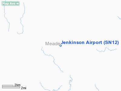
8 nautical miles NW of Meade, KS |
|
Location: |
Meade County, KS |
|
Magnetic Variation: |
09E (1985) |
Owner & Manager
|
Ownership: |
Privately owned |
|
Owner: |
J.j. Jenkinson Jr. |
|
Address: |
Rr 2 Box 105
Montezuma, KS 67867 |
|
Phone number: |
316-846-2456 |
|
Address: |
|
Airport
Operations and Facilities
|
Airport
Use: |
Private |
|
Wind
indicator: |
Yes |
|
Segmented Circle: |
No |
|
Control
Tower: |
No |
|
Lighting
Schedule: |
PHONE REQ
FOR LIRL RY 01/19 CALL 316-873-2287. |
|
Sectional chart: |
Wichita |
|
Region: |
ACE - Central |
|
Boundary
ARTCC: |
ZKC - Kansas City |
|
Tie-in
FSS: |
ICT - Wichita |
|
FSS Toll
Free: |
1-800-WX-BRIEF |
|
Runway Information
Runway 01/19
|
Dimension: |
3500 x 75 ft / 1066.8 x 22.9 m |
|
Surface: |
TURF, |
|
Edge Lights: |
Low |
|
|
Runway 01
|
Runway 19
|
|
Traffic
Pattern: |
Left |
Left |
|
Runway 12/30
|
Dimension: |
3030 x 50 ft / 923.5 x 15.2 m |
|
Surface: |
TURF, |
|
|
Runway 12
|
Runway 30
|
|
Traffic
Pattern: |
Left |
Left |
|
Radio Navigation Aids
|
ID |
Type |
Name |
Ch |
Freq |
Var |
Dist |
|
MEJ |
NDB |
Meade |
|
389.00 |
09E |
7.2 nm |
|
GC |
NDB |
Pieve |
|
347.00 |
09E |
30.4 nm |
|
HQG |
NDB |
Hugoton |
|
365.00 |
09E |
44.9 nm |
|
ULS |
NDB |
Ulysses |
|
395.00 |
09E |
45.0 nm |
|
LBL |
VORTAC |
Liberal |
070X |
112.30 |
11E |
30.7 nm |
|
GCK |
VORTAC |
Garden City |
080X |
113.30 |
11E |
35.5 nm |
|
DDC |
VORTAC |
Dodge City |
019X |
108.20 |
08E |
36.7 nm |
Remarks
-
PRVDD APCH TO
EACH RWY MAINTAINED FOR A MINIMUM 20:1 GLIDE SLOPE AND ARPT TRANSITIONAL SFC
MAINTAINED FOR A 7:1 SLOPE.
Jenkinson Airport
Address:
Marion County, FL
Tel:
316-846-2456
Images
and information placed above are from
http://www.airport-data.com/airport/SN12/
We
thank them for the data!
|
General Info |
| Country |
United
States |
| State |
KANSAS
|
| FAA ID |
SN12
|
| Latitude |
37-21-50.083N |
|
Longitude |
100-28-16.538W |
|
Elevation |
2737
feet |
| Near
City |
MEADE
|
We don't guarantee the information is fresh and accurate. The data may
be wrong or outdated.
For more up-to-date information please refer to other sources.
|
|


