 |
|
|
Location &
QuickFacts
|
FAA
Information Effective: |
2008-09-25 |
|
Airport
Identifier: |
SN00 |
|
Airport
Status: |
Operational |
|
Longitude/Latitude: |
097-33-01.1180W/38-50-48.7070N
-97.550311/38.846863 (Estimated) |
|
Elevation: |
1211 ft / 369.11 m (Estimated) |
|
Land: |
0 acres |
|
From
nearest city: |
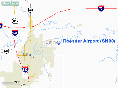
1 nautical miles E of Salina, KS |
|
Location: |
Saline County, KS |
|
Magnetic Variation: |
06E (1995) |
Owner & Manager
|
Ownership: |
Privately owned |
|
Owner: |
Jim Roesner |
|
Address: |
3216 East North
Salina, KS 67401 |
|
Phone number: |
785-825-5599
OFFICE |
|
Address: |
|
Airport
Operations and Facilities
|
Airport
Use: |
Private |
|
Wind
indicator: |
Yes
300 FT W OF RY 18/36. |
|
Segmented Circle: |
No |
|
Control
Tower: |
No |
|
Sectional chart: |
Wichita |
|
Region: |
ACE - Central |
|
Boundary
ARTCC: |
ZKC - Kansas City |
|
Tie-in
FSS: |
ICT - Wichita |
|
FSS Toll
Free: |
1-800-WX-BRIEF |
|
Runway Information
Runway 18/36
|
Dimension: |
1287 x 30 ft / 392.3 x 9.1 m |
|
Surface: |
TURF, |
|
|
Runway 18
|
Runway 36
|
|
Traffic
Pattern: |
Left |
Right |
|
Obstruction: |
28 ft pline, 68.0 ft from runway |
|
|
Radio Navigation Aids
|
ID |
Type |
Name |
Ch |
Freq |
Var |
Dist |
|
MPR |
NDB |
Mc Pherson |
|
227.00 |
06E |
30.6 nm |
|
HRU |
NDB |
Herington |
|
407.00 |
06E |
35.9 nm |
|
CYW |
NDB |
Clay Center |
|
362.00 |
07E |
36.9 nm |
|
CVY |
NDB |
Cavalry |
|
314.00 |
06E |
36.9 nm |
|
CNK |
NDB |
Concordia |
|
335.00 |
06E |
42.7 nm |
|
LYO |
NDB |
Lyons |
|
386.00 |
06E |
43.7 nm |
|
MQD |
NDB |
Mc Dowell Creek |
|
391.00 |
06E |
46.0 nm |
|
EWK |
NDB |
Newton |
|
281.00 |
06E |
48.8 nm |
|
FRI |
VOR |
Fort Riley |
|
109.40 |
06E |
33.1 nm |
|
MHK |
VOR/DME |
Manhattan |
039X |
110.20 |
06E |
44.9 nm |
|
SLN |
VORTAC |
Salina |
118X |
117.10 |
07E |
5.8 nm |
Remarks
-
PRVDD CLEAR 20:1
APCH AND 7:1 TRANSITIONAL SFC.
J Roesner Airport
Address:
Saline County, KS
Tel:
785-825-5599
Images
and information placed above are from
http://www.airport-data.com/airport/SN00/
We
thank them for the data!
|
General Info |
| Country |
United
States |
| State |
KANSAS
|
| FAA ID |
SN00
|
| Latitude |
38-50-48.707N |
|
Longitude |
097-33-01.118W |
|
Elevation |
1211
feet |
| Near
City |
SALINA
|
We don't guarantee the information is fresh and accurate. The data may
be wrong or outdated.
For more up-to-date information please refer to other sources.
|
|


