 |
|
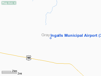
Ingalls Municipal Airport |
|
|
|
Location &
QuickFacts
|
FAA
Information Effective: |
2008-09-25 |
|
Airport
Identifier: |
30K |
|
Airport
Status: |
Operational |
|
Longitude/Latitude: |
100-31-53.7000W/37-54-24.8000N
-100.531583/37.906889 (Estimated) |
|
Elevation: |
2814 ft / 857.71 m (Surveyed) |
|
Land: |
626 acres |
|
From
nearest city: |
6 nautical miles NW of Ingalls, KS |
|
Location: |
Gray County, KS |
|
Magnetic Variation: |
09E (1985) |
Owner & Manager
|
Ownership: |
Publicly owned |
|
Owner: |
City Of Ingalls |
|
Address: |
Box 103
Ingalls, KS 67853 |
|
Phone number: |
620-335-5118 |
|
Manager: |
Ron Wilson |
|
Address: |
Box 103
Ingalls, KS 67853 |
|
Phone number: |
620-272-7878 |
Airport
Operations and Facilities
|
Airport
Use: |
Open to public |
|
Wind
indicator: |
Yes |
|
Segmented Circle: |
No |
|
Control
Tower: |
No |
|
Landing
fee charge: |
No |
|
Sectional chart: |
Wichita |
|
Region: |
ACE - Central |
|
Boundary
ARTCC: |
ZKC - Kansas City |
|
Tie-in
FSS: |
ICT - Wichita |
|
FSS on
Airport: |
No |
|
FSS Toll
Free: |
1-800-WX-BRIEF |
|
NOTAMs
Facility: |
ICT (NOTAM-d service avaliable) |
|
Federal Agreements: |
P |
Airport Communications
Airport Services
|
Airframe
Repair: |
NONE |
|
Power
Plant Repair: |
NONE |
|
Runway Information
Runway 17/35
|
Dimension: |
3000 x 75 ft / 914.4 x 22.9 m
CNTR 75 FT OF 275 FT WIDE CONC SFC; MKD AS RY LEAVING 100 FT WIDE CONC ON
EACH SIDE OF RY FULL LENGTH. |
|
Surface: |
CONC, Poor Condition
VEGETATION & LOOSE PIECES OF CONC IN JOINTS OF RY. |
|
Weight Limit: |
Single wheel: 21000 lbs. |
|
|
Runway 17
|
Runway 35
|
|
Longitude: |
100-31-53.6200W |
100-31-53.8700W |
|
Latitude: |
37-54-39.6200N |
37-54-09.9500N |
|
Traffic
Pattern: |
Left |
Left |
|
Markings: |
Nonstandard, Fair Condition
RWY 17 /35 MARKINGS NSTD WIDTH. |
Nonstandard, Fair Condition
RWY 17/35 MARKINGS NSTD WIDTH |
|
Obstruction: |
, 50:1 slope to clear |
22 ft pole, 870.0 ft from runway, 170 ft left of
centerline, 30:1 slope to clear |
|
Radio Navigation Aids
|
ID |
Type |
Name |
Ch |
Freq |
Var |
Dist |
|
GC |
NDB |
Pieve |
|
347.00 |
09E |
10.3 nm |
|
MEJ |
NDB |
Meade |
|
389.00 |
09E |
38.3 nm |
|
TQK |
NDB |
Scott City |
|
256.00 |
08E |
38.4 nm |
|
ULS |
NDB |
Ulysses |
|
395.00 |
09E |
43.9 nm |
|
GCK |
VORTAC |
Garden City |
080X |
113.30 |
11E |
9.2 nm |
|
DDC |
VORTAC |
Dodge City |
019X |
108.20 |
08E |
25.2 nm |
Remarks
-
NO PUBLIC PHONE AVBL.
-
CONST PRIOR TO 1959.
Based Aircraft
|
Aircraft based
on field: |
3 |
|
Single Engine
Airplanes: |
3 |
Operational Statistics
Time Period: 2005-06-14 - 2006-06-13
|
Aircraft
Operations: |
24/Week |
|
General
Aviation Local: |
100.0% |
Ingalls Municipal Airport
Address:
Gray County, KS
Tel:
620-335-5118, 620-272-7878
Images
and information placed above are from
http://www.airport-data.com/airport/30K/
We
thank them for the data!
|
General Info |
| Country |
United
States |
| State |
KANSAS
|
| FAA ID |
30K
|
| Latitude |
37-54-25.076N |
|
Longitude |
100-31-52.538W |
|
Elevation |
2814
feet |
| Near
City |
INGALLS
|
We don't guarantee the information is fresh and accurate. The data may
be wrong or outdated.
For more up-to-date information please refer to other sources.
|
|


