 |
|
Hutchinson Municipal Airport |
| Hutchinson Municipal Airport |
| IATA: HUT â ICAO: KHUT â FAA LID: HUT |
| Summary |
| Airport type |
Public |
| Owner |
City of Hutchinson |
| Serves |
Hutchinson, Kansas |
| Elevation AMSL |
1,543 ft / 470 m |
| Coordinates |
38°03â²56â³N 097°51â²38â³W / 38.06556°N 97.86056°W / 38.06556; -97.86056 |
| Runways |
| Direction |
Length |
Surface |
| ft |
m |
| 13/31 |
7,004 |
2,135 |
Asphalt |
| 4/22 |
6,000 |
1,829 |
Asphalt |
| 17/35 |
4,252 |
1,296 |
Asphalt |
| Statistics (2008) |
| Aircraft operations |
53,134 |
| Based aircraft |
29 |
| Source: Federal Aviation Administration |
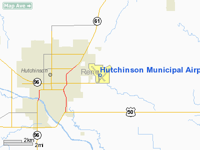
Hutchinson Municipal Airport (IATA: HUT, ICAO: KHUT, FAA LID: HUT) is a city-owned public-use airport located three nautical miles (6 km) east of the central business district of Hutchinson, a city in Reno County, Kansas, United States.
Facilities and aircraft
Hutchinson Municipal Airport covers an area of 1,597 acres (646 ha) at an elevation of 1,543 feet (470 m) above mean sea level. It has three asphalt paved runways: 13/31 is 7,004 by 100 feet (2,135 x 30 m); 4/22 is 6,000 by 100 feet (1,829 x 30 m); and 17/35 is 4,252 by 75 feet (1,296 x 23 m).
For the 12-month period ending September 30, 2008, the airport had 53,134 aircraft operations, an average of 145 per day: 88% general aviation, 7% military and 5% air taxi, At that time there were 29 aircraft based at this airport: 72% single-engine, 21% multi-engine, 3% jet and 3% helicopter.
The above content comes from Wikipedia and is published under free licenses – click here to read more.
|
Location &
QuickFacts
|
FAA
Information Effective: |
2008-09-25 |
|
Airport
Identifier: |
HUT |
|
Airport
Status: |
Operational |
|
Longitude/Latitude: |
097-51-38.3000W/38-03-55.8000N
-97.860639/38.065500 (Estimated) |
|
Elevation: |
1543 ft / 470.31 m (Surveyed) |
|
Land: |
1597 acres |
|
From
nearest city: |
3 nautical miles E of Hutchinson, KS |
|
Location: |
Reno County, KS |
|
Magnetic Variation: |
06E (2000) |
Owner & Manager
|
Ownership: |
Publicly owned |
|
Owner: |
City Of Hutchinson |
|
Address: |
Po Box 1567
Hutchinson, KS 67504 |
|
Phone number: |
620-694-2610 |
|
Manager: |
Mr. Mike J. Lueck |
|
Address: |
Box 1567
Hutchinson, KS 67504 |
|
Phone number: |
620-694-2692 |
Airport
Operations and Facilities
|
Airport
Use: |
Open to public |
|
Wind
indicator: |
Yes |
|
Segmented Circle: |
Yes |
|
Control
Tower: |
Yes |
|
Lighting
Schedule: |
DUSK-DAWN
ACTVT HIRL RY 13/31; MIRL RY 17/35; MIRL RY 04/22; MALSR RY 13; VASI
RYS 04 & 22; PAPI RYS 17 & 35 - CTAF. |
|
Beacon
Color: |
Clear-Green (lighted land airport) |
|
Landing
fee charge: |
No |
|
Sectional chart: |
Wichita |
|
Region: |
ACE - Central |
|
Boundary
ARTCC: |
ZKC - Kansas City |
|
Tie-in
FSS: |
ICT - Wichita |
|
FSS on
Airport: |
No |
|
FSS Toll
Free: |
1-800-WX-BRIEF |
|
NOTAMs
Facility: |
HUT (NOTAM-d service avaliable) |
|
Certification type/date: |
IV A U 06/197
ARPT CLSD TO ACR OPNS WITH OVR 30 PSGR SEATS EXCP 24 HR PPR.CALL AMGR
620-694-2692;CITY MGR 620-694-2610. |
|
Federal Agreements: |
NGPY3 |
Airport Communications
|
CTAF: |
118.500 |
|
Unicom: |
122.950 |
Airport Services
|
Fuel
available: |
100LLA |
|
Airframe
Repair: |
MAJOR |
|
Power
Plant Repair: |
MAJOR |
|
Bottled
Oxygen: |
NONE |
|
Bulk
Oxygen: |
LOW |
|
Runway Information
Runway 04/22
|
Dimension: |
6000 x 100 ft / 1828.8 x 30.5 m |
|
Surface: |
ASPH, Good Condition |
|
Weight Limit: |
Single wheel: 42000 lbs.
Dual wheel: 52000 lbs.
Dual tandem wheel: 76000 lbs. |
|
Edge Lights: |
Medium |
|
|
Runway 04
|
Runway 22
|
|
Longitude: |
097-51-49.1544W |
097-50-58.5430W |
|
Latitude: |
38-03-30.6060N |
38-04-14.3805N |
|
Elevation: |
1516.00 ft |
1543.00 ft |
|
Alignment: |
42 |
127 |
|
Traffic
Pattern: |
Left |
Left |
|
Markings: |
Non-precision instrument, Good Condition |
Non-precision instrument, Good Condition |
|
Crossing
Height: |
55.00 ft |
42.00 ft |
|
Displaced
threshold: |
400.00 ft |
0.00 ft |
|
VASI: |
4-box on left side |
4-box on left side |
|
Visual
Glide Angle: |
3.00° |
3.40° |
|
Runway End
Identifier: |
Yes |
Yes |
|
Obstruction: |
16 ft road, 400.0 ft from runway, 12:1 slope to clear
APCH RATIO 49:1 TO DSPLCD THR.
+16' ROAD 199' & 225' R OF CNTRLN. |
83 ft gnd, 2450.0 ft from runway, 450 ft left of
centerline, 27:1 slope to clear
+5 FT GROUND 199 FT BOTH SIDES OF CNTRLN. |
|
Decleard
distances: |
Take off run available 6000.00 ft
Take off distance available 6000.00 ft
Actual stop distance available 6000.00 ft
Landing distance available 5600.00 ft |
Take off run available 6000.00 ft
Take off distance available 6000.00 ft
Actual stop distance available 6000.00 ft
Landing distance available 6000.00 ft |
|
Runway 13/31
|
Dimension: |
7004 x 100 ft / 2134.8 x 30.5 m |
|
Surface: |
ASPH, Good Condition |
|
Weight Limit: |
Single wheel: 42000 lbs.
Dual wheel: 52000 lbs.
Dual tandem wheel: 76000 lbs. |
|
Edge Lights: |
High |
|
|
Runway 13
|
Runway 31
|
|
Longitude: |
097-52-15.8971W |
097-51-17.6121W |
|
Latitude: |
38-04-27.1494N |
38-03-35.4774N |
|
Elevation: |
1525.00 ft |
1515.00 ft |
|
Alignment: |
127 |
127 |
|
ILS Type: |
ILS |
|
|
Traffic
Pattern: |
Left |
Left |
|
Markings: |
Precision instrument, Good Condition |
Precision instrument, Good Condition |
|
Crossing
Height: |
0.00 ft |
42.00 ft |
|
VASI: |
|
4-box on left side |
|
Visual
Glide Angle: |
0.00° |
3.00° |
|
RVR
Equipment: |
touchdown |
|
|
Approach
lights: |
MALSR |
|
|
Runway End
Identifier: |
|
Yes |
|
Obstruction: |
96 ft tree, 4875.0 ft from runway, 1000 ft left of
centerline, 48:1 slope to clear |
21 ft road, 650.0 ft from runway, 21:1 slope to clear |
|
Decleard
distances: |
Take off run available 7004.00 ft
Take off distance available 7004.00 ft
Actual stop distance available 7004.00 ft
Landing distance available 7004.00 ft |
Take off run available 7004.00 ft
Take off distance available 7004.00 ft
Actual stop distance available 7004.00 ft
Landing distance available 7004.00 ft |
|
Runway 17/35
|
Dimension: |
4252 x 75 ft / 1296.0 x 22.9 m |
|
Surface: |
ASPH, Good Condition |
|
Weight Limit: |
Single wheel: 42000 lbs.
Dual wheel: 50000 lbs.
Dual tandem wheel: 76000 lbs. |
|
Edge Lights: |
Medium |
|
|
Runway 17
|
Runway 35
|
|
Longitude: |
097-51-45.9323W |
097-51-43.3839W |
|
Latitude: |
38-04-12.2743N |
38-03-30.2934N |
|
Elevation: |
1523.00 ft |
1516.00 ft |
|
Alignment: |
127 |
127 |
|
Traffic
Pattern: |
Left |
Left |
|
Markings: |
Basic, Fair Condition |
Basic, Fair Condition |
|
Crossing
Height: |
42.00 ft |
38.00 ft |
|
Displaced
threshold: |
0.00 ft |
800.00 ft |
|
VASI: |
4-light PAPI on left side |
4-light PAPI on left side |
|
Visual
Glide Angle: |
3.00° |
3.00° |
|
Obstruction: |
125 ft trees, 3900.0 ft from runway, 100 ft left of
centerline, 29:1 slope to clear |
16 ft road, 290.0 ft from runway, 5:1 slope to clear
APCH RATIO 50+:1 TO DSPLCD THR. |
|
Decleard
distances: |
Take off run available 4252.00 ft
Take off distance available 4252.00 ft
Actual stop distance available 4252.00 ft
Landing distance available 4252.00 ft |
Take off run available 4252.00 ft
Take off distance available 4252.00 ft
Actual stop distance available 4252.00 ft
Landing distance available 3452.00 ft |
|
Radio Navigation Aids
|
ID |
Type |
Name |
Ch |
Freq |
Var |
Dist |
|
MPR |
NDB |
Mc Pherson |
|
227.00 |
06E |
18.9 nm |
|
LYO |
NDB |
Lyons |
|
386.00 |
06E |
24.2 nm |
|
EWK |
NDB |
Newton |
|
281.00 |
06E |
27.8 nm |
|
IC |
NDB |
Piche |
|
332.00 |
07E |
35.0 nm |
|
PTT |
NDB |
Pratt |
|
356.00 |
07E |
46.8 nm |
|
EGT |
NDB |
Wellington |
|
414.00 |
07E |
49.9 nm |
|
IAB |
TACAN |
Mc Connell |
112X |
|
07E |
38.8 nm |
|
HUT |
VOR/DME |
Hutchinson |
115X |
116.80 |
09E |
5.4 nm |
|
ICT |
VORTAC |
Wichita |
085X |
113.80 |
07E |
23.3 nm |
|
ICT |
VOT |
Wichita |
|
114.00 |
|
32.8 nm |
Remarks
-
CRACKS & SPALLING;
APRON FAIR-GOOD, CRACKS.
-
MIGRATORY BIRDS
ON & INVOF ARPT.
-
SOUTH END OF TWY
'F' FM RAMP TO TWY 'D' CLSD PERMLY.
-
TWY 'F' BTWN TWYS
'D' & 'E' CLSD PERMLY.
-
TWY 'E' CLSD BTWN
RYS 13/31 & 17/35 CLSD PERMLY.
Based Aircraft
|
Aircraft based
on field: |
29 |
|
Single Engine
Airplanes: |
21 |
|
Multi Engine
Airplanes: |
6 |
|
Jet Engine
Airplanes: |
1 |
|
Helicopters: |
1 |
Operational Statistics
Time Period: 2006-10-01 - 2007-09-30
|
Aircraft
Operations: |
163/Day |
|
Air Taxi: |
4.9% |
|
General
Aviation Local: |
50.0% |
|
General
Aviation Itinerant: |
41.2% |
|
Military: |
4.0% |
Hutchinson Municipal Airport
Address:
Reno County, KS
Tel:
620-694-2610, 620-694-2692
Images
and information placed above are from
http://www.airport-data.com/airport/HUT/
We
thank them for the data!
|
General Info |
| Country |
United
States |
| State |
KANSAS
|
| FAA ID |
HUT
|
| Latitude |
38-03-55.980N |
|
Longitude |
097-51-38.300W |
|
Elevation |
1543
feet |
| Near
City |
HUTCHINSON |
We don't guarantee the information is fresh and accurate. The data may
be wrong or outdated.
For more up-to-date information please refer to other sources.
|
|


