|
|
Hugoton Municipal Airport |
| Hugoton Municipal Airport |
| IATA: none â ICAO: KHQG â FAA LID: HQG |
| Summary |
| Airport type |
Public |
| Owner |
Stevens County |
| Serves |
Hugoton, Kansas |
| Elevation AMSL |
3,134 ft / 955 m |
| Coordinates |
37°09â²47â³N 101°22â²14â³W / 37.16306°N 101.37056°W / 37.16306; -101.37056 |
| Runways |
| Direction |
Length |
Surface |
| ft |
m |
| 2/20 |
5,000 |
1,524 |
Concrete |
| 13/31 |
2,627 |
801 |
Asphalt |
| Statistics (2007) |
| Aircraft operations |
10,000 |
| Based aircraft |
18 |
| Source: Federal Aviation Administration |
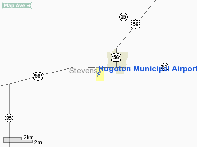
Hugoton Municipal Airport (ICAO: KHQG, FAA LID: HQG) is a county-owned public-use airport located two nautical miles (3.7 km) southwest of the central business district of Hugoton, a city in Stevens County, Kansas, United States.
Although most U.S. airports use the same three-letter location identifier for the FAA and IATA, this airport is assigned HQG by the FAA but has no designation from the IATA.
In 1952, a Braniff Airways Douglas DC-4 with an uncontrollable engine fire made a successful emergency landing at Hugoton Municipal Airport. Minor injuries were reported among the 45 passenger and three crew members. The DC-4 was destroyed by fire after the successful landing. Captain Stanford was praised for his quick actions and judgement. http://ntl1.specialcollection.net/scripts/ws.dll?websearch&site=dot_aircraftacc
Facilities and aircraft
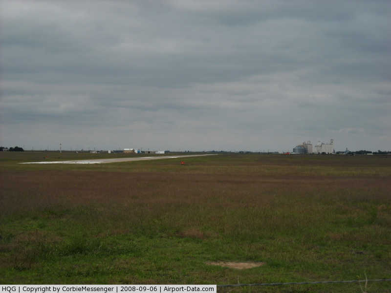
Hugoton Municipal Airport covers an area of 214 acres (87 ha) at an elevation of 3,134 feet (955 m) above mean sea level. It has two runways: 2/20 is 5,000 by 75 feet (1,524 x 23 m) with a concrete surface; 13/31 is 2,627 by 60 feet (801 x 18 m) with an asphalt surface.
For the 12-month period ending August 22, 2007, the airport had 10,000 general aviation aircraft operations, an average of 27 per day. At that time there were 18 aircraft based at this airport: 83% single-engine, 11% multi-engine, and 6% ultralight.
The above content comes from Wikipedia and is published under free licenses – click here to read more.
|
 |
(Click on the photo to enlarge) |
|
Location &
QuickFacts
|
FAA
Information Effective: |
2008-09-25 |
|
Airport
Identifier: |
HQG |
|
Airport
Status: |
Operational |
|
Longitude/Latitude: |
101-22-13.9000W/37-09-47.1000N
-101.370528/37.163083 (Estimated) |
|
Elevation: |
3134 ft / 955.24 m (Surveyed) |
|
Land: |
214 acres |
|
From
nearest city: |
2 nautical miles SW of Hugoton, KS |
|
Location: |
Stevens County, KS |
|
Magnetic Variation: |
09E (1985) |
Owner & Manager
|
Ownership: |
Publicly owned |
|
Owner: |
Stevens County |
|
Address: |
P.o. Box 130
Hugoton, KS 67951 |
|
Phone
number: |
620-544-7600 |
|
Manager: |
Harry Bartel
KIM HARPER CHMN ARPT BOARD. |
|
Address: |
Box 61
Hugoton, KS 67951 |
|
Phone number: |
620-544-7600 |
Airport
Operations and Facilities
|
Airport
Use: |
Open to public |
|
Wind
indicator: |
Yes |
|
Segmented Circle: |
Yes |
|
Control
Tower: |
No |
|
Lighting
Schedule: |
DUSK-DAWN
ACTVT HIRL RY 02/20; PAPI & REIL RYS 02 & 20 - CTAF. |
|
Beacon
Color: |
Clear-Green (lighted land airport) |
|
Landing
fee charge: |
No |
|
Sectional chart: |
Wichita |
|
Region: |
ACE - Central |
|
Boundary
ARTCC: |
ZKC - Kansas City |
|
Tie-in
FSS: |
ICT - Wichita |
|
FSS on
Airport: |
No |
|
FSS Toll
Free: |
1-800-WX-BRIEF |
|
NOTAMs
Facility: |
ICT (NOTAM-d service avaliable) |
|
Federal Agreements: |
NY1 |
Airport Communications
|
CTAF: |
122.800 |
|
Unicom: |
122.800 |
Airport Services
|
Fuel
available: |
100LLA |
|
Airframe
Repair: |
MINOR |
|
Power
Plant Repair: |
MINOR |
|
Bottled
Oxygen: |
NONE |
|
Bulk
Oxygen: |
NONE |
|
Runway Information
Runway 02/20
|
Dimension: |
5000 x 75 ft / 1524.0 x 22.9 m |
|
Surface: |
CONC, Good Condition |
|
Weight Limit: |
Single wheel: 12500 lbs. |
|
Edge Lights: |
High |
|
|
Runway 02
|
Runway 20
|
|
Longitude: |
101-22-28.3565W |
101-22-02.5997W |
|
Latitude: |
37-09-19.9928N |
37-10-04.9192N |
|
Elevation: |
3133.00 ft |
3130.00 ft |
|
Alignment: |
25 |
127 |
|
Traffic
Pattern: |
Left |
Left |
|
Markings: |
Non-precision instrument, Fair Condition |
Non-precision instrument, Fair Condition |
|
Crossing
Height: |
30.00 ft |
30.00 ft |
|
VASI: |
2-light PAPI on left side |
2-light PAPI on left side |
|
Visual
Glide Angle: |
3.00° |
3.00° |
|
Runway End
Identifier: |
Yes |
Yes |
|
Obstruction: |
24 ft road, 771.0 ft from runway, 23:1 slope to clear |
15 ft road, 700.0 ft from runway, 33:1 slope to clear |
|
Runway 13/31
|
Dimension: |
2627 x 60 ft / 800.7 x 18.3 m |
|
Surface: |
ASPH, Good Condition |
|
|
Runway 13
|
Runway 31
|
|
Longitude: |
101-22-22.3778W |
101-21-59.4938W |
|
Latitude: |
37-10-05.1152N |
37-09-46.7054N |
|
Elevation: |
3134.00 ft |
3128.00 ft |
|
Alignment: |
127 |
127 |
|
Traffic
Pattern: |
Left |
Left |
|
Markings: |
Basic, Good Condition
PAINT FADING/CHIPPING OFF |
Basic, Good Condition
PAINT FADING/CHIPPING OFF |
|
Displaced
threshold: |
0.00 ft |
202.00 ft
DSPLCD THLD PAINTED. |
|
Obstruction: |
35 ft pline, 800.0 ft from runway, 100 ft right of
centerline, 17:1 slope to clear |
10 ft tower, 201.0 ft from runway
10 FT TRAVELING IRRIGATION TOWERS AND PIPE 90-200 FT FROM RWY END. |
|
Radio Navigation Aids
|
ID |
Type |
Name |
Ch |
Freq |
Var |
Dist |
|
HQG |
NDB |
Hugoton |
|
365.00 |
09E |
0.2 nm |
|
ULS |
NDB |
Ulysses |
|
395.00 |
09E |
26.1 nm |
|
EHA |
NDB |
Elkhart |
|
377.00 |
10E |
26.5 nm |
|
GUY |
NDB |
Guymon |
|
275.00 |
09E |
28.3 nm |
|
JHN |
NDB |
Bear Creek |
|
341.00 |
10E |
33.3 nm |
|
MEJ |
NDB |
Meade |
|
389.00 |
09E |
49.0 nm |
|
LBL |
VORTAC |
Liberal |
070X |
112.30 |
11E |
20.4 nm |
Remarks
-
MAINT APCHS 20:1
GLIDE SLOPE; TRSNL SFC FOR 7:1 SLOPE; AND REMOVE 13' BLDG LOCATED 100' FM RWY
31 THR AND 30' LEFT OF CNTRLN.
Based Aircraft
|
Aircraft based
on field: |
18 |
|
Single Engine
Airplanes: |
15 |
|
Multi Engine
Airplanes: |
2 |
|
Ultralights: |
1 |
Operational Statistics
Time Period: 2006-08-23 - 2007-08-22
|
Aircraft
Operations: |
193/Week |
|
General
Aviation Local: |
80.0% |
|
General
Aviation Itinerant: |
20.0% |
Hugoton Municipal Airport
Address:
Stevens County, KS
Tel:
620-544-7600
Images
and information placed above are from
http://www.airport-data.com/airport/HQG/
We
thank them for the data!
|
General Info |
| Country |
United
States |
| State |
KANSAS
|
| FAA ID |
HQG
|
| Latitude |
37-09-47.090N |
|
Longitude |
101-22-13.896W |
|
Elevation |
3133
feet |
| Near
City |
HUGOTON
|
We don't guarantee the information is fresh and accurate. The data may
be wrong or outdated.
For more up-to-date information please refer to other sources.
|
|