 |
|
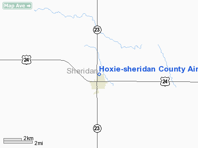
Hoxie-sheridan County Airport |
|
|
|
Location &
QuickFacts
|
FAA
Information Effective: |
2008-09-25 |
|
Airport
Identifier: |
1F5 |
|
Airport
Status: |
Operational |
|
Longitude/Latitude: |
100-26-20.4300W/39-21-53.7300N
-100.439008/39.364925 (Estimated) |
|
Elevation: |
2733 ft / 833.02 m (Surveyed) |
|
Land: |
80 acres |
|
From
nearest city: |
0 nautical miles N of Hoxie, KS |
|
Location: |
Sheridan County, KS |
|
Magnetic Variation: |
09E (1985) |
Owner & Manager
|
Ownership: |
Publicly owned |
|
Owner: |
County City Airport Commission |
|
Address: |
Po Box 898
Hoxie, KS 67740 |
|
Phone
number: |
785-675-3291 |
|
Manager: |
Roger Mauck |
|
Address: |
P O Box 898
Hoxie, KS 67740 |
|
Phone number: |
785-675-3988 |
Airport Operations and Facilities
|
Airport
Use: |
Open to public |
|
Wind
indicator: |
Yes |
|
Segmented Circle: |
No |
|
Control
Tower: |
No |
|
Lighting
Schedule: |
DUSK-DAWN
ACTVT HIRL RY 17/35 - CTAF. |
|
Beacon
Color: |
Clear-Green (lighted land airport) |
|
Landing
fee charge: |
No |
|
Sectional chart: |
Wichita |
|
Region: |
ACE - Central |
|
Boundary
ARTCC: |
ZDV - Denver |
|
Tie-in
FSS: |
ICT - Wichita |
|
FSS on
Airport: |
No |
|
FSS Toll
Free: |
1-800-WX-BRIEF |
|
NOTAMs
Facility: |
ICT (NOTAM-d service avaliable) |
Airport Communications
Airport Services
|
Airframe
Repair: |
NONE |
|
Power
Plant Repair: |
NONE |
|
Runway Information
Runway 08/26
|
Dimension: |
1750 x 150 ft / 533.4 x 45.7 m |
|
Surface: |
TURF, Good Condition |
|
|
Runway 08
|
Runway 26
|
|
Traffic
Pattern: |
Left |
Left |
|
Obstruction: |
17 ft road, 180.0 ft from runway, 10:1 slope to clear |
4 ft fence, 0.0 ft from runway |
|
Runway 17/35
|
Dimension: |
4400 x 50 ft / 1341.1 x 15.2 m |
|
Surface: |
ASPH, Fair Condition |
|
Edge Lights: |
High |
|
|
Runway 17
|
Runway 35
|
|
Traffic
Pattern: |
Left |
Left |
|
Markings: |
Numbers only, Fair Condition
RWY 17 MARKINGS FADED. |
Numbers only, Fair Condition |
|
Obstruction: |
60 ft tower, 1950.0 ft from runway, 70 ft left of
centerline, 29:1 slope to clear
3' FENCE 172' B. |
10 ft road, 210.0 ft from runway, 1:1 slope to clear
3' FENCE 160' FROM A/E; SIGN 11' HIGH 90' FROM A/E 90' LEFT; SIGN 11'
HIGH 155' FROM R/E 100' LEFT. |
|
Radio Navigation Aids
|
ID |
Type |
Name |
Ch |
Freq |
Var |
Dist |
|
MCK |
FAN MARKER |
Mc Cook |
|
|
11E |
49.2 nm |
|
OEL |
NDB |
Oakley |
|
380.00 |
08E |
23.2 nm |
|
OIN |
NDB |
Oberlin |
|
341.00 |
09E |
28.3 nm |
|
JDM |
NDB |
Wheatfield |
|
408.00 |
08E |
29.6 nm |
|
NRN |
NDB |
Norton |
|
230.00 |
08E |
39.0 nm |
|
ADT |
NDB |
Atwood |
|
365.00 |
09E |
40.0 nm |
|
HLC |
VORTAC |
Hill City |
084X |
113.70 |
08E |
11.8 nm |
Remarks
-
NO PUBLIC
TELEPHONE AT ARPT.
-
EXISTED PRIOR TO 1959.
Based Aircraft
|
Aircraft based
on field: |
7 |
|
Single Engine
Airplanes: |
7 |
Operational Statistics
Time Period: 2006-07-17 - 2007-07-16
|
Aircraft
Operations: |
224/Week |
|
Air Taxi: |
0.9% |
|
General
Aviation Local: |
77.6% |
|
General
Aviation Itinerant: |
21.6% |
Hoxie-sheridan County Airport
Address:
Sheridan County, KS
Tel:
785-675-3291,
785-675-3988
Images
and information placed above are from
http://www.airport-data.com/airport/1F5/
We
thank them for the data!
|
General Info |
| Country |
United
States |
| State |
KANSAS
|
| FAA ID |
1F5
|
| Latitude |
39-22-10.016N |
|
Longitude |
100-26-06.503W |
|
Elevation |
2733
feet |
| Near
City |
HOXIE
|
We don't guarantee the information is fresh and accurate. The data may
be wrong or outdated.
For more up-to-date information please refer to other sources.
|
|


