 |
|
|
Location &
QuickFacts
|
FAA
Information Effective: |
2008-09-25 |
|
Airport
Identifier: |
SN26 |
|
Airport
Status: |
Operational |
|
Longitude/Latitude: |
095-00-10.8900W/38-10-40.0970N
-95.003025/38.177805 (Estimated) |
|
Elevation: |
970 ft / 295.66 m (Estimated) |
|
Land: |
0 acres |
|
From
nearest city: |
5 nautical miles N of Blue Mound, KS |
|
Location: |
Linn County, KS |
|
Magnetic Variation: |
05E (1985) |
Owner & Manager
|
Ownership: |
Privately owned |
|
Owner: |
Donald J Horttor |
|
Address: |
1100 Bank Iv Tower
Topeka, KS 66603 |
|
Phone
number: |
913-235-9511 |
|
Manager: |
Donald J. Horttor |
|
Address: |
1100 Bank Iv Tower
Topeka, KS 66603 |
|
Phone number: |
913-235-9511 |
Airport Operations and Facilities
|
Airport Use: |
Private |
|
Wind indicator: |
No |
|
Segmented Circle: |
No |
|
Control Tower: |
No |
|
Landing fee charge: |
Yes |
|
Sectional chart: |
Kansas City |
|
Region: |
ACE - Central |
|
Boundary ARTCC: |
ZKC - Kansas City |
|
Tie-in FSS: |
ICT - Wichita |
|
FSS on Airport: |
No |
|
FSS Toll Free: |
1-800-WX-BRIEF |
Airport Services
|
Airframe
Repair: |
NONE |
|
Power
Plant Repair: |
NONE |
|
Runway Information
Runway N/S
|
Dimension: |
1550 x 35 ft / 472.4 x 10.7 m |
|
Surface: |
TURF, |
|
|
Runway N
|
Runway S
|
|
Traffic
Pattern: |
Left |
Left |
|
Radio Navigation Aids
|
ID |
Type |
Name |
Ch |
Freq |
Var |
Dist |
|
FSK |
NDB |
Fort Scott |
|
379.00 |
05E |
25.5 nm |
|
MSB |
NDB |
Monarch |
|
410.00 |
04E |
30.3 nm |
|
UKL |
NDB |
Boyd |
|
245.00 |
05E |
34.7 nm |
|
EAD |
NDB |
Nevada |
|
209.00 |
06E |
38.3 nm |
|
PTS |
NDB |
Pittsburg |
|
365.00 |
05E |
46.1 nm |
|
OJC |
VOR/DME |
Johnson County |
077X |
113.00 |
06E |
41.8 nm |
|
CNU |
VOR/DME |
Chanute |
029X |
109.20 |
05E |
43.4 nm |
|
BUM |
VORTAC |
Butler |
106X |
115.90 |
07E |
25.0 nm |
Based Aircraft
|
Aircraft based
on field: |
1 |
|
Single Engine
Airplanes: |
1 |
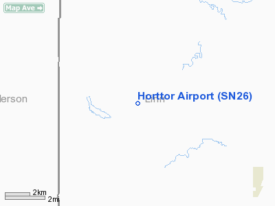
Horttor Airport
Address:
Linn County, KS
Tel:
913-235-9511
Images
and information placed above are from
http://www.airport-data.com/airport/SN26/
We
thank them for the data!
|
General Info |
| Country |
United
States |
| State |
KANSAS
|
| FAA ID |
SN26
|
| Latitude |
38-10-40.097N |
|
Longitude |
095-00-10.890W |
|
Elevation |
970 feet
|
| Near
City |
BLUE
MOUND |
We don't guarantee the information is fresh and accurate. The data may
be wrong or outdated.
For more up-to-date information please refer to other sources.
|
|


