 |
|
|
|
|
|
|
Location &
QuickFacts
|
FAA
Information Effective: |
2008-09-25 |
|
Airport
Identifier: |
K91 |
|
Airport
Status: |
Operational |
|
Longitude/Latitude: |
095-32-00.9290W/39-40-45.0070N
-95.533591/39.679169 (Estimated) |
|
Elevation: |
1134 ft / 345.64 m (Estimated) |
|
Land: |
103 acres |
|
From
nearest city: |
1 nautical miles NW of Horton, KS |
|
Location: |
Brown County, KS |
|
Magnetic Variation: |
06E (1985) |
Owner & Manager
|
Ownership: |
Publicly owned |
|
Owner: |
City Of Horton |
|
Address: |
Po Box 30
Horton, KS 66439 |
|
Phone
number: |
785-486-2681 |
|
Manager: |
N. A.
CANDY SCHMITT - CITY CLERK, LEVI HENRY - CITY ADMINISTRATOR. |
|
Address: |
Po Box 30
Horton, KS 66439 |
|
Phone number: |
785-486-2681 |
Airport
Operations and Facilities
|
Airport
Use: |
Open to public |
|
Wind
indicator: |
Yes |
|
Segmented Circle: |
Yes |
|
Control
Tower: |
No |
|
Lighting
Schedule: |
DUSK-DAWN |
|
Beacon
Color: |
Clear-Green (lighted land airport)
BCN OTS INDEFLY. |
|
Landing
fee charge: |
No |
|
Sectional chart: |
Kansas City |
|
Region: |
ACE - Central |
|
Boundary
ARTCC: |
ZKC - Kansas City |
|
Tie-in
FSS: |
ICT - Wichita |
|
FSS on
Airport: |
No |
|
FSS Toll
Free: |
1-800-WX-BRIEF |
|
NOTAMs
Facility: |
ICT (NOTAM-d service avaliable) |
|
Federal Agreements: |
1 |
Airport Communications
|
Runway Information
Runway 15/33
|
Dimension: |
1636 x 100 ft / 498.7 x 30.5 m |
|
Surface: |
TURF, Good Condition |
|
|
Runway 15
|
Runway 33
|
|
Traffic
Pattern: |
Left |
Left |
|
Obstruction: |
13 ft road, 237.0 ft from runway, 18:1 slope to clear |
4 ft fence, 15.0 ft from runway, 3:1 slope to clear |
|
Runway 17/35
|
Dimension: |
2223 x 100 ft / 677.6 x 30.5 m |
|
Surface: |
TURF, Good Condition |
|
|
Runway 17
|
Runway 35
|
|
Traffic
Pattern: |
Left |
Left |
|
Obstruction: |
5 ft fence, 5.0 ft from runway, 1:1 slope to clear |
5 ft fence, 35.0 ft from runway, 7:1 slope to clear |
|
Radio Navigation Aids
|
ID |
Type |
Name |
Ch |
Freq |
Var |
Dist |
|
FNB |
NDB |
Brenner |
|
404.00 |
05E |
24.0 nm |
|
AZN |
NDB |
Amazon |
|
233.00 |
06E |
31.4 nm |
|
TO |
NDB |
Biloy |
|
521.00 |
05E |
34.3 nm |
|
DO |
NDB |
Dotte |
|
359.00 |
05E |
45.6 nm |
|
AYB |
NDB |
Auburn |
|
430.00 |
05E |
47.1 nm |
|
EVU |
NDB |
Emville |
|
317.00 |
05E |
49.3 nm |
|
FOE |
TACAN |
Forbes |
053X |
|
05E |
44.4 nm |
|
RBA |
VOR/DME |
Robinson |
019X |
108.20 |
04E |
11.5 nm |
|
TOP |
VORTAC |
Topeka |
125X |
117.80 |
05E |
32.6 nm |
|
STJ |
VORTAC |
St Joseph |
102X |
115.50 |
08E |
32.8 nm |
|
MCI |
VORTAC |
Kansas City |
079Y |
113.25 |
05E |
43.9 nm |
|
PWE |
VORTAC |
Pawnee City |
071X |
112.40 |
05E |
44.1 nm |
|
FOE |
VOT |
Forbes |
|
111.00 |
|
44.2 nm |
Remarks
-
NO SNOW REMOVAL
WINTER MONTHS.
-
NO PUBLIC PHONE
OR FACILITIES AT ARPT.
-
+150 FT UNLGTD
ANT ON WTR TWR 3684 FT SE OF AER 33.
-
TIEDOWN AREA &
TWY UNMKD; MINIMAL MAINT.
-
BUILT PRIOR 1959.
Operational Statistics
Time Period: 2007-05-02 - 2008-04-30
|
Aircraft
Operations: |
9/Month |
|
General
Aviation Itinerant: |
100.0% |
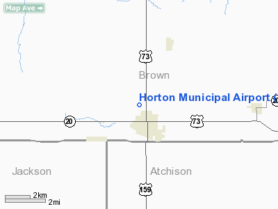
Horton Municipal Airport
Address:
Brown County, KS
Tel:
785-486-2681
Images
and information placed above are from
http://www.airport-data.com/airport/K91/
We
thank them for the data!
|
General Info |
| Country |
United
States |
| State |
KANSAS
|
| FAA ID |
K91
|
| Latitude |
39-40-45.007N |
|
Longitude |
095-32-00.929W |
|
Elevation |
1134
feet |
| Near
City |
HORTON
|
We don't guarantee the information is fresh and accurate. The data may
be wrong or outdated.
For more up-to-date information please refer to other sources.
|
|


