 |
|
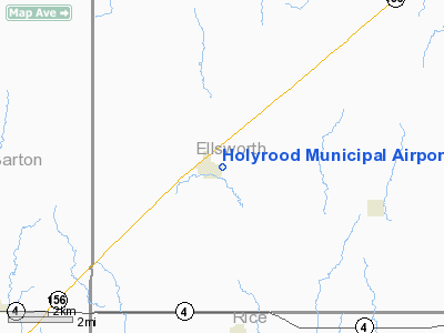
Holyrood Municipal Airport |
|
Location &
QuickFacts
|
FAA
Information Effective: |
2008-09-25 |
|
Airport
Identifier: |
87KS |
|
Airport
Status: |
Operational |
|
Longitude/Latitude: |
098-24-17.2380W/38-35-15.0370N
-98.404788/38.587510 (Estimated) |
|
Elevation: |
1805 ft / 550.16 m (Estimated) |
|
Land: |
13 acres |
|
From
nearest city: |
1 nautical miles SE of Holyrood, KS |
|
Location: |
Ellsworth County, KS |
|
Magnetic Variation: |
07E (1985) |
Owner & Manager
|
Ownership: |
Publicly owned |
|
Owner: |
City Of Holyrood |
|
Address: |
Box 67
Holyrood, KS 67450 |
|
Phone
number: |
913-252-3652 |
|
Manager: |
Neysa Brown |
|
Address: |
City Of Holyrood, Box 67
Holyrood, KS 67450 |
|
Phone number: |
913-252-3652 |
Airport Operations and Facilities
|
Airport Use: |
Private |
|
Wind indicator: |
Yes |
|
Segmented Circle: |
No |
|
Control Tower: |
No |
|
Landing fee charge: |
No |
|
Sectional chart: |
Wichita |
|
Region: |
ACE - Central |
|
Boundary ARTCC: |
ZKC - Kansas City |
|
Tie-in FSS: |
ICT - Wichita |
|
FSS on Airport: |
No |
|
FSS Toll Free: |
1-800-WX-BRIEF |
Airport Services
|
Airframe
Repair: |
NONE |
|
Power
Plant Repair: |
NONE |
|
Runway Information
Runway 17/35
|
Dimension: |
1650 x 100 ft / 502.9 x 30.5 m |
|
Surface: |
TURF, Good Condition |
|
|
Runway 17
|
Runway 35
|
|
Traffic
Pattern: |
Left |
Left |
|
Obstruction: |
50 ft poles, 350.0 ft from runway |
15 ft trees, 185.0 ft from runway, 67 ft left of
centerline, 12:1 slope to clear |
|
Radio Navigation Aids
|
ID |
Type |
Name |
Ch |
Freq |
Var |
Dist |
|
LYO |
NDB |
Lyons |
|
386.00 |
06E |
16.7 nm |
|
HIL |
NDB |
Hilyn |
|
338.00 |
08E |
27.2 nm |
|
MPR |
NDB |
Mc Pherson |
|
227.00 |
06E |
36.7 nm |
|
LQR |
NDB |
Larned |
|
296.00 |
08E |
39.6 nm |
|
HUT |
VOR/DME |
Hutchinson |
115X |
116.80 |
09E |
41.9 nm |
|
SLN |
VORTAC |
Salina |
118X |
117.10 |
07E |
42.0 nm |
|
HYS |
VORTAC |
Hays |
041X |
110.40 |
10E |
43.8 nm |
Remarks
Operational Statistics
Time Period: 1983-11-15 - 1984-11-13
|
Aircraft
Operations: |
10/Week |
|
General
Aviation Local: |
60.0% |
|
General
Aviation Itinerant: |
40.0% |
Holyrood Municipal Airport
Address:
Ellsworth County, KS
Tel:
913-252-3652
Images
and information placed above are from
http://www.airport-data.com/airport/87KS/
We
thank them for the data!
|
General Info |
| Country |
United
States |
| State |
KANSAS
|
| FAA ID |
87KS
|
| Latitude |
38-35-15.037N |
|
Longitude |
098-24-17.238W |
|
Elevation |
1805
feet |
| Near
City |
HOLYROOD
|
We don't guarantee the information is fresh and accurate. The data may
be wrong or outdated.
For more up-to-date information please refer to other sources.
|
|


