 |
|
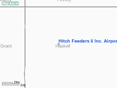
Hitch Feeders Ii Incorporated Airport |
|
Location &
QuickFacts
|
FAA
Information Effective: |
2008-09-25 |
|
Airport
Identifier: |
1KS7 |
|
Airport
Status: |
Operational |
|
Longitude/Latitude: |
101-01-01.6090W/37-40-25.0850N
-101.017114/37.673635 (Estimated) |
|
Elevation: |
3028 ft / 922.93 m (Estimated) |
|
Land: |
0 acres |
|
From
nearest city: |
14 nautical miles N of Satanta, KS |
|
Location: |
Haskell County, KS |
|
Magnetic Variation: |
09E (1985) |
Owner & Manager
|
Ownership: |
Privately owned |
|
Owner: |
Hitch Feeders Ii, Inc. |
|
Address: |
Box 1629
Garden City, KS 67846 |
|
Phone number: |
316-275-6181 |
|
Manager: |
Ronnie Pruitt |
|
Address: |
Box 1629
Garden City, KS 67846 |
|
Phone number: |
316-275-6181 |
Airport Operations and Facilities
|
Airport Use: |
Private |
|
Wind indicator: |
Yes |
|
Segmented Circle: |
No |
|
Control Tower: |
No |
|
Landing fee charge: |
No |
|
Sectional chart: |
Wichita |
|
Region: |
ACE - Central |
|
Boundary ARTCC: |
ZKC - Kansas City |
|
Tie-in FSS: |
ICT - Wichita |
|
FSS on Airport: |
No |
|
FSS Toll Free: |
1-800-WX-BRIEF |
Airport Services
|
Airframe
Repair: |
NONE |
|
Power
Plant Repair: |
NONE |
|
Runway Information
Runway N/S
|
Dimension: |
3500 x 100 ft / 1066.8 x 30.5 m |
|
Surface: |
DIRT-TURF, |
|
|
Runway N
|
Runway S
|
|
Traffic
Pattern: |
Left |
Left |
|
Radio Navigation Aids
|
ID |
Type |
Name |
Ch |
Freq |
Var |
Dist |
|
GC |
NDB |
Pieve |
|
347.00 |
09E |
16.8 nm |
|
ULS |
NDB |
Ulysses |
|
395.00 |
09E |
17.3 nm |
|
JHN |
NDB |
Bear Creek |
|
341.00 |
10E |
34.2 nm |
|
HQG |
NDB |
Hugoton |
|
365.00 |
09E |
35.1 nm |
|
MEJ |
NDB |
Meade |
|
389.00 |
09E |
39.2 nm |
|
TQK |
NDB |
Scott City |
|
256.00 |
08E |
48.9 nm |
|
GCK |
VORTAC |
Garden City |
080X |
113.30 |
11E |
20.2 nm |
|
LBL |
VORTAC |
Liberal |
070X |
112.30 |
11E |
37.9 nm |
|
DDC |
VORTAC |
Dodge City |
019X |
108.20 |
08E |
49.2 nm |
Hitch Feeders Ii Incorporated Airport
Address:
Haskell County, KS
Tel:
316-275-6181
Images
and information placed above are from
http://www.airport-data.com/airport/1KS7/
We
thank them for the data!
|
General Info |
| Country |
United
States |
| State |
KANSAS
|
| FAA ID |
1KS7
|
| Latitude |
37-40-25.085N |
|
Longitude |
101-01-01.609W |
|
Elevation |
3028
feet |
| Near
City |
SATANTA
|
We don't guarantee the information is fresh and accurate. The data may
be wrong or outdated.
For more up-to-date information please refer to other sources.
|
|


