 |
|
| Hillside Airport |
| IATA: none â ICAO: none â FAA LID: 63K |
| Summary |
| Airport type |
Public |
| Owner |
W. Sheldon/Tom Tietze |
| Serves |
Stilwell, Kansas |
| Elevation AMSL |
1,025 ft / 312 m |
| Coordinates |
38°49â²16â³N 094°36â²34â³W / 38.82111°N 94.60944°W / 38.82111; -94.60944 |
| Runways |
| Direction |
Length |
Surface |
| ft |
m |
| 17/35 |
2,000 |
610 |
Turf/Gravel |
| Statistics (2007) |
| Aircraft operations |
2,000 |
| Based aircraft |
18 |
| Source: Federal Aviation Administration |
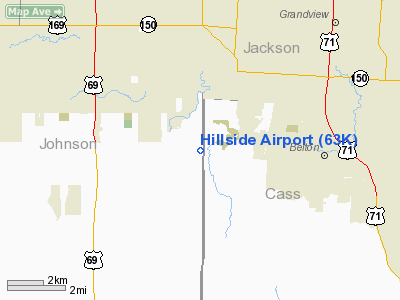
Hillside Airport (FAA LID: 63K) is a public use airport located four nautical miles (7 km) northeast of the central business district of Stilwell, a town in Johnson County, Kansas, United States.
Facilities and aircraft
Hillside Airport covers an area of 30 acres (12 ha) at an elevation of 1,025 feet (312 m) above mean sea level. It has one runway designated 17/35 with a turf and gravel surface measuring is 2,000 by 56 feet (610 x 17 m).
For the 12-month period ending May 31, 2007, the airport had 2,000 general aviation aircraft operations, an average of 166 per month. At that time there were 18 aircraft based at this airport: 61% single-engine and 39% ultralight.
The above content comes from Wikipedia and is published under free licenses – click here to read more.
|
Location &
QuickFacts
|
FAA
Information Effective: |
2008-09-25 |
|
Airport
Identifier: |
63K |
|
Airport
Status: |
Operational |
|
Longitude/Latitude: |
094-36-34.3000W/38-49-16.5000N
-94.609528/38.821250 (Estimated) |
|
Elevation: |
1025 ft / 312.42 m (Estimated) |
|
Land: |
30 acres |
|
From
nearest city: |
4 nautical miles NE of Stilwell, KS |
|
Location: |
Johnson County, KS |
|
Magnetic Variation: |
05E (1985) |
Owner & Manager
|
Ownership: |
Privately owned |
|
Owner: |
W. Sheldon/tom Tietze |
|
Address: |
16885 S. Kenneth Rd
Stilwell, KS 66085 |
|
Manager: |
William C. Sheldon |
|
Address: |
16935 S. Kenneth Rd
Stilwell, KS 66085 |
|
Phone number: |
913-897-2647 |
Airport Operations and Facilities
|
Airport
Use: |
Open to public |
|
Wind
indicator: |
Yes |
|
Segmented Circle: |
No |
|
Control
Tower: |
No |
|
Landing
fee charge: |
No |
|
Sectional chart: |
Kansas City |
|
Region: |
ACE - Central |
|
Boundary
ARTCC: |
ZKC - Kansas City |
|
Tie-in
FSS: |
COU - Columbia |
|
FSS on
Airport: |
No |
|
FSS Toll
Free: |
1-800-WX-BRIEF |
|
NOTAMs
Facility: |
COU (NOTAM-d service avaliable) |
Airport Communications
Airport Services
|
Airframe
Repair: |
NONE |
|
Power
Plant Repair: |
NONE |
|
Bottled
Oxygen: |
NONE |
|
Bulk
Oxygen: |
NONE |
|
Runway Information
Runway 17/35
|
Dimension: |
2000 x 56 ft / 609.6 x 17.1 m |
|
Surface: |
TURF-GRVL, Fair Condition |
|
|
Runway 17
|
Runway 35
|
|
Longitude: |
094-36-34.2900W |
094-36-34.3600W |
|
Latitude: |
38-49-26.3400N |
38-49-06.5700N |
|
Traffic
Pattern: |
Right |
Left |
|
Obstruction: |
36 ft trees, 345.0 ft from runway, 9:1 slope to clear |
8 ft road, 10.0 ft from runway, 1:1 slope to clear |
|
Radio Navigation Aids
|
ID |
Type |
Name |
Ch |
Freq |
Var |
Dist |
|
LXT |
NDB |
Lesumit |
|
263.00 |
04E |
13.9 nm |
|
GKB |
NDB |
Norge |
|
517.00 |
05E |
14.6 nm |
|
GQ |
NDB |
Norge |
|
517.00 |
05E |
14.6 nm |
|
DO |
NDB |
Dotte |
|
359.00 |
05E |
24.9 nm |
|
GPH |
NDB |
Mosby |
|
284.00 |
03E |
34.6 nm |
|
HCK |
NDB |
Hawks |
|
296.00 |
04E |
50.0 nm |
|
FOE |
TACAN |
Forbes |
053X |
|
05E |
49.8 nm |
|
SZL |
TACAN |
Whiteman |
035X |
|
04E |
49.9 nm |
|
OJC |
VOR/DME |
Johnson County |
077X |
113.00 |
06E |
6.1 nm |
|
RIS |
VOR/DME |
Riverside |
051X |
111.40 |
05E |
18.0 nm |
|
ANX |
VORTAC |
Napoleon |
087X |
114.00 |
07E |
27.9 nm |
|
MCI |
VORTAC |
Kansas City |
079Y |
113.25 |
05E |
28.5 nm |
|
BUM |
VORTAC |
Butler |
106X |
115.90 |
07E |
33.5 nm |
|
TOP |
VORTAC |
Topeka |
125X |
117.80 |
05E |
47.8 nm |
|
MKC |
VOT |
Kansas City Downtown |
|
108.60 |
|
18.2 nm |
Remarks
-
WILDLIFE ON & INVOF ARPT.
-
TREES AND UNEVEN
TERRAIN BOTH SIDES OF RY.
TREES IN APCH ZONES.
-
+10 EARTH
EMBANKMENT MIDFLD, W. EDGE OF RY.
-
EXISTED PRIOR TO 1959.
Based Aircraft
|
Aircraft based
on field: |
18 |
|
Single Engine
Airplanes: |
11 |
|
Ultralights: |
7 |
Operational Statistics
Time Period: 2006-06-01 - 2007-05-31
|
Aircraft
Operations: |
39/Week |
|
General
Aviation Local: |
65.0% |
|
General
Aviation Itinerant: |
35.0% |
Hillside Airport
Address:
Johnson County, KS
Tel:
913-897-2647
Images
and information placed above are from
http://www.airport-data.com/airport/63K/
We
thank them for the data!
|
General Info |
| Country |
United
States |
| State |
KANSAS
|
| FAA ID |
63K
|
| Latitude |
38-49-16.029N |
|
Longitude |
094-36-34.840W |
|
Elevation |
1025
feet |
| Near
City |
STILWELL
|
We don't guarantee the information is fresh and accurate. The data may
be wrong or outdated.
For more up-to-date information please refer to other sources.
|
|


