 |
|
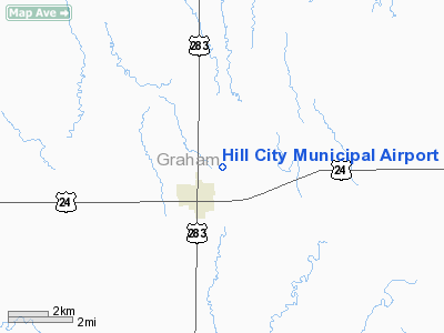
Hill City Municipal Airport |
| Hill City Municipal Airport |
| IATA: HLC â ICAO: KHLC â FAA LID: HLC |
| Summary |
| Airport type |
Public |
| Owner |
City of Hill City |
| Serves |
Hill City, Kansas |
| Elevation AMSL |
2,238 ft / 682 m |
| Coordinates |
39°22â²49â³N 099°49â²53â³W / 39.38028°N 99.83139°W / 39.38028; -99.83139 |
| Runways |
| Direction |
Length |
Surface |
| ft |
m |
| 17/35 |
5,000 |
1,524 |
Concrete |
| Statistics (2006) |
| Aircraft operations |
14,600 |
| Based aircraft |
10 |
| Source: Federal Aviation Administration |
Hill City Municipal Airport (IATA: HLC, ICAO: KHLC, FAA LID: HLC) is a city-owned public-use airport located one nautical mile (1.85 km) northeast of the central business district of Hill City, in Graham County, Kansas, United States.
Facilities and aircraft
Hill City Municipal Airport covers an area of 183 acres (74 ha) at an elevation of 2,238 feet (682 m) above mean sea level. It has one runway designated 17/35 with a concrete surface measuring 5,000 by 75 feet (1,524 x 23 m).
For the 12-month period ending October 30, 2006, the airport had 14,600 aircraft operations, an average of 40 per day: 99% general aviation and 1% air taxi. At that time there were 10 aircraft based at this airport, all single-engine.
The above content comes from Wikipedia and is published under free licenses – click here to read more.
|
Location &
QuickFacts
|
FAA
Information Effective: |
2008-09-25 |
|
Airport
Identifier: |
HLC |
|
Airport
Status: |
Operational |
|
Longitude/Latitude: |
099-49-53.3000W/39-22-48.7000N
-99.831472/39.380194 (Estimated) |
|
Elevation: |
2238 ft / 682.14 m (Surveyed) |
|
Land: |
183 acres |
|
From
nearest city: |
1 nautical miles NE of Hill City, KS |
|
Location: |
Graham County, KS |
|
Magnetic Variation: |
09E (1980) |
Owner & Manager
|
Ownership: |
Publicly owned |
|
Owner: |
City Of Hill City |
|
Address: |
Hill City, KS 67642 |
|
Manager: |
Dennis Mersch |
|
Address: |
205 N. Pomeroy St.
Hill City, KS 67642 |
|
Phone number: |
785-421-3422
FOR ATTENDENT CALL 785-421-5613 |
Airport
Operations and Facilities
|
Airport
Use: |
Open to public |
|
Wind
indicator: |
Yes |
|
Segmented Circle: |
Yes |
|
Control
Tower: |
No |
|
Lighting
Schedule: |
DUSK-DAWN
ACTVT HIRL RY 17/35, REIL & PAPI RYS 17 & 35 - CTAF. |
|
Beacon
Color: |
Clear-Green (lighted land airport) |
|
Landing
fee charge: |
No |
|
Sectional chart: |
Wichita |
|
Region: |
ACE - Central |
|
Traffic
Pattern Alt: |
800 ft |
|
Boundary
ARTCC: |
ZDV - Denver |
|
Tie-in
FSS: |
ICT - Wichita |
|
FSS on
Airport: |
No |
|
FSS Toll
Free: |
1-800-WX-BRIEF |
|
NOTAMs
Facility: |
HLC (NOTAM-d service avaliable) |
|
Federal Agreements: |
NGY |
Airport Communications
Airport Services
|
Fuel
available: |
100LL |
|
Bottled
Oxygen: |
NONE |
|
Bulk
Oxygen: |
NONE |
|
Runway Information
Runway 17/35
|
Dimension: |
5000 x 75 ft / 1524.0 x 22.9 m |
|
Surface: |
CONC, |
|
Weight Limit: |
Single wheel: 12500 lbs.
Dual wheel: 16000 lbs. |
|
Edge Lights: |
High |
|
|
Runway 17
|
Runway 35
|
|
Longitude: |
099-49-52.5976W |
099-49-53.9083W |
|
Latitude: |
39-23-13.4381N |
39-22-24.0364N |
|
Elevation: |
2238.00 ft |
2188.00 ft |
|
Alignment: |
127 |
1 |
|
Traffic
Pattern: |
Left |
Left |
|
Markings: |
Non-precision instrument, Good Condition |
Basic, Good Condition |
|
Crossing
Height: |
40.00 ft |
40.00 ft |
|
VASI: |
4-light PAPI on left side |
4-light PAPI on left side |
|
Visual
Glide Angle: |
3.00° |
3.00° |
|
Runway End
Identifier: |
Yes |
Yes |
|
Obstruction: |
, 34:1 slope to clear |
11 ft road, 225.0 ft from runway, ft right of centerline,
20:1 slope to clear |
|
Radio Navigation Aids
|
ID |
Type |
Name |
Ch |
Freq |
Var |
Dist |
|
NRN |
NDB |
Norton |
|
230.00 |
08E |
28.7 nm |
|
PHG |
NDB |
Phillipsburg |
|
368.00 |
08E |
31.9 nm |
|
OIN |
NDB |
Oberlin |
|
341.00 |
09E |
42.4 nm |
|
OEL |
NDB |
Oakley |
|
380.00 |
08E |
48.5 nm |
|
HLC |
VORTAC |
Hill City |
084X |
113.70 |
08E |
19.7 nm |
|
HYS |
VORTAC |
Hays |
041X |
110.40 |
10E |
41.2 nm |
Remarks
-
AGRICULTURAL ACFT
OPERG VCNTY ARPT DALGT HRS.
-
PHONE ACCESS 24 HRS.
-
PROVIDED APCH TO
EACH RWY IS MAINTAINED FOR A MINIMUM 20:1 GLIDE SLOPE AND THE TRANSITIONAL
SURFACE BE MAINTAINED FOR A 7:1 SLOPE.
Based Aircraft
|
Aircraft based
on field: |
10 |
|
Single Engine
Airplanes: |
10 |
Operational Statistics
Time Period: 2005-10-31 - 2006-10-30
|
Aircraft
Operations: |
281/Week |
|
Air Taxi: |
0.7% |
|
General
Aviation Local: |
85.6% |
|
General
Aviation Itinerant: |
13.7% |
Hill City Municipal Airport
Address:
Graham County, KS
Tel:
785-421-3422
Images
and information placed above are from
http://www.airport-data.com/airport/HLC/
We
thank them for the data!
|
General Info |
| Country |
United
States |
| State |
KANSAS
|
| FAA ID |
HLC
|
| Latitude |
39-22-43.810N |
|
Longitude |
099-49-53.380W |
|
Elevation |
2230
feet |
| Near
City |
HILL
CITY |
We don't guarantee the information is fresh and accurate. The data may
be wrong or outdated.
For more up-to-date information please refer to other sources.
|
|


