 |
|
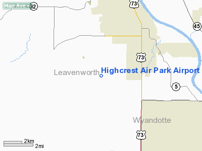
Highcrest Air Park Airport |
|
|
|
Location &
QuickFacts
|
FAA
Information Effective: |
2008-09-25 |
|
Airport
Identifier: |
SN83 |
|
Airport
Status: |
Operational |
|
Longitude/Latitude: |
094-57-04.8730W/39-13-38.0050N
-94.951354/39.227224 (Estimated) |
|
Elevation: |
1000 ft / 304.80 m (Estimated) |
|
Land: |
9 acres |
|
From
nearest city: |
3 nautical miles SW of Lansing, KS |
|
Location: |
Leavenworth County, KS |
|
Magnetic Variation: |
05E (1985) |
Owner & Manager
|
Ownership: |
Privately owned |
|
Owner: |
Highcrest Airpark, Llc |
|
Address: |
16228 Dana Lane
Leavenworth, KS 66048 |
|
Phone number: |
913-727-3409 |
|
Manager: |
Terry Bartkoski |
|
Address: |
16228 Dana Lane
Leavenworth, KS 66048 |
|
Phone number: |
913-727-3409 |
Airport
Operations and Facilities
|
Airport
Use: |
Private |
|
Wind
indicator: |
No |
|
Segmented Circle: |
No |
|
Control
Tower: |
No |
|
Landing
fee charge: |
Yes
LNDG FEE $100, INCL TOUCH & GO; WAIVED IF GUEST HAS WRITTEN PERMISSION
BEFORE, OTHERWISE TKOF WILL BE PROHIBITED TIL FEE PAID IN CASH. |
|
Sectional chart: |
Kansas City |
|
Region: |
ACE - Central |
|
Boundary ARTCC: |
ZKC - Kansas City |
|
Tie-in FSS: |
ICT - Wichita |
|
FSS on Airport: |
No |
|
FSS Toll Free: |
1-800-WX-BRIEF |
Airport Services
|
Airframe
Repair: |
NONE |
|
Power
Plant Repair: |
NONE |
|
Runway Information
Runway 17/35
|
Dimension: |
2400 x 50 ft / 731.5 x 15.2 m |
|
Surface: |
TURF, |
|
|
Runway 17
|
Runway 35
|
|
Traffic
Pattern: |
Left |
Right |
|
Radio Navigation Aids
|
ID |
Type |
Name |
Ch |
Freq |
Var |
Dist |
|
DO |
NDB |
Dotte |
|
359.00 |
05E |
9.4 nm |
|
GQ |
NDB |
Norge |
|
517.00 |
05E |
17.0 nm |
|
GKB |
NDB |
Norge |
|
517.00 |
05E |
17.0 nm |
|
GPH |
NDB |
Mosby |
|
284.00 |
03E |
30.8 nm |
|
LXT |
NDB |
Lesumit |
|
263.00 |
04E |
31.4 nm |
|
TO |
NDB |
Biloy |
|
521.00 |
05E |
34.9 nm |
|
AZN |
NDB |
Amazon |
|
233.00 |
06E |
39.5 nm |
|
EZZ |
NDB |
Cameron |
|
394.00 |
03E |
43.6 nm |
|
FOE |
TACAN |
Forbes |
053X |
|
05E |
37.1 nm |
|
RIS |
VOR/DME |
Riverside |
051X |
111.40 |
05E |
17.7 nm |
|
OJC |
VOR/DME |
Johnson County |
077X |
113.00 |
06E |
25.3 nm |
|
RBA |
VOR/DME |
Robinson |
019X |
108.20 |
04E |
43.4 nm |
|
MCI |
VORTAC |
Kansas City |
079Y |
113.25 |
05E |
10.6 nm |
|
TOP |
VORTAC |
Topeka |
125X |
117.80 |
05E |
28.4 nm |
|
ANX |
VORTAC |
Napoleon |
087X |
114.00 |
07E |
39.1 nm |
|
STJ |
VORTAC |
St Joseph |
102X |
115.50 |
08E |
44.1 nm |
|
MKC |
VOT |
Kansas City Downtown |
|
108.60 |
|
17.6 nm |
|
FOE |
VOT |
Forbes |
|
111.00 |
|
37.3 nm |
Remarks
-
GLIDER OPNS ON &
INVOF ARPT.
-
HOT AIR BALLOON
ACTIVITY ON & INVOF ARPT.
-
FOR LANDING FEE &
AIRPORT USE REQUIREMENTS CONTACT AIRPARK AT 913-727-3409.
-
OPNS RESTRICTED
TO EAST SIDE OF AIRPORT.
Based Aircraft
|
Aircraft based
on field: |
6 |
|
Single Engine
Airplanes: |
5 |
|
Gliders: |
1 |
Highcrest Air Park Airport
Address:
Leavenworth County, KS
Tel:
913-727-3409
Images
and information placed above are from
http://www.airport-data.com/airport/SN83/
We
thank them for the data!
|
General Info |
| Country |
United
States |
| State |
KANSAS
|
| FAA ID |
SN83
|
| Latitude |
39-13-38.005N |
|
Longitude |
094-57-04.873W |
|
Elevation |
1000
feet |
| Near
City |
LANSING
|
We don't guarantee the information is fresh and accurate. The data may
be wrong or outdated.
For more up-to-date information please refer to other sources.
|
|


