 |
|
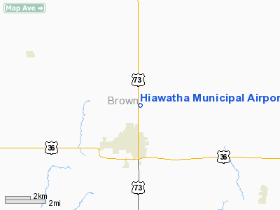
Hiawatha Municipal Airport |
|
|
|
Location &
QuickFacts
|
FAA
Information Effective: |
2008-09-25 |
|
Airport
Identifier: |
K87 |
|
Airport
Status: |
Operational |
|
Longitude/Latitude: |
095-31-30.9350W/39-52-45.0120N
-95.525260/39.879170 (Estimated) |
|
Elevation: |
1130 ft / 344.42 m (Estimated) |
|
Land: |
157 acres |
|
From
nearest city: |
2 nautical miles NE of Hiawatha, KS |
|
Location: |
Brown County, KS |
|
Magnetic Variation: |
06E (1985) |
Owner & Manager
|
Ownership: |
Publicly owned |
|
Owner: |
City Of Hiawatha |
|
Address: |
723 Oregon St
Hiawatha, KS 66434 |
|
Phone number: |
785-742-7417 |
|
Manager: |
Lynne Ladner |
|
Address: |
723 Oregon St
Hiawatha, KS 66434 |
|
Phone number: |
785-742-7417 |
Airport
Operations and Facilities
|
Airport
Use: |
Open to public |
|
Wind
indicator: |
Yes |
|
Segmented Circle: |
No |
|
Control
Tower: |
No |
|
Lighting
Schedule: |
DUSK-DAWN |
|
Landing
fee charge: |
No |
|
Sectional chart: |
Kansas City |
|
Region: |
ACE - Central |
|
Boundary
ARTCC: |
ZKC - Kansas City |
|
Tie-in
FSS: |
ICT - Wichita |
|
FSS on
Airport: |
No |
|
FSS Toll
Free: |
1-800-WX-BRIEF |
|
NOTAMs
Facility: |
ICT (NOTAM-d service avaliable) |
|
Federal Agreements: |
1 |
Airport Communications
Airport Services
|
Airframe
Repair: |
NONE |
|
Power
Plant Repair: |
NONE |
|
Runway Information
Runway 10/28
|
Dimension: |
2430 x 130 ft / 740.7 x 39.6 m |
|
Surface: |
TURF, Good Condition
VERY SOFT WHEN WET. LOW AREAS MAY HAVE STANDING WATER AFTER RAIN.
RY 10/28 HAS SEVERAL TRANSVERSE DEPRESSIONS & VARMINT HOLES.
HEAVY GRASS CLIPPINGS ON RWY. |
|
|
Runway 10
|
Runway 28
|
|
Traffic
Pattern: |
Left |
Left |
|
Obstruction: |
13 ft road, 234.0 ft from runway, 18:1 slope to clear |
39 ft tree, 222.0 ft from runway, 143 ft right of
centerline, 5:1 slope to clear |
|
Runway 17/35
|
Dimension: |
3400 x 100 ft / 1036.3 x 30.5 m |
|
Surface: |
TURF, Good Condition
VERY SOFT WHEN WET. LOW AREAS MAY HAVE STANDING WATER AFTER RAIN.
RY 10/28 HAS SEVERAL TRANSVERSE DEPRESSIONS & VARMINT HOLES.
HEAVY GRASS CLIPPINGS ON RWY. |
|
Edge Lights: |
Low |
|
|
Runway 17
|
Runway 35
|
|
Traffic
Pattern: |
Left |
Left |
|
Obstruction: |
, 50:1 slope to clear |
13 ft road, 315.0 ft from runway, 24:1 slope to clear |
|
Radio Navigation Aids
|
ID |
Type |
Name |
Ch |
Freq |
Var |
Dist |
|
FNB |
NDB |
Brenner |
|
404.00 |
05E |
12.2 nm |
|
AZN |
NDB |
Amazon |
|
233.00 |
06E |
28.5 nm |
|
AYB |
NDB |
Auburn |
|
430.00 |
05E |
35.8 nm |
|
EVU |
NDB |
Emville |
|
317.00 |
05E |
39.8 nm |
|
TO |
NDB |
Biloy |
|
521.00 |
05E |
46.2 nm |
|
AFK |
NDB |
Nebraska City |
|
347.00 |
05E |
46.3 nm |
|
RBA |
VOR/DME |
Robinson |
019X |
108.20 |
04E |
5.0 nm |
|
STJ |
VORTAC |
St Joseph |
102X |
115.50 |
08E |
28.1 nm |
|
PWE |
VORTAC |
Pawnee City |
071X |
112.40 |
05E |
36.8 nm |
|
TOP |
VORTAC |
Topeka |
125X |
117.80 |
05E |
44.6 nm |
Remarks
-
FARM VEHICLES AND
EQUIPMENT ON AND INVOF RYS.
-
EXISTED PRIOR TO 1959.
Based Aircraft
|
Aircraft based
on field: |
7 |
|
Single Engine
Airplanes: |
7 |
Operational Statistics
Time Period: 2007-05-02 - 2008-04-30
|
Aircraft
Operations: |
22/Week |
|
General
Aviation Local: |
90.9% |
|
General
Aviation Itinerant: |
9.1% |
Hiawatha Municipal Airport
Address:
Brown County, KS
Tel:
785-742-7417
Images
and information placed above are from
http://www.airport-data.com/airport/K87/
We
thank them for the data!
|
General Info |
| Country |
United
States |
| State |
KANSAS
|
| FAA ID |
K87
|
| Latitude |
39-52-45.012N |
|
Longitude |
095-31-30.935W |
|
Elevation |
1130
feet |
| Near
City |
HIAWATHA
|
We don't guarantee the information is fresh and accurate. The data may
be wrong or outdated.
For more up-to-date information please refer to other sources.
|
|


