 |
|
|
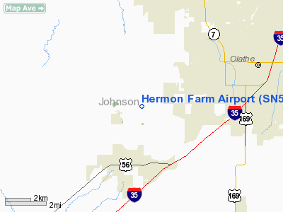
Location &
QuickFacts
|
FAA
Information Effective: |
2008-09-25 |
|
Airport
Identifier: |
SN59 |
|
Airport
Status: |
Operational |
|
Longitude/Latitude: |
094-54-35.8710W/38-51-10.0240N
-94.909964/38.852784 (Estimated) |
|
Elevation: |
1060 ft / 323.09 m (Estimated) |
|
Land: |
0 acres |
|
From
nearest city: |
3 nautical miles NE of Gardner, KS |
|
Location: |
Johnson County, KS |
|
Magnetic Variation: |
05E (1985) |
Owner & Manager
|
Ownership: |
Privately owned |
|
Owner: |
Dale Hermon |
|
Address: |
15280 Moonlight Rd
Olathe, KS 66061 |
|
Phone number: |
913-884-8566 |
|
Manager: |
Dale Hermon |
|
Address: |
15280 Moonlight Rd
Olathe, KS 66061 |
|
Phone number: |
913-884-8566 |
Airport Operations and Facilities
|
Airport Use: |
Private |
|
Wind indicator: |
Yes |
|
Segmented Circle: |
No |
|
Control Tower: |
No |
|
Landing fee charge: |
No |
|
Sectional chart: |
Kansas City |
|
Region: |
ACE - Central |
|
Boundary ARTCC: |
ZKC - Kansas City |
|
Tie-in FSS: |
COU - Columbia |
|
FSS on Airport: |
No |
|
FSS Toll Free: |
1-800-WX-BRIEF |
Airport Services
|
Airframe
Repair: |
NONE |
|
Power
Plant Repair: |
NONE |
|
Runway Information
Runway 17/35
|
Dimension: |
1300 x 50 ft / 396.2 x 15.2 m |
|
Surface: |
TURF, |
|
|
Runway 17
|
Runway 35
|
|
Traffic
Pattern: |
Right |
Left |
|
Displaced
threshold: |
600.00 ft |
0.00 ft |
|
Radio Navigation Aids
|
ID |
Type |
Name |
Ch |
Freq |
Var |
Dist |
|
GQ |
NDB |
Norge |
|
517.00 |
05E |
17.3 nm |
|
GKB |
NDB |
Norge |
|
517.00 |
05E |
17.3 nm |
|
DO |
NDB |
Dotte |
|
359.00 |
05E |
23.4 nm |
|
LXT |
NDB |
Lesumit |
|
263.00 |
04E |
26.0 nm |
|
TO |
NDB |
Biloy |
|
521.00 |
05E |
39.7 nm |
|
GPH |
NDB |
Mosby |
|
284.00 |
03E |
40.9 nm |
|
FOE |
TACAN |
Forbes |
053X |
|
05E |
35.6 nm |
|
OJC |
VOR/DME |
Johnson County |
077X |
113.00 |
06E |
8.1 nm |
|
RIS |
VOR/DME |
Riverside |
051X |
111.40 |
05E |
21.8 nm |
|
MCI |
VORTAC |
Kansas City |
079Y |
113.25 |
05E |
27.2 nm |
|
TOP |
VORTAC |
Topeka |
125X |
117.80 |
05E |
34.4 nm |
|
ANX |
VORTAC |
Napoleon |
087X |
114.00 |
07E |
39.3 nm |
|
BUM |
VORTAC |
Butler |
106X |
115.90 |
07E |
40.1 nm |
|
MKC |
VOT |
Kansas City Downtown |
|
108.60 |
|
21.8 nm |
|
FOE |
VOT |
Forbes |
|
111.00 |
|
35.9 nm |
Remarks
-
PLINES EAST & NORTH.
-
PERSONAL USE; VFR
CONDS ONLY; RGT TFC PTN ON RWY 17.
Hermon Farm Airport
Address:
Johnson County, KS
Tel:
913-884-8566
Images
and information placed above are from
http://www.airport-data.com/airport/SN59/
We
thank them for the data!
|
General Info |
| Country |
United
States |
| State |
KANSAS
|
| FAA ID |
SN59
|
| Latitude |
38-51-10.024N |
|
Longitude |
094-54-35.871W |
|
Elevation |
1060
feet |
| Near
City |
GARDNER
|
We don't guarantee the information is fresh and accurate. The data may
be wrong or outdated.
For more up-to-date information please refer to other sources.
|
|


