 |
|
|
|
|
|
|
Location &
QuickFacts
|
FAA
Information Effective: |
2008-09-25 |
|
Airport
Identifier: |
8K2 |
|
Airport
Status: |
Operational |
|
Longitude/Latitude: |
098-02-36.5220W/37-16-41.4710N
-98.043478/37.278186 (Estimated) |
|
Elevation: |
1427 ft / 434.95 m (Surveyed) |
|
Land: |
127 acres |
|
From
nearest city: |
1 nautical miles SW of Harper, KS |
|
Location: |
Harper County, KS |
|
Magnetic Variation: |
07E (1985) |
Owner & Manager
|
Ownership: |
Publicly owned |
|
Owner: |
City Of Harper |
|
Address: |
201 W. Main
Harper, KS 67058 |
|
Phone number: |
620-896-2511 |
|
Manager: |
Tanya Wilson...city Clerk |
|
Address: |
201 West Main
Harper, KS 67058 |
|
Phone number: |
620-896-2511 |
Airport
Operations and Facilities
|
Airport
Use: |
Open to public |
|
Wind
indicator: |
Yes |
|
Segmented Circle: |
No |
|
Control
Tower: |
No |
|
Lighting
Schedule: |
DUSK-DAWN |
|
Landing
fee charge: |
No |
|
Sectional chart: |
Wichita |
|
Region: |
ACE - Central |
|
Boundary
ARTCC: |
ZKC - Kansas City |
|
Tie-in
FSS: |
ICT - Wichita |
|
FSS on
Airport: |
No |
|
FSS Toll
Free: |
1-800-WX-BRIEF |
|
NOTAMs
Facility: |
ICT (NOTAM-d service avaliable) |
|
Federal Agreements: |
1 |
Airport Communications
Airport Services
|
Fuel
available: |
100LL
FOR FUEL CALL CITY HALL (620) 896-2511 OR POLICE DEPT (620) 896-2538. |
|
Bottled
Oxygen: |
NONE |
|
Bulk
Oxygen: |
NONE |
|
Runway Information
Runway 12/30
|
Dimension: |
2138 x 160 ft / 651.7 x 48.8 m |
|
Surface: |
TURF, Good Condition |
|
|
Runway 12
|
Runway 30
|
|
Longitude: |
098-02-48.3850W |
098-02-29.3160W |
|
Latitude: |
37-16-52.7250N |
37-16-38.0770N |
|
Elevation: |
1426.00 ft |
1426.00 ft |
|
Alignment: |
127 |
127 |
|
Traffic
Pattern: |
Left |
Left |
|
Obstruction: |
45 ft pline, 900.0 ft from runway, 20:1 slope to clear |
40 ft pline, 800.0 ft from runway, 20:1 slope to clear |
|
Runway 17/35
|
Dimension: |
3268 x 38 ft / 996.1 x 11.6 m |
|
Surface: |
ASPH, Good Condition |
|
Edge Lights: |
Medium |
|
|
Runway 17
|
Runway 35
|
|
Longitude: |
098-02-36.9420W |
098-02-33.1060W |
|
Latitude: |
37-16-54.9680N |
37-16-22.8060N |
|
Elevation: |
1427.00 ft |
1424.00 ft |
|
Alignment: |
127 |
127 |
|
Traffic
Pattern: |
Left |
Left |
|
Markings: |
Basic, Good Condition |
Basic, Good Condition |
|
Obstruction: |
34 ft tree, 450.0 ft from runway, 60 ft left of
centerline, 7:1 slope to clear |
40 ft pline, 1600.0 ft from runway, 35:1 slope to clear |
|
Radio Navigation Aids
|
ID |
Type |
Name |
Ch |
Freq |
Var |
Dist |
|
EGT |
NDB |
Wellington |
|
414.00 |
07E |
31.4 nm |
|
IC |
NDB |
Piche |
|
332.00 |
07E |
33.3 nm |
|
AVK |
NDB |
Alva |
|
203.00 |
08E |
42.5 nm |
|
PTT |
NDB |
Pratt |
|
356.00 |
07E |
42.9 nm |
|
IAB |
TACAN |
Mc Connell |
112X |
|
07E |
42.4 nm |
|
HUT |
VOR/DME |
Hutchinson |
115X |
116.80 |
09E |
43.5 nm |
|
ANY |
VORTAC |
Anthony |
076X |
112.90 |
07E |
9.4 nm |
|
ICT |
VORTAC |
Wichita |
085X |
113.80 |
07E |
35.6 nm |
|
ICT |
VOT |
Wichita |
|
114.00 |
|
36.2 nm |
Remarks
-
PHONE AT FLD.
-
30 INCH DITCH AER 12.
-
MAINT APCHS FOR A
20:1 GLIDE SLOPE AND TRSNL SFC FOR A 7:1 SLOPE.
Based Aircraft
|
Aircraft based
on field: |
13 |
|
Single Engine
Airplanes: |
12 |
|
Multi Engine
Airplanes: |
1 |
Operational Statistics
Time Period: 2006-01-19 - 2007-01-18
|
Aircraft
Operations: |
60/Week |
|
General
Aviation Local: |
64.5% |
|
General
Aviation Itinerant: |
35.5% |
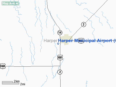
Harper Municipal Airport
Address:
Harper County, KS
Tel:
620-896-2511
Images
and information placed above are from
http://www.airport-data.com/airport/8K2/
We
thank them for the data!
|
General Info |
| Country |
United
States |
| State |
KANSAS
|
| FAA ID |
8K2
|
| Latitude |
37-16-41.471N |
|
Longitude |
098-02-36.522W |
|
Elevation |
1427
feet |
| Near
City |
HARPER
|
We don't guarantee the information is fresh and accurate. The data may
be wrong or outdated.
For more up-to-date information please refer to other sources.
|
|


