 |
|
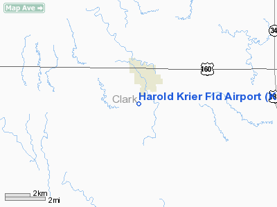
Harold Krier Field Airport |
|
|
|
Location &
QuickFacts
|
FAA
Information Effective: |
2008-09-25 |
|
Airport
Identifier: |
K58 |
|
Airport
Status: |
Operational |
|
Longitude/Latitude: |
099-46-30.4610W/37-10-00.0970N
-99.775128/37.166694 (Estimated) |
|
Elevation: |
1951 ft / 594.66 m (Surveyed) |
|
Land: |
180 acres |
|
From
nearest city: |
1 nautical miles S of Ashland, KS |
|
Location: |
Clark County, KS |
|
Magnetic Variation: |
08E (1985) |
Owner & Manager
|
Ownership: |
Publicly owned |
|
Owner: |
City Of Ashland |
|
Address: |
Po Box 547
Ashland, KS 67831 |
|
Phone number: |
620-635-2531 |
|
Manager: |
Bill Gibson |
|
Address: |
Box 547
Ashland, KS 67831 |
|
Phone number: |
620-635-0133 |
Airport
Operations and Facilities
|
Airport
Use: |
Open to public |
|
Wind
indicator: |
Yes |
|
Segmented Circle: |
No |
|
Control
Tower: |
No |
|
Lighting
Schedule: |
DUSK-DAWN |
|
Beacon
Color: |
Clear (unlighted land airport) |
|
Landing
fee charge: |
No |
|
Sectional chart: |
Wichita |
|
Region: |
ACE - Central |
|
Boundary
ARTCC: |
ZKC - Kansas City |
|
Tie-in
FSS: |
ICT - Wichita |
|
FSS on
Airport: |
No |
|
FSS Toll
Free: |
1-800-WX-BRIEF |
|
NOTAMs
Facility: |
ICT (NOTAM-d service avaliable) |
Airport Communications
Airport Services
|
Fuel
available: |
100LL
PPR FOR FUEL CALL (620) 635-2200. |
|
Airframe
Repair: |
NONE |
|
Power
Plant Repair: |
NONE |
|
Bottled
Oxygen: |
NONE |
|
Bulk
Oxygen: |
NONE |
|
Runway Information
Runway 02/20
|
Dimension: |
3125 x 300 ft / 952.5 x 91.4 m |
|
Surface: |
TURF, Fair Condition |
|
|
Runway 02
|
Runway 20
|
|
Traffic
Pattern: |
Left |
Left |
|
Obstruction: |
6 ft fence |
15 ft road, 0.0 ft from runway, 6:1 slope to clear |
|
Runway 14/32
|
Dimension: |
3135 x 300 ft / 955.5 x 91.4 m |
|
Surface: |
TURF, Fair Condition |
|
Edge Lights: |
Non-standard lighting system
RY LGTS OTS INDEFLY.
NSTD LIRL; LGTS LCTD ON OUTER EDGE OF RY. |
|
|
Runway 14
|
Runway 32
|
|
Traffic
Pattern: |
Right |
Left |
|
Obstruction: |
4 ft fence, 129.0 ft from runway, 32:1 slope to clear |
15 ft road, 110.0 ft from runway, 7:1 slope to clear |
|
Radio Navigation Aids
|
ID |
Type |
Name |
Ch |
Freq |
Var |
Dist |
|
BFK |
NDB |
Buffalo |
|
215.00 |
08E |
19.6 nm |
|
MEJ |
NDB |
Meade |
|
389.00 |
09E |
28.8 nm |
|
OWU |
NDB |
West Woodward |
|
329.00 |
08E |
45.6 nm |
|
MDF |
NDB |
Mooreland/dcmsnd |
|
284.00 |
08E |
49.6 nm |
|
DDC |
VORTAC |
Dodge City |
019X |
108.20 |
08E |
42.6 nm |
|
GAG |
VORTAC |
Gage |
103X |
115.60 |
10E |
49.7 nm |
Remarks
-
PUBLIC PHONE AVBL 24 HRS
620-635-2153.
-
ARPT CONSTRUCTED PRIOR TO
1959.
Based Aircraft
|
Aircraft based
on field: |
5 |
|
Single Engine
Airplanes: |
5 |
Operational Statistics
Time Period: 2005-06-15 - 2006-06-14
|
Aircraft
Operations: |
49/Week |
|
General
Aviation Local: |
80.0% |
|
General
Aviation Itinerant: |
20.0% |
Harold Krier Field Airport
Address:
Clark County, KS
Tel:
620-635-2531, 620-635-0133
Images
and information placed above are from
http://www.airport-data.com/airport/K58/
We
thank them for the data!
|
General Info |
| Country |
United
States |
| State |
KANSAS
|
| FAA ID |
K58
|
| Latitude |
37-10-00.097N |
|
Longitude |
099-46-30.461W |
|
Elevation |
1951
feet |
| Near
City |
ASHLAND
|
We don't guarantee the information is fresh and accurate. The data may
be wrong or outdated.
For more up-to-date information please refer to other sources.
|
|


