 |
|
|
Location &
QuickFacts
|
FAA
Information Effective: |
2008-09-25 |
|
Airport
Identifier: |
5KS4 |
|
Airport
Status: |
Operational |
|
Longitude/Latitude: |
101-58-58.6440W/39-13-48.0040N
-101.982957/39.230001 (Estimated) |
|
Elevation: |
3908 ft / 1191.16 m (Estimated) |
|
Land: |
0 acres |
|
From
nearest city: |
7 nautical miles SE of Kanorado, KS |
|
Location: |
Sherman County, KS |
|
Magnetic Variation: |
10E (1985) |
Owner & Manager
|
Ownership: |
Privately owned |
|
Owner: |
Eugene Hall |
|
Address: |
Rr 2
Kanorado, KS 67741 |
|
Manager: |
Charles Hall |
|
Address: |
Kanorado, KS 67741 |
|
Phone number: |
785-890-5095 |
Airport
Operations and Facilities
|
Airport
Use: |
Private |
|
Wind
indicator: |
Yes |
|
Segmented Circle: |
No |
|
Control
Tower: |
No |
|
Landing
fee charge: |
No |
|
Sectional chart: |
Wichita |
|
Region: |
ACE - Central |
|
Boundary
ARTCC: |
ZDV - Denver |
|
Tie-in
FSS: |
ICT - Wichita |
|
FSS on
Airport: |
No |
|
FSS Toll
Free: |
1-800-WX-BRIEF |
|
Runway Information
Runway 08/26
|
Dimension: |
1500 x 25 ft / 457.2 x 7.6 m |
|
Surface: |
DIRT, |
|
|
Runway 08
|
Runway 26
|
|
Traffic
Pattern: |
Left |
Left |
|
Runway 17/35
|
Dimension: |
2640 x 25 ft / 804.7 x 7.6 m |
|
Surface: |
DIRT, |
|
|
Runway 17
|
Runway 35
|
|
Traffic
Pattern: |
Left |
Left |
|
Radio Navigation Aids
|
ID |
Type |
Name |
Ch |
Freq |
Var |
Dist |
|
ITR |
NDB |
Kit Carson |
|
209.00 |
10E |
14.0 nm |
|
GL |
NDB |
Shugr |
|
414.00 |
09E |
18.2 nm |
|
SYF |
NDB |
St Francis |
|
386.00 |
10E |
31.5 nm |
|
JDM |
NDB |
Wheatfield |
|
408.00 |
08E |
46.6 nm |
|
GLD |
VORTAC |
Goodland |
098X |
115.10 |
12E |
16.5 nm |
Remarks
-
THE DSPLCD RWY
END SHOULD BE DAY MARKED USING PAINTED AUTO TIRES OR OTHER APPROPRIATE
MARKING. DSPLCD END OF RWY CAN BE USED FOR TKOFS & ROLLOUTS.
-
PROVIDED PLINE IS
LOWERED, BURIED OR E END OF RWY 26 THR DSPLCD A SUFFICIENT DIST SO PLINE NO
LONGER PRESENTS PSBL UNSAFE COND FOR ACFT USING RWY 26.
Based Aircraft
|
Aircraft based
on field: |
1 |
|
Single Engine
Airplanes: |
1 |
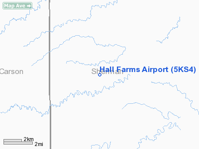
Hall Farms Airport
Address:
Sherman County, KS
Tel:
785-890-5095
Images
and information placed above are from
http://www.airport-data.com/airport/5KS4/
We
thank them for the data!
|
General Info |
| Country |
United
States |
| State |
KANSAS
|
| FAA ID |
5KS4
|
| Latitude |
39-13-48.004N |
|
Longitude |
101-58-58.644W |
|
Elevation |
3908
feet |
| Near
City |
KANORADO
|
We don't guarantee the information is fresh and accurate. The data may
be wrong or outdated.
For more up-to-date information please refer to other sources.
|
|


