 |
|
|
Location &
QuickFacts
|
FAA
Information Effective: |
2008-09-25 |
|
Airport
Identifier: |
SN72 |
|
Airport
Status: |
Operational |
|
Longitude/Latitude: |
095-26-23.9300W/38-18-00.0710N
-95.439981/38.300020 (Estimated) |
|
Elevation: |
985 ft / 300.23 m (Estimated) |
|
Land: |
0 acres |
|
From
nearest city: |
1 nautical miles S of Harris, KS |
|
Location: |
Anderson County, KS |
|
Magnetic Variation: |
06E (1985) |
Owner & Manager
|
Ownership: |
Privately owned |
|
Owner: |
Frank Graham |
|
Address: |
641 W. Hwy 31
Garnett, KS 66032 |
|
Phone number: |
785-448-6106 |
|
Address: |
|
Airport Operations and Facilities
|
Airport Use: |
Private |
|
Wind indicator: |
Yes |
|
Segmented Circle: |
No |
|
Control Tower: |
No |
|
Landing fee charge: |
No |
|
Sectional chart: |
Kansas City |
|
Region: |
ACE - Central |
|
Boundary ARTCC: |
ZKC - Kansas City |
|
Tie-in FSS: |
ICT - Wichita |
|
FSS on Airport: |
No |
|
FSS Toll Free: |
1-800-WX-BRIEF |
Airport Services
|
Airframe
Repair: |
NONE |
|
Power
Plant Repair: |
NONE |
|
Runway Information
Runway 18/36
|
Dimension: |
2310 x 100 ft / 704.1 x 30.5 m |
|
Surface: |
TURF, |
|
|
Runway 18
|
Runway 36
|
|
Traffic
Pattern: |
Left |
Left |
|
Radio Navigation Aids
|
ID |
Type |
Name |
Ch |
Freq |
Var |
Dist |
|
UKL |
NDB |
Boyd |
|
245.00 |
05E |
13.3 nm |
|
MSB |
NDB |
Monarch |
|
410.00 |
04E |
30.6 nm |
|
FSK |
NDB |
Fort Scott |
|
379.00 |
05E |
44.0 nm |
|
FOE |
TACAN |
Forbes |
053X |
|
05E |
40.3 nm |
|
CNU |
VOR/DME |
Chanute |
029X |
109.20 |
05E |
41.2 nm |
|
OJC |
VOR/DME |
Johnson County |
077X |
113.00 |
06E |
46.3 nm |
|
EMP |
VORTAC |
Emporia |
075X |
112.80 |
08E |
32.9 nm |
|
BUM |
VORTAC |
Butler |
106X |
115.90 |
07E |
44.9 nm |
|
FOE |
VOT |
Forbes |
|
111.00 |
|
40.6 nm |
Remarks
Based Aircraft
|
Aircraft based
on field: |
1 |
|
Single Engine
Airplanes: |
1 |
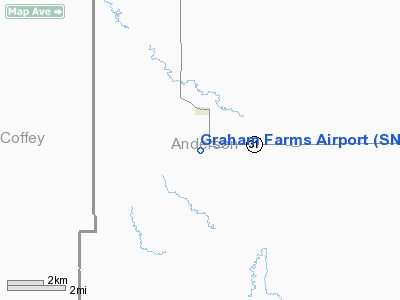
Graham Farms Airport
Address:
Anderson County, KS
Tel:
785-448-6106
Images
and information placed above are from
http://www.airport-data.com/airport/SN72/
We
thank them for the data!
|
General Info |
| Country |
United
States |
| State |
KANSAS
|
| FAA ID |
SN72
|
| Latitude |
38-18-00.071N |
|
Longitude |
095-26-23.930W |
|
Elevation |
985 feet
|
| Near
City |
HARRIS
|
We don't guarantee the information is fresh and accurate. The data may
be wrong or outdated.
For more up-to-date information please refer to other sources.
|
|


