 |
|
|
Location &
QuickFacts
|
FAA
Information Effective: |
2008-06-05 |
|
Airport
Identifier: |
SN91 |
|
Airport
Status: |
Operational |
|
Longitude/Latitude: |
096-06-55.9820W/38-06-35.0810N
-96.115551/38.109745 (Estimated) |
|
Elevation: |
1100 ft / 335.28 m (Estimated) |
|
Land: |
0 acres |
|
From
nearest city: |
2 nautical miles SE of Madison, KS |
|
Location: |
Greenwood County, KS |
|
Magnetic Variation: |
06E (1985) |
Owner & Manager
|
Ownership: |
Privately owned |
|
Owner: |
Warren G. Godfrey |
|
Address: |
Rr 1, Box 770
Madison, KS 66860 |
|
Phone number: |
316-437-2576 |
|
Address: |
|
Airport Operations and Facilities
|
Airport Use: |
Private |
|
Wind indicator: |
Yes |
|
Segmented Circle: |
No |
|
Control Tower: |
No |
|
Landing fee charge: |
No |
|
Sectional chart: |
Kansas City |
|
Region: |
ACE - Central |
|
Boundary ARTCC: |
ZKC - Kansas City |
|
Tie-in FSS: |
ICT - Wichita |
|
FSS on Airport: |
No |
|
FSS Toll Free: |
1-800-WX-BRIEF |
Airport Services
|
Airframe
Repair: |
NONE |
|
Power
Plant Repair: |
NONE |
|
Runway Information
Runway 06/24
|
Dimension: |
2300 x 100 ft / 701.0 x 30.5 m |
|
Surface: |
TURF-DIRT, |
|
|
Runway 06
|
Runway 24
|
|
Traffic
Pattern: |
Right |
Left |
|
Radio Navigation Aids
|
ID |
Type |
Name |
Ch |
Freq |
Var |
Dist |
|
UKL |
NDB |
Boyd |
|
245.00 |
05E |
21.8 nm |
|
MSB |
NDB |
Monarch |
|
410.00 |
04E |
38.3 nm |
|
EQA |
NDB |
El Dorado |
|
383.00 |
05E |
38.7 nm |
|
HRU |
NDB |
Herington |
|
407.00 |
06E |
48.0 nm |
|
CNU |
VOR/DME |
Chanute |
029X |
109.20 |
05E |
38.2 nm |
|
EMP |
VORTAC |
Emporia |
075X |
112.80 |
08E |
11.0 nm |
Remarks
-
PROVIDED A CLEAR
APPROACH TO EACH RWY IS MAINTAINED FOR A MINIMUM 20:1 GLIDE SLOPE AND THE
TRANSITIONAL SURFACE IS MAINTAINED FOR A 7:1 SLOPE.
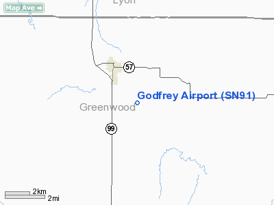
Godfrey Airport
Address:
Greenwood County, KS
Tel:
316-437-2576
Images
and information placed above are from
http://www.airport-data.com/airport/SN91/
We
thank them for the data!
|
General Info |
| Country |
United
States |
| State |
KANSAS
|
| FAA ID |
SN91
|
| Latitude |
38-06-35.081N |
|
Longitude |
096-06-55.982W |
|
Elevation |
1100
feet |
| Near
City |
MADISON
|
We don't guarantee the information is fresh and accurate. The data may
be wrong or outdated.
For more up-to-date information please refer to other sources.
|
|


