 |
|
|
|
|
|
|
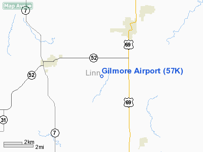
Location &
QuickFacts
|
FAA
Information Effective: |
2008-06-05 |
|
Airport
Identifier: |
57K |
|
Airport
Status: |
Operational |
|
Longitude/Latitude: |
094-44-50.6000W/38-07-41.3000N
-94.747389/38.128139 (Estimated) |
|
Elevation: |
900 ft / 274.32 m (Estimated) |
|
Land: |
7 acres |
|
From
nearest city: |
3 nautical miles SW of Pleasanton, KS |
|
Location: |
Linn County, KS |
|
Magnetic Variation: |
05E (1985) |
Owner & Manager
|
Ownership: |
Privately owned |
|
Owner: |
Tracy Gilmore, Trust |
|
Address: |
4200 So. Mackay Drive
Taylorsville, UT 84119 |
|
Phone
number: |
913-352-8219 |
|
Manager: |
David Lamb - Linn County Clerk |
|
Address: |
315 Main St., P.o. Box 350
Mound City, KS 66056 |
|
Phone number: |
913-795-2668 |
Airport Operations and Facilities
|
Airport
Use: |
Open to public |
|
Wind
indicator: |
Yes |
|
Segmented Circle: |
No |
|
Control
Tower: |
No |
|
Landing
fee charge: |
No |
|
Sectional chart: |
Kansas City |
|
Region: |
ACE - Central |
|
Boundary
ARTCC: |
ZKC - Kansas City |
|
Tie-in
FSS: |
ICT - Wichita |
|
FSS on
Airport: |
No |
|
FSS Toll
Free: |
1-800-WX-BRIEF |
|
NOTAMs
Facility: |
ICT (NOTAM-d service avaliable) |
Airport Communications
Airport Services
|
Bottled
Oxygen: |
NONE |
|
Bulk
Oxygen: |
NONE |
|
Runway Information
Runway 03/21
|
Dimension: |
2870 x 35 ft / 874.8 x 10.7 m |
|
Surface: |
ASPH, Fair Condition |
|
|
Runway 03
|
Runway 21
|
|
Longitude: |
094-45-01.2400W |
094-44-40.0500W |
|
Latitude: |
38-07-29.8500N |
38-07-52.7700N |
|
Traffic
Pattern: |
Left |
Left |
|
Obstruction: |
81 ft trees, 1554.0 ft from runway, 17:1 slope to clear
+12 FT ROAD 50 FT FM RY END. |
, 50:1 slope to clear
+12 FT ROAD 50 FT FM RY END. |
|
Radio Navigation Aids
|
ID |
Type |
Name |
Ch |
Freq |
Var |
Dist |
|
FSK |
NDB |
Fort Scott |
|
379.00 |
05E |
19.9 nm |
|
EAD |
NDB |
Nevada |
|
209.00 |
06E |
26.6 nm |
|
MSB |
NDB |
Monarch |
|
410.00 |
04E |
37.6 nm |
|
PTS |
NDB |
Pittsburg |
|
365.00 |
05E |
41.2 nm |
|
LLU |
NDB |
Spring River |
|
356.00 |
05E |
43.8 nm |
|
UKL |
NDB |
Boyd |
|
245.00 |
05E |
47.2 nm |
|
OJC |
VOR/DME |
Johnson County |
077X |
113.00 |
06E |
42.8 nm |
|
BUM |
VORTAC |
Butler |
106X |
115.90 |
07E |
15.0 nm |
Remarks
-
WILDLIFE ON AND
INVOF ARPT.
-
LINN COUNTY
PROVIDES MINIMUM MAINTENANCE TO AIRSTRIP.
Based Aircraft
|
Aircraft based
on field: |
1 |
|
Single Engine
Airplanes: |
1 |
Operational Statistics
Time Period: 2005-05-02 - 2006-05-01
|
Aircraft
Operations: |
39/Week |
|
General
Aviation Local: |
75.0% |
|
General
Aviation Itinerant: |
25.0% |
Gilmore Airport
Address:
Linn County, KS
Tel:
913-352-8219,
913-795-2668
Images
and information placed above are from
http://www.airport-data.com/airport/57K/
We
thank them for the data!
|
General Info |
| Country |
United
States |
| State |
KANSAS
|
| FAA ID |
57K
|
| Latitude |
38-07-42.107N |
|
Longitude |
094-44-52.854W |
|
Elevation |
900 feet
|
| Near
City |
PLEASANTON |
We don't guarantee the information is fresh and accurate. The data may
be wrong or outdated.
For more up-to-date information please refer to other sources.
|
|


