|
|
Garden City Regional Airport |
| Garden City Regional Airport |
 |
| IATA: GCK â ICAO: KGCK |
| Summary |
| Airport type |
Public |
| Operator |
City of Garden City |
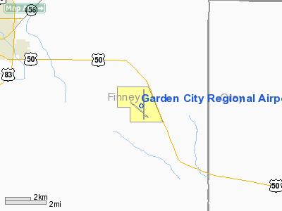
| Location |
Pierceville Township, Finney County, near Garden City, Kansas |
| Elevation AMSL |
2,890 ft / 880.9 m |
| Coordinates |
37°55â²39â³N 100°43â²28â³W / 37.9275°N 100.72444°W / 37.9275; -100.72444Coordinates: 37°55â²39â³N 100°43â²28â³W / 37.9275°N 100.72444°W / 37.9275; -100.72444 |
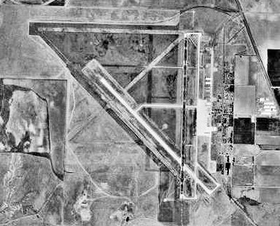
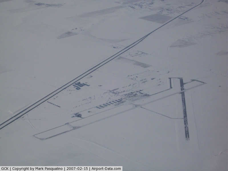
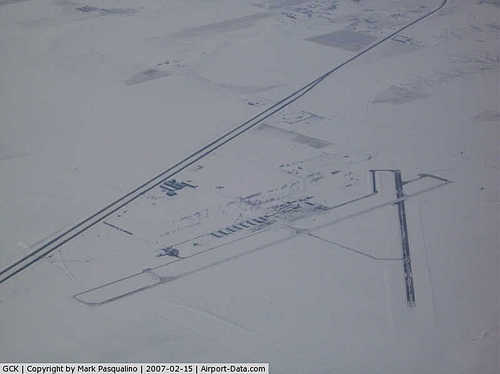
| Runways |
| Direction |
Length |
Surface |
| ft |
m |
| 17/35 |
7,300 |
2,225 |
Concrete |
| 12/30 |
5,700 |
1,737 |
Concrete |
Garden City Regional Airport (IATA: GCK, ICAO: KGCK, FAA LID: GCK) is a public airport located eight miles (13 km) southeast of the central business district (CBD) of Garden City, in Finney County, Kansas, USA. The airport covers 1,848 acres (748 ha) and has two runways. It is mostly used for general aviation, but is also served by one commercial airline. Service is subsidized by the Essential Air Service program. Airlines and destinations
| Airlines |
Destinations |
| Great Lakes Airlines |
Denver, Kansas City, Liberal, Salina |
History
During World War II, the United States Army Air Forces used Garden City Airport as a training airfield by the Army Air Forces Flying Training Command, Gulf Coast Training Center. The facility was known as Garden City Army Airfield.
The immediate construction involved runways and airplane hangars, with five concrete runways, several taxiways and a large parking apron and a control tower. Four large hangars were also constructed. Buildings were ultimately utilitarian and quickly assembled. Most base buildings, not meant for long-term use, were constructed of temporary or semi-permanent materials. Although some hangars had steel frames and the occasional brick or tile brick building could be seen, most support buildings sat on concrete foundations but were of frame construction clad in little more than plywood and tarpaper.
The airfield opened in early 1942 and originally trained Royal Air Force pilots in basic flight training. In June 1943 it wa converted as part of the 70,000 Pilot Training Program into the Army Air Forces Pilot School (Basic) (later 49th Basic Flying Training Group). Flying cadets learned to fly with Vultee BT-13A Valiants. The BT-13 was the basic trainer flown by most pilots during WWII. It was the second phase of the three phase training program for pilots.
There were three auxiliary airfields associated with Garden City AAF which were built in 1943. On 15 December 1944 flying training ceased at the airfield and Garden City AAF was reassigned to Air Service Command, becoming an auxiliary storage depot for the Oklahoma City Air Depot, and was placed on standby status. On 27 April 1945, the airfield was reactivated as an aircraft storage depot, and for the next two years, may of the basic and primary training aircraft used by Air Training Command were flown to Garden City for storage, and ultimately sale or reclamation. The main Garden City Army Airfield and it's auxiliaries were closed at the end of the war in November 1945, and were declared excess by the military on 18 May 1947. Civil authorities developed the main airfield into Garden City Regional Airport.
Garden City Regional Airport's former status as Garden City AAF helped it serve an important role during the terrorist attacks of September 11, 2001. When orders were dispatched to ground all domestic flights, three large jets were ordered to land at GCRA as it was the closest airport with runways that could accommodate the planes. Since planes of such size don't normally use the airport, the passengers had to be evacuated with the aid of ladder trucks from the Garden City Fire Department.
The above content comes from Wikipedia and is published under free licenses – click here to read more.
|
 |
(Click on the photo to enlarge) |
|
Location &
QuickFacts
|
FAA
Information Effective: |
2008-06-05 |
|
Airport
Identifier: |
GCK |
|
Airport
Status: |
Operational |
|
Longitude/Latitude: |
100-43-27.9000W/37-55-39.1000N
-100.724417/37.927528 (Estimated) |
|
Elevation: |
2891 ft / 881.18 m (Surveyed) |
|
Land: |
1848 acres |
|
From
nearest city: |
8 nautical miles SE of Garden City, KS |
|
Location: |
Finney County, KS |
|
Magnetic Variation: |
09E (1985) |
Owner & Manager
|
Ownership: |
Publicly owned |
|
Owner: |
City Of Garden City |
|
Address: |
City Hall, Box 499
Garden City, KS 67846 |
|
Phone
number: |
620-276-1160 |
|
Manager: |
Rachelle Powell |
|
Address: |
2225 S. Air Service Rd. 112
Garden City, KS 67846 |
|
Phone number: |
620-276-1190
FAX 620-276-1192 |
Airport Operations and Facilities
|
Airport
Use: |
Open to public |
|
Wind
indicator: |
Yes |
|
Segmented Circle: |
Yes |
|
Control
Tower: |
Yes |
|
Lighting
Schedule: |
DUSK-DAWN
ACTVT MIRL RY 12/30 & HIRL RY 17/35; REIL RYS 17; 12; 30 & MALSR RY 35
- CTAF.
PAPI RYS 12 & 30 & VASI RYS 17 & 35 ON 24 HRS. |
|
Beacon
Color: |
Clear-Green (lighted land airport) |
|
Landing
fee charge: |
No |
|
Sectional chart: |
Wichita |
|
Region: |
ACE - Central |
|
Boundary
ARTCC: |
ZKC - Kansas City |
|
Tie-in
FSS: |
ICT - Wichita |
|
FSS on
Airport: |
No |
|
FSS Toll
Free: |
1-800-WX-BRIEF |
|
NOTAMs
Facility: |
GCK (NOTAM-d service avaliable) |
|
Certification type/date: |
II A S 05/197
CLSD TO UNSKED ACR OPNS WITH MORE THAN 30 PSGR SEATS EXCP PPR 24 HRS
CALL AMGR (620) 276-1190/(620) 937-4008. |
|
Federal Agreements: |
NGPY |
Airport Communications
|
CTAF: |
118.150 |
|
Unicom: |
122.950 |
Airport Services
|
Fuel
available: |
100LLA
FOR MILITARY FUEL CALL 620-275-5055. |
|
Airframe
Repair: |
MAJOR |
|
Power
Plant Repair: |
MAJOR |
|
Bottled
Oxygen: |
NONE |
|
Bulk
Oxygen: |
LOW |
|
Runway Information
Runway 12/30
|
Dimension: |
5700 x 100 ft / 1737.4 x 30.5 m |
|
Surface: |
CONC, Good Condition |
|
Weight Limit: |
Single wheel: 48000 lbs.
Dual wheel: 60000 lbs. |
|
Edge Lights: |
Medium |
|
|
Runway 12
|
Runway 30
|
|
Longitude: |
100-43-59.7955W |
100-43-09.8727W |
|
Latitude: |
37-55-51.2131N |
37-55-11.0767N |
|
Elevation: |
2891.00 ft |
2878.00 ft |
|
Alignment: |
127 |
127 |
|
Traffic
Pattern: |
Left |
Left |
|
Markings: |
Non-precision instrument, Good Condition |
Non-precision instrument, Good Condition |
|
VASI: |
2-light PAPI on left side |
2-light PAPI on left side |
|
Visual
Glide Angle: |
3.00° |
3.00° |
|
Runway End
Identifier: |
Yes |
Yes |
|
Runway 17/35
|
Dimension: |
7300 x 100 ft / 2225.0 x 30.5 m |
|
Surface: |
CONC, Good Condition |
|
Weight Limit: |
Single wheel: 76000 lbs.
Dual wheel: 91000 lbs.
Dual tandem wheel: 125000 lbs. |
|
Edge Lights: |
High |
|
|
Runway 17
|
Runway 35
|
|
Longitude: |
100-43-22.1514W |
100-43-22.8153W |
|
Latitude: |
37-56-21.2934N |
37-55-09.1433N |
|
Elevation: |
2889.00 ft |
2877.00 ft |
|
Alignment: |
127 |
0 |
|
ILS Type: |
|
ILS |
|
Traffic
Pattern: |
Left |
Left |
|
Markings: |
Precision instrument, Good Condition |
Precision instrument, Good Condition |
|
Crossing
Height: |
39.00 ft |
40.00 ft |
|
VASI: |
4-box on left side |
4-box on left side |
|
Visual
Glide Angle: |
3.00° |
3.00° |
|
Approach
lights: |
|
MALSR |
|
Runway End
Identifier: |
Yes |
|
|
Radio Navigation Aids
|
ID |
Type |
Name |
Ch |
Freq |
Var |
Dist |
|
GC |
NDB |
Pieve |
|
347.00 |
09E |
5.9 nm |
|
TQK |
NDB |
Scott City |
|
256.00 |
08E |
34.1 nm |
|
ULS |
NDB |
Ulysses |
|
395.00 |
09E |
36.5 nm |
|
MEJ |
NDB |
Meade |
|
389.00 |
09E |
42.4 nm |
|
GCK |
VORTAC |
Garden City |
080X |
113.30 |
11E |
0.5 nm |
|
DDC |
VORTAC |
Dodge City |
019X |
108.20 |
08E |
34.4 nm |
Remarks
-
RY 35 DESIGNATED
THE CALM WIND RY.
-
AIR CARRIER OPS
ARE NOT AUTHORIZED IN EXCESS OF 15 MINUTES BEFORE OR AFTER SCHEDULED
ARRIVAL/DEPARTURE TIMES WITHOUT PRIOR COORDINATION WITH AMGR AND CONFIRMATION
THAT ARFF IS AVBL PRIOR TO LDNG OR TKOF.
Based Aircraft
|
Aircraft based
on field: |
46 |
|
Single Engine
Airplanes: |
38 |
|
Multi Engine
Airplanes: |
8 |
Operational Statistics
Time Period: 2006-08-01 - 2007-07-31
|
Aircraft
Operations: |
59/Day |
|
Commerical: |
23.4% |
|
General
Aviation Local: |
6.3% |
|
General
Aviation Itinerant: |
59.4% |
|
Military: |
10.9% |
Garden City Regional Airport
Address:
Finney County, KS
Tel:
620-276-1160,
620-276-1190
Fax:
620-276-1192
Images
and information placed above are from
http://www.airport-data.com/airport/GCK/
We
thank them for the data!
|
General Info |
| Country |
United
States |
| State |
KANSAS
|
| FAA ID |
GCK
|
| Latitude |
37-55-39.056N |
|
Longitude |
100-43-27.893W |
|
Elevation |
2890
feet |
| Near
City |
GARDEN
CITY |
We don't guarantee the information is fresh and accurate. The data may
be wrong or outdated.
For more up-to-date information please refer to other sources.
|
|