 |
|
|
|
|
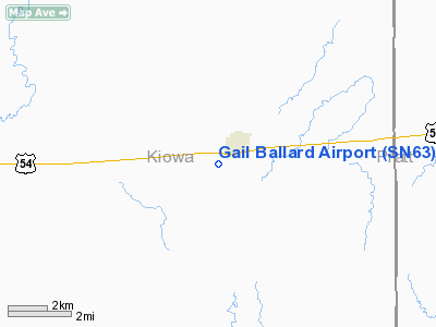
Location &
QuickFacts
|
FAA
Information Effective: |
2008-06-05 |
|
Airport
Identifier: |
SN63 |
|
Airport
Status: |
Operational |
|
Longitude/Latitude: |
099-06-56.3840W/37-36-30.0650N
-99.115662/37.608351 (Estimated) |
|
Elevation: |
2165 ft / 659.89 m (Estimated) |
|
Land: |
12 acres |
|
From
nearest city: |
1 nautical miles W of Haviland, KS |
|
Location: |
Kiowa County, KS |
|
Magnetic Variation: |
08E (1985) |
Owner & Manager
|
Ownership: |
Privately owned |
|
Owner: |
Haviland Airpark Association |
|
Address: |
P.o. Box 328
Haviland, KS 67059 |
|
Phone
number: |
316-862-5678 |
|
Manager: |
Robert Ellis |
|
Address: |
P.o. Box 328
Haviland, KS 67059 |
|
Phone number: |
316-862-5678 |
Airport Operations and Facilities
|
Airport Use: |
Private |
|
Wind indicator: |
Yes |
|
Segmented Circle: |
No |
|
Control Tower: |
No |
|
Lighting Schedule: |
DUSK-DAWN |
|
Landing fee charge: |
No |
|
Sectional chart: |
Wichita |
|
Region: |
ACE - Central |
|
Boundary ARTCC: |
ZKC - Kansas City |
|
Tie-in FSS: |
ICT - Wichita |
|
FSS on Airport: |
No |
|
FSS Toll Free: |
1-800-WX-BRIEF |
Airport Services
|
Airframe
Repair: |
NONE |
|
Power
Plant Repair: |
NONE |
|
Runway Information
Runway 17/35
|
Dimension: |
3100 x 120 ft / 944.9 x 36.6 m |
|
Surface: |
TURF, Fair Condition |
|
Edge Lights: |
Non-standard lighting system
NSTD LIRL; FIRST 800 FT RY 17 UNLGTD; FIRST 400 FT OF RY 35 UNLGTD. |
|
|
Runway 17
|
Runway 35
|
|
Traffic
Pattern: |
Right |
Left |
|
Obstruction: |
35 ft poles, 60 ft left of centerline |
, 50:1 slope to clear |
|
Radio Navigation Aids
|
ID |
Type |
Name |
Ch |
Freq |
Var |
Dist |
|
PTT |
NDB |
Pratt |
|
356.00 |
07E |
18.9 nm |
|
LQR |
NDB |
Larned |
|
296.00 |
08E |
35.9 nm |
|
HIL |
NDB |
Hilyn |
|
338.00 |
08E |
46.2 nm |
|
DDC |
VORTAC |
Dodge City |
019X |
108.20 |
08E |
44.7 nm |
Remarks
-
RODENT HOLES IN
SOUTH 300 FT OF RY 35.
-
MAINTAIN APCH
EACH RWY FOR A MINIMUM 20:1 GLIDE SLOPE AND MAINTAIN TRANSITIONAL SFC FOR A
7:1 SLOPE.
Based Aircraft
|
Aircraft based
on field: |
5 |
|
Single Engine
Airplanes: |
5 |
Operational Statistics
Time Period: 1996-05-29 - 1997-05-28
|
Aircraft
Operations: |
16/Week |
|
General
Aviation Local: |
75.0% |
|
General
Aviation Itinerant: |
25.0% |
Gail Ballard Airport
Address:
Kiowa County, KS
Tel:
316-862-5678
Images
and information placed above are from
http://www.airport-data.com/airport/SN63/
We
thank them for the data!
|
General Info |
| Country |
United
States |
| State |
KANSAS
|
| FAA ID |
SN63
|
| Latitude |
37-36-30.065N |
|
Longitude |
099-06-56.384W |
|
Elevation |
2165
feet |
| Near
City |
HAVILAND
|
We don't guarantee the information is fresh and accurate. The data may
be wrong or outdated.
For more up-to-date information please refer to other sources.
|
|


