 |
|
|
|
|
|
|
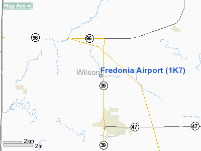
Location &
QuickFacts
|
FAA
Information Effective: |
2008-06-05 |
|
Airport
Identifier: |
1K7 |
|
Airport
Status: |
Operational |
|
Longitude/Latitude: |
095-50-13.3000W/37-34-49.9000N
-95.837028/37.580528 (Estimated) |
|
Elevation: |
880 ft / 268.22 m (Estimated) |
|
Land: |
155 acres |
|
From
nearest city: |
2 nautical miles N of Fredonia, KS |
|
Location: |
Wilson County, KS |
|
Magnetic Variation: |
06E (1985) |
Owner & Manager
|
Ownership: |
Publicly owned |
|
Owner: |
City Of Fredonia |
|
Address: |
314 N 7th St
Fredonia, KS 66736 |
|
Phone
number: |
620-378-2231 |
|
Manager: |
April Engstrom, City Clerk
RUSTY RATZLAFF, STREETS SUPERINTENDENT IS CO-MANAGER OF AIRPORT
FACILITY. |
|
Address: |
314 N 7th St
Fredonia, KS 66736 |
|
Phone number: |
620-378-2231 |
Airport Operations and Facilities
|
Airport
Use: |
Open to public |
|
Wind
indicator: |
Yes
WIND SOCK FADED. |
|
Segmented Circle: |
No |
|
Control
Tower: |
No |
|
Lighting
Schedule: |
DUSK-DAWN |
|
Beacon
Color: |
Clear-Green (lighted land airport)
ROTG BCN OTS INDEFLY. |
|
Landing
fee charge: |
No |
|
Sectional chart: |
Kansas City |
|
Region: |
ACE - Central |
|
Traffic
Pattern Alt: |
800 ft |
|
Boundary
ARTCC: |
ZKC - Kansas City |
|
Tie-in
FSS: |
ICT - Wichita |
|
FSS on
Airport: |
No |
|
FSS Toll
Free: |
1-800-WX-BRIEF |
|
NOTAMs
Facility: |
ICT (NOTAM-d service avaliable) |
Airport Communications
Airport Services
|
Power
Plant Repair: |
NONE |
|
Bottled
Oxygen: |
NONE |
|
Bulk
Oxygen: |
NONE |
|
Runway Information
Runway 17/35
|
Dimension: |
4579 x 45 ft / 1395.7 x 13.7 m |
|
Surface: |
CONC, Fair Condition |
|
Edge Lights: |
Low |
|
|
Runway 17
|
Runway 35
|
|
Longitude: |
095-50-13.2100W |
095-50-13.4500W |
|
Latitude: |
37-35-12.5600N |
37-34-27.2800N |
|
Traffic
Pattern: |
Left |
Left |
|
Markings: |
Nonstandard, Fair Condition
NSTD SMALL BSC MARKINGS. |
Nonstandard, Fair Condition
NSTD SMALL BSC MARKINGS. |
|
Obstruction: |
36 ft trees, 200.0 ft from runway, 60 ft right of
centerline
+18 FT TREES, 0FT FROM RYEND, 60FT R |
15 ft road, 200.0 ft from runway |
|
Radio Navigation Aids
|
ID |
Type |
Name |
Ch |
Freq |
Var |
Dist |
|
PPF |
NDB |
Parsons |
|
258.00 |
06E |
21.4 nm |
|
MSB |
NDB |
Monarch |
|
410.00 |
04E |
23.7 nm |
|
CFV |
NDB |
Coffeyville |
|
212.00 |
05E |
31.9 nm |
|
UKL |
NDB |
Boyd |
|
245.00 |
05E |
43.6 nm |
|
EQA |
NDB |
El Dorado |
|
383.00 |
05E |
48.1 nm |
|
CNU |
VOR/DME |
Chanute |
029X |
109.20 |
05E |
11.9 nm |
|
BVO |
VOR/DME |
Bartlesville |
126X |
117.90 |
08E |
45.7 nm |
|
OSW |
VORTAC |
Oswego |
123X |
117.60 |
08E |
39.5 nm |
|
EMP |
VORTAC |
Emporia |
075X |
112.80 |
08E |
45.0 nm |
Remarks
-
PUBLIC PHONE AT ARPT
-
WILDLIFE ON & INVOF ARPT.
Based Aircraft
|
Aircraft based
on field: |
5 |
|
Single Engine
Airplanes: |
5 |
Operational Statistics
Time Period: 2006-09-16 - 2007-09-15
|
Aircraft
Operations: |
76/Week |
|
General
Aviation Local: |
83.5% |
|
General
Aviation Itinerant: |
16.5% |
Fredonia Airport
Address:
Wilson County, KS
Tel:
620-378-2231
Images
and information placed above are from
http://www.airport-data.com/airport/1K7/
We
thank them for the data!
|
General Info |
| Country |
United
States |
| State |
KANSAS
|
| FAA ID |
1K7
|
| Latitude |
37-34-45.170N |
|
Longitude |
095-50-15.937W |
|
Elevation |
880 feet
|
| Near
City |
FREDONIA
|
We don't guarantee the information is fresh and accurate. The data may
be wrong or outdated.
For more up-to-date information please refer to other sources.
|
|


