 |
|
|
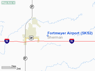
Location &
QuickFacts
|
FAA
Information Effective: |
2008-06-05 |
|
Airport
Identifier: |
5KS2 |
|
Airport
Status: |
Operational |
|
Longitude/Latitude: |
101-39-56.6150W/39-20-30.0010N
-101.665726/39.341667 (Estimated) |
|
Elevation: |
3650 ft / 1112.52 m (Estimated) |
|
Land: |
0 acres |
|
From
nearest city: |
2 nautical miles E of Goodland, KS |
|
Location: |
Sherman County, KS |
|
Magnetic Variation: |
09E (1985) |
Owner & Manager
|
Ownership: |
Privately owned |
|
Owner: |
Eileen Fortmeyer |
|
Address: |
2198-rd 64
Goodland, KS 67735-8808 |
|
Phone number: |
913-899-3562 |
|
Manager: |
Eileen Fortmeyer |
|
Address: |
2198-rd 64
Goodland, KS 67735-8808 |
|
Phone number: |
913-899-3562 |
Airport Operations and Facilities
|
Airport Use: |
Private |
|
Wind indicator: |
Yes |
|
Segmented Circle: |
No |
|
Control Tower: |
No |
|
Landing fee charge: |
No |
|
Sectional chart: |
Wichita |
|
Region: |
ACE - Central |
|
Boundary ARTCC: |
ZDV - Denver |
|
Tie-in FSS: |
ICT - Wichita |
|
FSS on Airport: |
No |
|
FSS Toll Free: |
1-800-WX-BRIEF |
Airport Services
|
Fuel
available: |
80 |
|
Airframe
Repair: |
NONE |
|
Power
Plant Repair: |
NONE |
|
Runway
Information
Runway E/W
|
Dimension: |
4000 x 100 ft / 1219.2 x 30.5 m |
|
Surface: |
DIRT, |
|
|
Runway E
|
Runway W
|
|
Traffic
Pattern: |
Left |
Left |
|
Runway N/S
|
Dimension: |
1000 x 100 ft / 304.8 x 30.5 m |
|
Surface: |
DIRT, |
|
|
Runway N
|
Runway S
|
|
Traffic
Pattern: |
Left |
Left |
|
Radio Navigation Aids
|
ID |
Type |
Name |
Ch |
Freq |
Var |
Dist |
|
GL |
NDB |
Shugr |
|
414.00 |
09E |
4.2 nm |
|
SYF |
NDB |
St Francis |
|
386.00 |
10E |
23.6 nm |
|
ITR |
NDB |
Kit Carson |
|
209.00 |
10E |
29.3 nm |
|
JDM |
NDB |
Wheatfield |
|
408.00 |
08E |
30.4 nm |
|
ADT |
NDB |
Atwood |
|
365.00 |
09E |
41.5 nm |
|
OEL |
NDB |
Oakley |
|
380.00 |
08E |
41.9 nm |
|
GLD |
VORTAC |
Goodland |
098X |
115.10 |
12E |
3.0 nm |
Remarks
-
PROVIDED A CLEAR
APPROACH TO EACH RWY IS MAINTAINED FOR A MINIMUM 20:1 GLIDE SLOPE AND THE
TRANSITIONAL SURFACE BE MAINTAINED FOR A 7:1 SLOPE.
Based Aircraft
|
Aircraft based
on field: |
3 |
|
Single Engine
Airplanes: |
3 |
Fortmeyer Airport
Address:
Sherman County, KS
Tel:
913-899-3562
Images
and information placed above are from
http://www.airport-data.com/airport/5KS2/
We
thank them for the data!
|
General Info |
| Country |
United
States |
| State |
KANSAS
|
| FAA ID |
5KS2
|
| Latitude |
39-20-30.001N |
|
Longitude |
101-39-56.615W |
|
Elevation |
3650
feet |
| Near
City |
GOODLAND
|
We don't guarantee the information is fresh and accurate. The data may
be wrong or outdated.
For more up-to-date information please refer to other sources.
|
|


