 |
|
|
Location &
QuickFacts
|
FAA
Information Effective: |
2008-06-05 |
|
Airport
Identifier: |
41KS |
|
Airport
Status: |
Operational |
|
Longitude/Latitude: |
094-47-50.4000W/38-44-07.8000N
-94.797333/38.735500 (Estimated) |
|
Elevation: |
1075 ft / 327.66 m (Estimated) |
|
Land: |
160 acres |
|
From
nearest city: |
2 nautical miles SE of Spring Hill, KS |
|
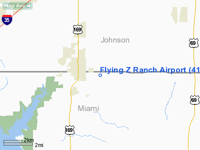
Location: |
Miami County, KS |
|
Magnetic Variation: |
() |
Owner & Manager
|
Ownership: |
Privately owned |
|
Owner: |
Steven W. Zimmerman |
|
Address: |
2344 W. Cothrell
Olathe, KS 66061 |
|
Phone number: |
913-782-9895 |
|
Manager: |
Steven W. Zimmerman |
|
Address: |
2344 W. Cothrell
Olathe, KS 66061 |
|
Phone number: |
913-782-9895 |
Airport
Operations and Facilities
|
Airport
Use: |
Private |
|
Wind
indicator: |
Yes |
|
Control
Tower: |
No |
|
Region: |
ACE - Central |
|
Boundary
ARTCC: |
ZKC - Kansas City |
|
Tie-in
FSS: |
ICT - Wichita |
|
FSS Toll
Free: |
1-800-WX-BRIEF |
|
Runway Information
Runway 06/24
|
Dimension: |
1600 x 100 ft / 487.7 x 30.5 m |
|
Surface: |
TURF, |
|
|
Runway 06
|
Runway 24
|
|
Traffic
Pattern: |
Left |
Left |
|
Runway 13/31
|
Dimension: |
1600 x 100 ft / 487.7 x 30.5 m |
|
Surface: |
TURF, |
|
|
Runway 13
|
Runway 31
|
|
Traffic
Pattern: |
Left |
Left |
|
Runway 18/36
|
Dimension: |
2600 x 150 ft / 792.5 x 45.7 m |
|
Surface: |
TURF, |
|
|
Runway 18
|
Runway 36
|
|
Traffic
Pattern: |
Left |
Left |
|
Radio Navigation Aids
|
ID |
Type |
Name |
Ch |
Freq |
Var |
Dist |
|
GKB |
NDB |
Norge |
|
517.00 |
05E |
20.7 nm |
|
GQ |
NDB |
Norge |
|
517.00 |
05E |
20.7 nm |
|
LXT |
NDB |
Lesumit |
|
263.00 |
04E |
24.1 nm |
|
DO |
NDB |
Dotte |
|
359.00 |
05E |
29.3 nm |
|
GPH |
NDB |
Mosby |
|
284.00 |
03E |
43.2 nm |
|
TO |
NDB |
Biloy |
|
521.00 |
05E |
47.6 nm |
|
FOE |
TACAN |
Forbes |
053X |
|
05E |
42.4 nm |
|
OJC |
VOR/DME |
Johnson County |
077X |
113.00 |
06E |
6.9 nm |
|
RIS |
VOR/DME |
Riverside |
051X |
111.40 |
05E |
25.0 nm |
|
BUM |
VORTAC |
Butler |
106X |
115.90 |
07E |
31.4 nm |
|
MCI |
VORTAC |
Kansas City |
079Y |
113.25 |
05E |
33.2 nm |
|
ANX |
VORTAC |
Napoleon |
087X |
114.00 |
07E |
38.0 nm |
|
TOP |
VORTAC |
Topeka |
125X |
117.80 |
05E |
42.6 nm |
|
MKC |
VOT |
Kansas City Downtown |
|
108.60 |
|
25.1 nm |
|
FOE |
VOT |
Forbes |
|
111.00 |
|
42.7 nm |
Remarks
-
410 FT TOWER 2.5
NM WEST & 200 FT TOWER 2.5 NM SOUTH OF ARPT.
-
PRVDD CLEAR 20:1
APCHS & CLEAR 7:1 TRANSITIONAL SFC.
Based Aircraft
|
Aircraft based
on field: |
1 |
|
Single Engine
Airplanes: |
1 |
Flying Z Ranch Airport
Address:
Miami County, KS
Tel:
913-782-9895
Images
and information placed above are from
http://www.airport-data.com/airport/41KS/
We
thank them for the data!
We don't guarantee the information is fresh and accurate. The data may
be wrong or outdated.
For more up-to-date information please refer to other sources.
|
|


