 |
|
|
Location &
QuickFacts
|
FAA
Information Effective: |
2008-06-05 |
|
Airport
Identifier: |
7KS0 |
|
Airport
Status: |
Operational |
|
Longitude/Latitude: |
095-19-00.8990W/39-16-16.9950N
-95.316916/39.271387 (Estimated) |
|
Elevation: |
1160 ft / 353.57 m (Estimated) |
|
Land: |
0 acres |
|
From
nearest city: |
4 nautical miles N of Oskaloosa, KS |
|
Location: |
Jefferson County, KS |
|
Magnetic Variation: |
05E (1985) |
Owner & Manager
|
Ownership: |
Privately owned |
|
Owner: |
Howard B Twibell |
|
Address: |
Rr 2, Box 201
Oskaloosa, KS 66066 |
|
Phone number: |
913-863-2009 |
|
Manager: |
Howard B Twibell |
|
Address: |
Rr 2, Box 201
Oskaloosa, KS 66066 |
|
Phone number: |
913-863-2009 |
Airport
Operations and Facilities
|
Airport
Use: |
Private |
|
Wind
indicator: |
Yes |
|
Segmented Circle: |
No |
|
Control
Tower: |
No |
|
Landing
fee charge: |
No |
|
Sectional chart: |
Kansas City |
|
Region: |
ACE - Central |
|
Boundary
ARTCC: |
ZKC - Kansas City |
|
Tie-in
FSS: |
ICT - Wichita |
|
FSS on
Airport: |
No |
|
FSS Toll
Free: |
1-800-WX-BRIEF |
|
Runway Information
Runway 09/27
|
Dimension: |
1600 x 60 ft / 487.7 x 18.3 m |
|
Surface: |
TURF, |
|
|
Runway 09
|
Runway 27
|
|
Traffic
Pattern: |
Left |
Left |
|
Markings: |
Nonstandard, |
, |
|
Obstruction: |
|
40 ft pline, 500.0 ft from runway |
|
Radio Navigation Aids
|
ID |
Type |
Name |
Ch |
Freq |
Var |
Dist |
|
TO |
NDB |
Biloy |
|
521.00 |
05E |
19.5 nm |
|
DO |
NDB |
Dotte |
|
359.00 |
05E |
26.6 nm |
|
GQ |
NDB |
Norge |
|
517.00 |
05E |
33.3 nm |
|
GKB |
NDB |
Norge |
|
517.00 |
05E |
33.3 nm |
|
AZN |
NDB |
Amazon |
|
233.00 |
06E |
41.4 nm |
|
GPH |
NDB |
Mosby |
|
284.00 |
03E |
47.2 nm |
|
LXT |
NDB |
Lesumit |
|
263.00 |
04E |
47.9 nm |
|
FNB |
NDB |
Brenner |
|
404.00 |
05E |
50.0 nm |
|
FOE |
TACAN |
Forbes |
053X |
|
05E |
25.2 nm |
|
RIS |
VOR/DME |
Riverside |
051X |
111.40 |
05E |
34.8 nm |
|
RBA |
VOR/DME |
Robinson |
019X |
108.20 |
04E |
35.2 nm |
|
OJC |
VOR/DME |
Johnson County |
077X |
113.00 |
06E |
37.5 nm |
|
TOP |
VORTAC |
Topeka |
125X |
117.80 |
05E |
13.5 nm |
|
MCI |
VORTAC |
Kansas City |
079Y |
113.25 |
05E |
27.0 nm |
|
STJ |
VORTAC |
St Joseph |
102X |
115.50 |
08E |
45.2 nm |
|
FOE |
VOT |
Forbes |
|
111.00 |
|
25.2 nm |
|
MKC |
VOT |
Kansas City Downtown |
|
108.60 |
|
34.6 nm |
Remarks
-
PRVDD EACH APCH
MAINT FOR MIN 20:1 GLIDE SLOPE & TRSNL SFC MAINT 7:1 SLOPE.
Based Aircraft
|
Aircraft based
on field: |
3 |
|
Single Engine
Airplanes: |
3 |
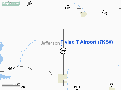
Flying T Airport
Address:
Jefferson County, KS
Tel:
913-863-2009
Images
and information placed above are from
http://www.airport-data.com/airport/7KS0/
We
thank them for the data!
|
General Info |
| Country |
United
States |
| State |
KANSAS
|
| FAA ID |
7KS0
|
| Latitude |
39-16-16.995N |
|
Longitude |
095-19-00.899W |
|
Elevation |
1160
feet |
| Near
City |
OSKALOOSA |
We don't guarantee the information is fresh and accurate. The data may
be wrong or outdated.
For more up-to-date information please refer to other sources.
|
|


