 |
|
|
|
|
|
|
Location &
QuickFacts
|
FAA
Information Effective: |
2008-06-05 |
|
Airport
Identifier: |
13K |
|
Airport
Status: |
Operational |
|
Longitude/Latitude: |
096-17-30.1130W/37-51-05.6970N
-96.291698/37.851582 (Estimated) |
|
Elevation: |
1206 ft / 367.59 m (Surveyed) |
|
Land: |
148 acres |
|
From
nearest city: |
2 nautical miles N of Eureka, KS |
|
Location: |
Greenwood County, KS |
|
Magnetic Variation: |
06E (1985) |
Owner & Manager
|
Ownership: |
Publicly owned |
|
Owner: |
City Of Eureka |
|
Address: |
Memorial Hall
Eureka, KS 67045 |
|
Phone number: |
620-583-6511 |
|
Manager: |
Bob Kenneson |
|
Address: |
Rt 2, Box 77
Eureka, KS 67045 |
|
Phone number: |
620-583-7732 |
Airport
Operations and Facilities
|
Airport
Use: |
Open to public |
|
Wind
indicator: |
Yes |
|
Segmented Circle: |
Yes |
|
Control
Tower: |
No |
|
Lighting
Schedule: |
DUSK-DAWN |
|
Beacon
Color: |
Clear-Green (lighted land airport) |
|
Landing
fee charge: |
No |
|
Sectional chart: |
Kansas City |
|
Region: |
ACE - Central |
|
Boundary
ARTCC: |
ZKC - Kansas City |
|
Tie-in
FSS: |
ICT - Wichita |
|
FSS on
Airport: |
No |
|
FSS Toll
Free: |
1-800-WX-BRIEF |
|
NOTAMs
Facility: |
ICT (NOTAM-d service avaliable) |
|
Federal Agreements: |
NGY |
Airport Communications
|
CTAF: |
122.800 |
|
Unicom: |
122.800 |
Airport Services
|
Fuel
available: |
100LLMOGAS |
|
Airframe
Repair: |
MAJOR |
|
Power
Plant Repair: |
MAJOR |
|
Bottled
Oxygen: |
NONE |
|
Bulk
Oxygen: |
NONE |
|
Runway Information
Runway 08/26
|
Dimension: |
2075 x 55 ft / 632.5 x 16.8 m |
|
Surface: |
TURF, Fair Condition |
|
|
Runway 08
|
Runway 26
|
|
Alignment: |
90 |
127 |
|
Traffic
Pattern: |
Left |
Left |
|
Runway End
Identifier: |
No |
No |
|
Centerline
Lights: |
No |
No |
|
Touchdown
Lights: |
No |
No |
|
Obstruction: |
4 ft fence, 76.0 ft from runway, 19:1 slope to clear |
28 ft pline, 450.0 ft from runway, 16:1 slope to clear |
|
Runway 18/36
|
Dimension: |
3503 x 60 ft / 1067.7 x 18.3 m |
|
Surface: |
ASPH, Good Condition |
|
Weight Limit: |
Single wheel: 8000 lbs. |
|
Edge Lights: |
Low |
|
|
Runway 18
|
Runway 36
|
|
Longitude: |
096-17-25.1470W |
096-17-33.1530W |
|
Latitude: |
37-51-19.4250N |
37-50-45.3760N |
|
Elevation: |
1205.00 ft |
1194.00 ft |
|
Alignment: |
127 |
11 |
|
Traffic
Pattern: |
Left |
Left |
|
Markings: |
Numbers only, Poor Condition
NRS ARE FADED DUE TO AGE AND WEATHER. |
Numbers only, Poor Condition
NRS ARE FADED DUE TO AGE AND WEATHER. |
|
Runway End
Identifier: |
No |
No |
|
Centerline
Lights: |
No |
No |
|
Touchdown
Lights: |
No |
No |
|
Radio Navigation Aids
|
ID |
Type |
Name |
Ch |
Freq |
Var |
Dist |
|
EQA |
NDB |
El Dorado |
|
383.00 |
05E |
25.3 nm |
|
UKL |
NDB |
Boyd |
|
245.00 |
05E |
38.1 nm |
|
MSB |
NDB |
Monarch |
|
410.00 |
04E |
41.8 nm |
|
EWK |
NDB |
Newton |
|
281.00 |
06E |
48.2 nm |
|
PPF |
NDB |
Parsons |
|
258.00 |
06E |
48.4 nm |
|
IAB |
TACAN |
Mc Connell |
112X |
|
07E |
48.4 nm |
|
CNU |
VOR/DME |
Chanute |
029X |
109.20 |
05E |
35.9 nm |
|
EMP |
VORTAC |
Emporia |
075X |
112.80 |
08E |
27.4 nm |
Remarks
-
WILDLIFE ON & INVOF ARPT.
-
RY 18/36 NSTD
LIRL; NON-BREAKABLE COUPLINGS & VARIES IN ELEV OVR 14 INCHES.
RY 18 THLD LGTS ON GND; RY 36
NSTD THLD LGTS.
-
A 20:1 APCH
MAINTD OVR FENCE.
Based Aircraft
|
Aircraft based
on field: |
11 |
|
Single Engine
Airplanes: |
11 |
Operational Statistics
Time Period: 2006-08-31 - 2007-08-30
|
Aircraft
Operations: |
77/Week |
|
General
Aviation Local: |
75.0% |
|
General
Aviation Itinerant: |
25.0% |
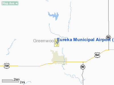
Eureka Municipal Airport
Address:
Greenwood County, KS
Tel:
620-583-6511, 620-583-7732
Images
and information placed above are from
http://www.airport-data.com/airport/13K/
We
thank them for the data!
|
General Info |
| Country |
United
States |
| State |
KANSAS
|
| FAA ID |
13K
|
| Latitude |
37-51-05.697N |
|
Longitude |
096-17-30.113W |
|
Elevation |
1206
feet |
| Near
City |
EUREKA
|
We don't guarantee the information is fresh and accurate. The data may
be wrong or outdated.
For more up-to-date information please refer to other sources.
|
|


