 |
|
|
Location &
QuickFacts
|
FAA
Information Effective: |
2008-06-05 |
|
Airport
Identifier: |
74KS |
|
Airport
Status: |
Operational |
|
Longitude/Latitude: |
095-13-01.9200W/37-56-00.1270N
-95.217200/37.933369 (Estimated) |
|
Elevation: |
1070 ft / 326.14 m (Estimated) |
|
Land: |
0 acres |
|
From
nearest city: |
3 nautical miles W of Moran, KS |
|
Location: |
Allen County, KS |
|
Magnetic Variation: |
05E (1990) |
Owner & Manager
|
Ownership: |
Privately owned |
|
Owner: |
Brian D Ensminger |
|
Address: |
Route 1 Box 78
Moran, KS 66755-9728 |
|
Phone number: |
316-237-8893 |
|
Manager: |
Brian D Ensminger |
|
Address: |
Route 1 Box 78
Moran, KS 66755-9728 |
|
Phone number: |
316-237-8893 |
Airport
Operations and Facilities
|
Airport
Use: |
Private |
|
Wind
indicator: |
Yes |
|
Segmented Circle: |
No |
|
Control
Tower: |
No |
|
Sectional chart: |
Kansas City |
|
Region: |
ACE - Central |
|
Boundary
ARTCC: |
ZKC - Kansas City |
|
Tie-in
FSS: |
ICT - Wichita |
|
FSS Toll
Free: |
1-800-WX-BRIEF |
|
Runway Information
Runway 18/36
|
Dimension: |
2500 x 125 ft / 762.0 x 38.1 m |
|
Surface: |
TURF, |
|
|
Runway 18
|
Runway 36
|
|
Traffic
Pattern: |
Left |
Left |
|
Radio Navigation Aids
|
ID |
Type |
Name |
Ch |
Freq |
Var |
Dist |
|
MSB |
NDB |
Monarch |
|
410.00 |
04E |
12.7 nm |
|
FSK |
NDB |
Fort Scott |
|
379.00 |
05E |
22.9 nm |
|
UKL |
NDB |
Boyd |
|
245.00 |
05E |
32.5 nm |
|
PTS |
NDB |
Pittsburg |
|
365.00 |
05E |
37.6 nm |
|
PPF |
NDB |
Parsons |
|
258.00 |
06E |
38.4 nm |
|
EAD |
NDB |
Nevada |
|
209.00 |
06E |
43.6 nm |
|
CNU |
VOR/DME |
Chanute |
029X |
109.20 |
05E |
25.7 nm |
|
BUM |
VORTAC |
Butler |
106X |
115.90 |
07E |
40.0 nm |
|
OSW |
VORTAC |
Oswego |
123X |
117.60 |
08E |
46.6 nm |
|
EMP |
VORTAC |
Emporia |
075X |
112.80 |
08E |
48.6 nm |
Remarks
-
PRVDD APCHS
MAINTAINED FOR 20:1 GLIDE SLOPE TRANSITIONAL SURFACES FOR A 7:1 SLOPE.
Based Aircraft
|
Aircraft based
on field: |
1 |
|
Single Engine
Airplanes: |
1 |
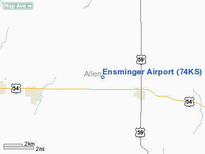
Ensminger Airport
Address:
Allen County, KS
Tel:
316-237-8893
Images
and information placed above are from
http://www.airport-data.com/airport/74KS/
We
thank them for the data!
|
General Info |
| Country |
United
States |
| State |
KANSAS
|
| FAA ID |
74KS
|
| Latitude |
37-56-00.127N |
|
Longitude |
095-13-01.920W |
|
Elevation |
1070
feet |
| Near
City |
MORAN
|
We don't guarantee the information is fresh and accurate. The data may
be wrong or outdated.
For more up-to-date information please refer to other sources.
|
|


