 |
|
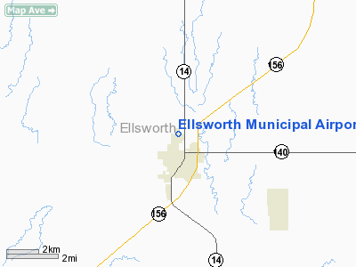
Ellsworth Municipal Airport |
|
|
|
Location &
QuickFacts
|
FAA
Information Effective: |
2008-06-05 |
|
Airport
Identifier: |
9K7 |
|
Airport
Status: |
Operational |
|
Longitude/Latitude: |
098-13-45.3900W/38-45-01.4400N
-98.229275/38.750400 (Estimated) |
|
Elevation: |
1615 ft / 492.25 m (Estimated) |
|
Land: |
160 acres |
|
From
nearest city: |
1 nautical miles N of Ellsworth, KS |
|
Location: |
Ellsworth County, KS |
|
Magnetic Variation: |
07E (1985) |
Owner & Manager
|
Ownership: |
Publicly owned |
|
Owner: |
City Of Ellsworth |
|
Address: |
City Hall 1st & K
Ellsworth, KS 67439 |
|
Phone number: |
785-472-5566 |
|
Manager: |
Jonathan Mitchell-city Mgr. |
|
Address: |
City Hall
Ellsworth, KS 67439 |
|
Phone number: |
785-472-5566 |
Airport
Operations and Facilities
|
Airport
Use: |
Open to public |
|
Wind
indicator: |
Yes |
|
Segmented Circle: |
No |
|
Control
Tower: |
No |
|
Lighting
Schedule: |
DUSK-DAWN
ACTVT MIRL RY 17/35 & TRIL RY 35 - CTAF. |
|
Beacon
Color: |
Clear-Green (lighted land airport) |
|
Landing
fee charge: |
No |
|
Sectional chart: |
Wichita |
|
Region: |
ACE - Central |
|
Boundary
ARTCC: |
ZKC - Kansas City |
|
Tie-in
FSS: |
ICT - Wichita |
|
FSS on
Airport: |
No |
|
FSS Toll
Free: |
1-800-WX-BRIEF |
|
NOTAMs
Facility: |
ICT (NOTAM-d service avaliable) |
|
Federal Agreements: |
N |
Airport Communications
|
CTAF: |
122.700 |
|
Unicom: |
122.700 |
Airport Services
|
Fuel
available: |
100LL
FOR FUEL AFT HRS CALL 785-472-4416. |
|
Airframe
Repair: |
NONE |
|
Power
Plant Repair: |
NONE |
|
Bottled
Oxygen: |
NONE |
|
Bulk
Oxygen: |
NONE |
|
Runway Information
Runway 12/30
|
Dimension: |
2229 x 250 ft / 679.4 x 76.2 m |
|
Surface: |
TURF, Good Condition |
|
|
Runway 12
|
Runway 30
|
|
Traffic
Pattern: |
Left |
Left |
|
Obstruction: |
20 ft pline, 329.0 ft from runway, 16:1 slope to clear |
, 50:1 slope to clear |
|
Runway 17/35
|
Dimension: |
3919 x 48 ft / 1194.5 x 14.6 m |
|
Surface: |
ASPH, Good Condition |
|
Edge Lights: |
Medium |
|
|
Runway 17
|
Runway 35
|
|
Longitude: |
098-13-48.8000W |
098-13-49.5000W |
|
Latitude: |
38-45-27.8000N |
38-44-49.1000N |
|
Traffic
Pattern: |
Left |
Left |
|
Markings: |
Numbers only, Good Condition |
Numbers only, Good Condition |
|
Displaced
threshold: |
0.00 ft |
412.00 ft |
|
VASI: |
|
tri-color on left side
TRIL OPER NIGHT ONLY. |
|
Obstruction: |
, 50:1 slope to clear |
40 ft pole, 938.0 ft from runway, 18:1 slope to clear
33:1 TO DSPLCD THR. |
|
Radio Navigation Aids
|
ID |
Type |
Name |
Ch |
Freq |
Var |
Dist |
|
LYO |
NDB |
Lyons |
|
386.00 |
06E |
24.2 nm |
|
MPR |
NDB |
Mc Pherson |
|
227.00 |
06E |
35.1 nm |
|
HIL |
NDB |
Hilyn |
|
338.00 |
08E |
39.4 nm |
|
HUT |
VOR/DME |
Hutchinson |
115X |
116.80 |
09E |
47.4 nm |
|
SLN |
VORTAC |
Salina |
118X |
117.10 |
07E |
30.3 nm |
|
HYS |
VORTAC |
Hays |
041X |
110.40 |
10E |
49.4 nm |
Remarks
-
PLINE ACROSS APCH
TO RY 12 OUTLINED WITH RED MKR BALLS.
-
IN APCH AREA TO
RY 35 ARE FENCES; CLUSTER LIGHTS & TOWERS.
-
ARPT PUBLIC PHONE NUMBER
785-472-5608.
Based Aircraft
|
Aircraft based
on field: |
15 |
|
Single Engine
Airplanes: |
13 |
|
Ultralights: |
2 |
Operational Statistics
Time Period: 2005-05-13 - 2006-05-12
|
Aircraft
Operations: |
55/Day |
|
General
Aviation Local: |
69.7% |
|
General
Aviation Itinerant: |
29.9% |
|
Military: |
0.4% |
Ellsworth Municipal Airport
Address:
Ellsworth County, KS
Tel:
785-472-5566
Images
and information placed above are from
http://www.airport-data.com/airport/9K7/
We
thank them for the data!
|
General Info |
| Country |
United
States |
| State |
KANSAS
|
| FAA ID |
9K7
|
| Latitude |
38-44-51.032N |
|
Longitude |
098-13-50.204W |
|
Elevation |
1615
feet |
| Near
City |
ELLSWORTH |
We don't guarantee the information is fresh and accurate. The data may
be wrong or outdated.
For more up-to-date information please refer to other sources.
|
|


