 |
|
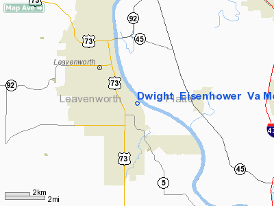
Dwight Eisenhower Veterans Affairs Medical Center Heliport |
|
|
|
Location &
QuickFacts
|
FAA
Information Effective: |
2008-06-05 |
|
Airport
Identifier: |
SN01 |
|
Airport
Status: |
Operational |
|
Longitude/Latitude: |
094-53-16.8670W/39-16-58.0030N
-94.888019/39.282779 (Estimated) |
|
Elevation: |
897 ft / 273.41 m (Estimated) |
|
Land: |
0 acres |
|
From
nearest city: |
0 nautical miles N of Leavenworth, KS |
|
Location: |
Leavenworth County, KS |
|
Magnetic Variation: |
04E (1995) |
Owner & Manager
|
Ownership: |
Publicly owned |
|
Owner: |
U.s. Dept Of Veterans Affairs |
|
Address: |
4101 S. 4th Street
Leavenworth, KS 66048-5055 |
|
Phone
number: |
913-758-4144 |
|
Manager: |
Walter Ellingwood
POLICE CHIEF. |
|
Address: |
4101 S. 4th Street
Leavenworth, KS 66048-5055 |
|
Phone number: |
913-758-4144 |
Airport Operations and Facilities
|
Airport
Use: |
Private
MEDICAL USE. |
|
Wind
indicator: |
Yes |
|
Segmented Circle: |
No |
|
Control
Tower: |
No |
|
Lighting
Schedule: |
PHONE REQ
FOR ROTG BCN CALL 913-758-4144. |
|
Beacon
Color: |
Clear-Green-Yellow (heliport) |
|
Region: |
ACE - Central |
|
Boundary
ARTCC: |
ZKC - Kansas City |
|
Tie-in
FSS: |
ICT - Wichita |
|
FSS Toll
Free: |
1-800-WX-BRIEF |
|
Runway Information
Helipad H1
|
Dimension: |
20 x 20 ft / 6.1 x 6.1 m |
|
Surface: |
ASPH, |
|
|
Runway H1
|
Runway
|
|
Traffic
Pattern: |
Left |
Left |
|
Radio Navigation Aids
|
ID |
Type |
Name |
Ch |
Freq |
Var |
Dist |
|
DO |
NDB |
Dotte |
|
359.00 |
05E |
7.4 nm |
|
GQ |
NDB |
Norge |
|
517.00 |
05E |
17.2 nm |
|
GKB |
NDB |
Norge |
|
517.00 |
05E |
17.2 nm |
|
GPH |
NDB |
Mosby |
|
284.00 |
03E |
27.3 nm |
|
LXT |
NDB |
Lesumit |
|
263.00 |
04E |
30.9 nm |
|
AZN |
NDB |
Amazon |
|
233.00 |
06E |
36.1 nm |
|
TO |
NDB |
Biloy |
|
521.00 |
05E |
38.5 nm |
|
EZZ |
NDB |
Cameron |
|
394.00 |
03E |
39.2 nm |
|
FOE |
TACAN |
Forbes |
053X |
|
05E |
41.3 nm |
|
RIS |
VOR/DME |
Riverside |
051X |
111.40 |
05E |
16.7 nm |
|
OJC |
VOR/DME |
Johnson County |
077X |
113.00 |
06E |
27.5 nm |
|
RBA |
VOR/DME |
Robinson |
019X |
108.20 |
04E |
42.2 nm |
|
MCI |
VORTAC |
Kansas City |
079Y |
113.25 |
05E |
7.0 nm |
|
TOP |
VORTAC |
Topeka |
125X |
117.80 |
05E |
32.0 nm |
|
ANX |
VORTAC |
Napoleon |
087X |
114.00 |
07E |
37.1 nm |
|
STJ |
VORTAC |
St Joseph |
102X |
115.50 |
08E |
40.8 nm |
|
MKC |
VOT |
Kansas City Downtown |
|
108.60 |
|
16.6 nm |
|
FOE |
VOT |
Forbes |
|
111.00 |
|
41.4 nm |
Remarks
-
OWNER DESIRES
ARPT NOT BE CHARTED.
-
SEE AIRSPACE CASE
97-ACE-230-NRA.
Dwight Eisenhower Veterans Affairs
Medical Center Heliport
Address:
Leavenworth County, KS
Tel:
913-758-4144
Images
and information placed above are from
http://www.airport-data.com/airport/SN01/
We
thank them for the data!
|
General Info |
| Country |
United
States |
| State |
KANSAS
|
| FAA ID |
SN01
|
| Latitude |
39-16-58.003N |
|
Longitude |
094-53-16.867W |
|
Elevation |
897 feet
|
| Near
City |
LEAVENWORTH |
We don't guarantee the information is fresh and accurate. The data may
be wrong or outdated.
For more up-to-date information please refer to other sources.
|
|


