 |
|
|
|
|
|
|
Location &
QuickFacts
|
FAA
Information Effective: |
2008-06-05 |
|
Airport
Identifier: |
K65 |
|
Airport
Status: |
Operational |
|
Longitude/Latitude: |
100-28-46.5050W/38-29-23.0600N
-100.479585/38.489739 (Estimated) |
|
Elevation: |
2778 ft / 846.73 m (Surveyed) |
|
Land: |
110 acres |
|
From
nearest city: |
1 nautical miles NW of Dighton, KS |
|
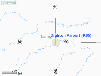
Location: |
Lane County, KS |
|
Magnetic Variation: |
09E (1985) |
Owner & Manager
|
Ownership: |
Publicly owned |
|
Owner: |
City-county |
|
Address: |
Box 788
Dighton, KS 67839 |
|
Phone
number: |
620-397-5541 |
|
Manager: |
Dennis Selfridge
AIRPORT BOARD MEMBER. |
|
Address: |
Box 209
Dighton, KS 67839 |
|
Phone number: |
620-397-3751
620-397-2802 EX 218. |
Airport
Operations and Facilities
|
Airport
Use: |
Open to public |
|
Wind
indicator: |
Yes |
|
Segmented Circle: |
No |
|
Control
Tower: |
No |
|
Lighting
Schedule: |
RDO-CTL
ACTVT LIRL 17/35 - CTAF. |
|
Landing
fee charge: |
No |
|
Sectional chart: |
Wichita |
|
Region: |
ACE - Central |
|
Boundary
ARTCC: |
ZKC - Kansas City |
|
Tie-in
FSS: |
ICT - Wichita |
|
FSS on
Airport: |
No |
|
FSS Toll
Free: |
1-800-WX-BRIEF |
|
NOTAMs
Facility: |
ICT (NOTAM-d service avaliable) |
Airport Communications
Airport Services
|
Airframe
Repair: |
NONE |
|
Power
Plant Repair: |
NONE |
|
Bottled
Oxygen: |
NONE |
|
Bulk
Oxygen: |
NONE |
|
Runway Information
Runway 06/24
|
Dimension: |
2000 x 110 ft / 609.6 x 33.5 m |
|
Surface: |
TURF, Fair Condition |
|
|
Runway 06
|
Runway 24
|
|
Traffic
Pattern: |
Left |
Left |
|
Obstruction: |
15 ft road, 600.0 ft from runway, 40:1 slope to clear |
15 ft road, 40.0 ft from runway, 2:1 slope to clear |
|
Runway 13/31
|
Dimension: |
2000 x 110 ft / 609.6 x 33.5 m |
|
Surface: |
TURF, Fair Condition |
|
|
Runway 13
|
Runway 31
|
|
Traffic
Pattern: |
Left |
Left |
|
Markings: |
, |
None, |
|
Runway End
Identifier: |
|
No |
|
Centerline
Lights: |
|
No |
|
Touchdown
Lights: |
|
No |
|
Obstruction: |
65 ft pline, 2750.0 ft from runway, 42:1 slope to clear |
23 ft rr, 50.0 ft from runway, 2:1 slope to clear |
|
Runway 17/35
|
Dimension: |
2400 x 40 ft / 731.5 x 12.2 m |
|
Surface: |
ASPH, Good Condition |
|
Edge Lights: |
Low |
|
|
Runway 17
|
Runway 35
|
|
Traffic
Pattern: |
Left |
Left |
|
Markings: |
Basic, Fair Condition |
Basic, Fair Condition |
|
Obstruction: |
65 ft pline, 1300.0 ft from runway, 16:1 slope to clear
3 FT FENCE POST AT 50 FT.16:1. |
, 50:1 slope to clear
RY 35 +23 FT RR AT 50.
OBSTN CLNC
SLOPE 2:1. |
|
Helipad H1
|
Dimension: |
30 x 30 ft / 9.1 x 9.1 m |
|
Surface: |
CONC, Good Condition |
|
|
Runway H1
|
Runway
|
|
Traffic
Pattern: |
Left |
Left |
|
Radio Navigation Aids
|
ID |
Type |
Name |
Ch |
Freq |
Var |
Dist |
|
TQK |
NDB |
Scott City |
|
256.00 |
08E |
19.2 nm |
|
OEL |
NDB |
Oakley |
|
380.00 |
08E |
40.6 nm |
|
GC |
NDB |
Pieve |
|
347.00 |
09E |
41.4 nm |
|
GCK |
VORTAC |
Garden City |
080X |
113.30 |
11E |
36.2 nm |
|
DDC |
VORTAC |
Dodge City |
019X |
108.20 |
08E |
44.5 nm |
|
HLC |
VORTAC |
Hill City |
084X |
113.70 |
08E |
47.7 nm |
Remarks
-
PUBLIC PHONE AVBL -
620-397-8651.
-
EXISTED PRIOR TO 1959.
Based Aircraft
|
Aircraft based
on field: |
3 |
|
Single Engine
Airplanes: |
3 |
Operational Statistics
Time Period: 2005-08-30 - 2006-08-29
|
Aircraft
Operations: |
29/Week |
|
General
Aviation Local: |
66.7% |
|
General
Aviation Itinerant: |
33.3% |
Dighton Airport
Address:
Lane County, KS
Tel:
620-397-5541,
620-397-3751, 620-397-2802
Images
and information placed above are from
http://www.airport-data.com/airport/K65/
We
thank them for the data!
|
General Info |
| Country |
United
States |
| State |
KANSAS
|
| FAA ID |
K65
|
| Latitude |
38-29-23.060N |
|
Longitude |
100-28-46.505W |
|
Elevation |
2778
feet |
| Near
City |
DIGHTON
|
We don't guarantee the information is fresh and accurate. The data may
be wrong or outdated.
For more up-to-date information please refer to other sources.
|
|


