 |
|
|
Location &
QuickFacts
|
FAA
Information Effective: |
2008-06-05 |
|
Airport
Identifier: |
8KS3 |
|
Airport
Status: |
Operational |
|
Longitude/Latitude: |
095-28-49.9310W/39-51-10.0120N
-95.480536/39.852781 (Estimated) |
|
Elevation: |
1100 ft / 335.28 m (Estimated) |
|
Land: |
0 acres |
|
From
nearest city: |
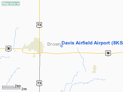
3 nautical miles E of Hiawatha, KS |
|
Location: |
Brown County, KS |
|
Magnetic Variation: |
05E (1985) |
Owner & Manager
|
Ownership: |
Privately owned |
|
Owner: |
Robert Davis |
|
Address: |
Rt 2
Hiawatha, KS 66434 |
|
Phone number: |
913-742-2269 |
|
Manager: |
Robert Davis |
|
Address: |
Rt 2
Hiawatha, KS 66434 |
|
Phone number: |
913-742-2269 |
Airport Operations and Facilities
|
Airport Use: |
Private |
|
Wind indicator: |
Yes |
|
Segmented Circle: |
No |
|
Control Tower: |
No |
|
Landing fee charge: |
No |
|
Sectional chart: |
Kansas City |
|
Region: |
ACE - Central |
|
Boundary ARTCC: |
ZKC - Kansas City |
|
Tie-in FSS: |
ICT - Wichita |
|
FSS on Airport: |
No |
|
FSS Toll Free: |
1-800-WX-BRIEF |
Airport Services
|
Runway Information
Runway 17/35
|
Dimension: |
2540 x 50 ft / 774.2 x 15.2 m |
|
Surface: |
TURF, |
|
|
Runway 17
|
Runway 35
|
|
Traffic
Pattern: |
Left |
Right |
|
Radio Navigation Aids
|
ID |
Type |
Name |
Ch |
Freq |
Var |
Dist |
|
FNB |
NDB |
Brenner |
|
404.00 |
05E |
14.3 nm |
|
AZN |
NDB |
Amazon |
|
233.00 |
06E |
26.5 nm |
|
AYB |
NDB |
Auburn |
|
430.00 |
05E |
38.1 nm |
|
EVU |
NDB |
Emville |
|
317.00 |
05E |
39.5 nm |
|
TO |
NDB |
Biloy |
|
521.00 |
05E |
45.1 nm |
|
AFK |
NDB |
Nebraska City |
|
347.00 |
05E |
48.5 nm |
|
RBA |
VOR/DME |
Robinson |
019X |
108.20 |
04E |
2.7 nm |
|
STJ |
VORTAC |
St Joseph |
102X |
115.50 |
08E |
26.4 nm |
|
PWE |
VORTAC |
Pawnee City |
071X |
112.40 |
05E |
39.4 nm |
|
TOP |
VORTAC |
Topeka |
125X |
117.80 |
05E |
43.1 nm |
|
MCI |
VORTAC |
Kansas City |
079Y |
113.25 |
05E |
48.5 nm |
Remarks
-
EXTENSIVE RADIO
CONTROL MODEL AIRPLANE FLYING ON THE AIRFIELD.
-
PRVDD THAT THE
OPERATOR OF DAVIS FIELD AIRPORT ESTAB ALL TFC PATS TO THE EAST OF HIS ARPT TO
AVOID CONFLICTING TFC PATS WITH THE HIAWATHA MUNI ARPT. APCH TO EACH RWY MUST
MAINTAINED FOR A MINIMUM 20:1 GLIDE SLOPE AND THE TRANSITIONAL SURFACE BE
MAINTAINED FOR A 7:1 SLOPE.
Based Aircraft
|
Aircraft based
on field: |
1 |
|
Single Engine
Airplanes: |
1 |
Davis Airfield Airport
Address:
Brown County, KS
Tel:
913-742-2269
Images
and information placed above are from
http://www.airport-data.com/airport/8KS3/
We
thank them for the data!
|
General Info |
| Country |
United
States |
| State |
KANSAS
|
| FAA ID |
8KS3
|
| Latitude |
39-51-10.012N |
|
Longitude |
095-28-49.931W |
|
Elevation |
1100
feet |
| Near
City |
HIAWATHA
|
We don't guarantee the information is fresh and accurate. The data may
be wrong or outdated.
For more up-to-date information please refer to other sources.
|
|


