 |
|
|
Location &
QuickFacts
|
FAA
Information Effective: |
2008-06-05 |
|
Airport
Identifier: |
9KS9 |
|
Airport
Status: |
Operational |
|
Longitude/Latitude: |
097-37-06.0000W/38-47-27.0000N
-97.618333/38.790833 (Estimated) |
|
Elevation: |
1272 ft / 387.71 m (Estimated) |
|
Land: |
0 acres |
|
From
nearest city: |
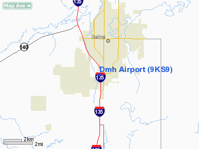
1 nautical miles SW of Salina, KS |
|
Location: |
Saline County, KS |
|
Magnetic Variation: |
06E (1995) |
Owner & Manager
|
Ownership: |
Privately owned |
|
Owner: |
Darrell M Hills |
|
Address: |
1 Dmh Lane
Salina, KS 67401-7965 |
|
Phone number: |
913-827-9207 |
|
Manager: |
Darrell M Hills |
|
Address: |
1 Dmh Lane
Salina, KS 67401-7965 |
|
Phone number: |
913-827-9207 |
Airport
Operations and Facilities
|
Airport
Use: |
Private |
|
Segmented Circle: |
No |
|
Control
Tower: |
No |
|
Sectional chart: |
Wichita |
|
Region: |
ACE - Central |
|
Boundary
ARTCC: |
ZKC - Kansas City |
|
Tie-in
FSS: |
ICT - Wichita |
|
FSS on
Airport: |
No |
|
FSS Toll
Free: |
1-800-WX-BRIEF |
|
Runway Information
Runway 17/35
|
Dimension: |
1000 x 20 ft / 304.8 x 6.1 m |
|
Surface: |
ASPH, |
|
|
Runway 17
|
Runway 35
|
|
Traffic
Pattern: |
Left |
Right |
|
Radio Navigation Aids
|
ID |
Type |
Name |
Ch |
Freq |
Var |
Dist |
|
MPR |
NDB |
Mc Pherson |
|
227.00 |
06E |
26.8 nm |
|
HRU |
NDB |
Herington |
|
407.00 |
06E |
38.3 nm |
|
LYO |
NDB |
Lyons |
|
386.00 |
06E |
39.1 nm |
|
CVY |
NDB |
Cavalry |
|
314.00 |
06E |
41.0 nm |
|
CYW |
NDB |
Clay Center |
|
362.00 |
07E |
41.4 nm |
|
CNK |
NDB |
Concordia |
|
335.00 |
06E |
45.9 nm |
|
EWK |
NDB |
Newton |
|
281.00 |
06E |
46.6 nm |
|
FRI |
VOR |
Fort Riley |
|
109.40 |
06E |
37.0 nm |
|
MHK |
VOR/DME |
Manhattan |
039X |
110.20 |
06E |
49.2 nm |
|
HUT |
VOR/DME |
Hutchinson |
115X |
116.80 |
09E |
50.0 nm |
|
SLN |
VORTAC |
Salina |
118X |
117.10 |
07E |
8.1 nm |
Remarks
-
OWNER DESIRES
ARPT NOT BE CHARTED.
-
HOUSING AREA &
UTILITY LINES AT S END OF ARPT.
-
PRVDD MAINTAINA
CLEAR 20:1 APCH & 7: 1 TRANSITIONAL SFC & TFC PATTERN ESTAB ON E SIDE RY & CTC
SALINA ATCT PRIOR TO ENTERING OR LEAVING ARPT.
Based Aircraft
|
Aircraft based
on field: |
1 |
|
Single Engine
Airplanes: |
1 |
Darrell M Hills Airport
Address:
Saline County, KS
Tel:
913-827-9207
Images
and information placed above are from
http://www.airport-data.com/airport/9KS9/
We
thank them for the data!
|
General Info |
| Country |
United
States |
| State |
KANSAS
|
| FAA ID |
9KS9
|
| Latitude |
38-47-27.000N |
|
Longitude |
097-37-06.000W |
|
Elevation |
1272
feet |
| Near
City |
SALINA
|
We don't guarantee the information is fresh and accurate. The data may
be wrong or outdated.
For more up-to-date information please refer to other sources.
|
|


