 |
|
|
Location &
QuickFacts
|
FAA
Information Effective: |
2008-06-05 |
|
Airport
Identifier: |
SN16 |
|
Airport
Status: |
Operational |
|
Longitude/Latitude: |
097-16-11.1450W/37-51-23.0430N
-97.269762/37.856401 (Estimated) |
|
Elevation: |
1380 ft / 420.62 m (Estimated) |
|
Land: |
5 acres |
|
From
nearest city: |
4 nautical miles S of Kechi, KS |
|
Location: |
Sedgwick County, KS |
|
Magnetic Variation: |
07E (1990) |
Owner & Manager
|
Ownership: |
Privately owned |
|
Owner: |
Lloyd W. Curtis |
|
Address: |
Rt 2 Box 62
Valley Center, KS 67147 |
|
Phone
number: |
316-744-3265 |
|
Manager: |
Lloyd W. Curtis |
|
Address: |
Rt 2 Box 62
Valley Center, KS 67147 |
|
Phone number: |
316-744-3265 |
Airport Operations and Facilities
|
Airport
Use: |
Private |
|
Wind
indicator: |
Yes |
|
Segmented Circle: |
No |
|
Control
Tower: |
No |
|
Sectional chart: |
Wichita |
|
Region: |
ACE - Central |
|
Boundary
ARTCC: |
ZKC - Kansas City |
|
Tie-in
FSS: |
ICT - Wichita |
|
FSS Toll
Free: |
1-800-WX-BRIEF |
|
Runway Information
Runway 18/36
|
Dimension: |
630 x 50 ft / 192.0 x 15.2 m |
|
Surface: |
TURF, |
|
|
Runway 18
|
Runway 36
|
|
Traffic
Pattern: |
Left |
Left |
|
Obstruction: |
|
20 ft trees, 0.0 ft from runway |
|
Radio Navigation Aids
|
ID |
Type |
Name |
Ch |
Freq |
Var |
Dist |
|
EWK |
NDB |
Newton |
|
281.00 |
06E |
12.5 nm |
|
IC |
NDB |
Piche |
|
332.00 |
07E |
18.9 nm |
|
EQA |
NDB |
El Dorado |
|
383.00 |
05E |
22.0 nm |
|
EGT |
NDB |
Wellington |
|
414.00 |
07E |
32.5 nm |
|
MPR |
NDB |
Mc Pherson |
|
227.00 |
06E |
35.6 nm |
|
IAB |
TACAN |
Mc Connell |
112X |
|
07E |
14.1 nm |
|
HUT |
VOR/DME |
Hutchinson |
115X |
116.80 |
09E |
32.6 nm |
|
ICT |
VORTAC |
Wichita |
085X |
113.80 |
07E |
16.3 nm |
|
ICT |
VOT |
Wichita |
|
114.00 |
|
15.3 nm |
Remarks
-
OWNER DESIRES
ARPT NOT BE CHARTED.
-
PRVDD APCH TO EA
RY MAINTAINED FOR A MINIMUM 20:1 GLIDE SLOPE & ARPT TRANSITIONAL SFC
MAINTAINED FOR A 7:1 SLOPE.
Based Aircraft
|
Aircraft based
on field: |
1 |
|
Single Engine
Airplanes: |
1 |
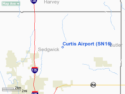
Curtis Airport
Address:
Sedgwick County, KS
Tel:
316-744-3265
Images
and information placed above are from
http://www.airport-data.com/airport/SN16/
We
thank them for the data!
|
General Info |
| Country |
United
States |
| State |
KANSAS
|
| FAA ID |
SN16
|
| Latitude |
37-51-23.043N |
|
Longitude |
097-16-11.145W |
|
Elevation |
1380
feet |
| Near
City |
KECHI
|
We don't guarantee the information is fresh and accurate. The data may
be wrong or outdated.
For more up-to-date information please refer to other sources.
|
|


