 |
|
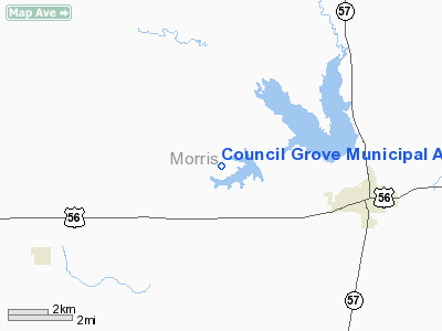
Council Grove Municipal Airport |
|
|
|
Location &
QuickFacts
|
FAA
Information Effective: |
2008-06-05 |
|
Airport
Identifier: |
K63 |
|
Airport
Status: |
Operational |
|
Longitude/Latitude: |
096-34-21.9000W/38-40-35.3000N
-96.572750/38.676472 (Estimated) |
|
Elevation: |
1409 ft / 429.46 m (Surveyed) |
|
Land: |
100 acres |
|
From
nearest city: |
3 nautical miles NW of Council Grove, KS |
|
Location: |
Morris County, KS |
|
Magnetic Variation: |
06E (1985) |
Owner & Manager
|
Ownership: |
Publicly owned |
|
Owner: |
City Of Council Grove |
|
Address: |
313 West Main
Council Grove, KS 66846 |
|
Phone
number: |
620-767-5417 |
|
Manager: |
Ted King |
|
Address: |
Rt 1, Box 200
Council Grove, KS 66846 |
|
Phone number: |
620-767-5417 |
Airport Operations and Facilities
|
Airport
Use: |
Open to public |
|
Wind
indicator: |
Yes |
|
Segmented Circle: |
No |
|
Control
Tower: |
No |
|
Landing
fee charge: |
No |
|
Sectional chart: |
Kansas City |
|
Region: |
ACE - Central |
|
Boundary
ARTCC: |
ZKC - Kansas City |
|
Tie-in
FSS: |
ICT - Wichita |
|
FSS on
Airport: |
No |
|
FSS Toll
Free: |
1-800-WX-BRIEF |
|
NOTAMs
Facility: |
ICT (NOTAM-d service avaliable) |
Airport Communications
Airport Services
|
Airframe
Repair: |
NONE |
|
Power
Plant Repair: |
NONE |
|
Bottled
Oxygen: |
NONE |
|
Bulk
Oxygen: |
NONE |
|
Runway Information
Runway 04/22
|
Dimension: |
1845 x 120 ft / 562.4 x 36.6 m |
|
Surface: |
TURF, Good Condition
RY 04/22 VERY SOFT & SLICK DURING PERIODS OF INCLEMENT WEATHER.
RY 12/30 VERY SOFT & SLICK DURING PERIODS OF INCLEMENT WEATHER. |
|
|
Runway 04
|
Runway 22
|
|
Longitude: |
096-34-29.4300W |
096-34-12.6200W |
|
Latitude: |
38-40-28.7300N |
38-40-41.3500N |
|
Traffic
Pattern: |
Left |
Left |
|
Obstruction: |
10 ft trees, 185.0 ft from runway, 40 ft right of
centerline, 18:1 slope to clear |
12 ft pline, 225.0 ft from runway, 18:1 slope to clear |
|
Runway 12/30
|
Dimension: |
1690 x 75 ft / 515.1 x 22.9 m |
|
Surface: |
TURF, Good Condition
RY 04/22 VERY SOFT & SLICK DURING PERIODS OF INCLEMENT WEATHER.
RY 12/30 VERY SOFT & SLICK DURING PERIODS OF INCLEMENT WEATHER. |
|
|
Runway 12
|
Runway 30
|
|
Longitude: |
096-34-32.2300W |
096-34-13.5100W |
|
Latitude: |
38-40-39.6000N |
38-40-31.6000N |
|
Traffic
Pattern: |
Left |
Left |
|
Obstruction: |
14 ft trees, 12.0 ft from runway |
31 ft trees, 540.0 ft from runway, 17:1 slope to clear |
|
Radio Navigation Aids
|
ID |
Type |
Name |
Ch |
Freq |
Var |
Dist |
|
HRU |
NDB |
Herington |
|
407.00 |
06E |
11.2 nm |
|
CVY |
NDB |
Cavalry |
|
314.00 |
06E |
23.4 nm |
|
MQD |
NDB |
Mc Dowell Creek |
|
391.00 |
06E |
26.6 nm |
|
UKL |
NDB |
Boyd |
|
245.00 |
05E |
46.0 nm |
|
TO |
NDB |
Biloy |
|
521.00 |
05E |
49.3 nm |
|
EWK |
NDB |
Newton |
|
281.00 |
06E |
49.4 nm |
|
FOE |
TACAN |
Forbes |
053X |
|
05E |
45.7 nm |
|
FRI |
VOR |
Fort Riley |
|
109.40 |
06E |
22.2 nm |
|
MHK |
VOR/DME |
Manhattan |
039X |
110.20 |
06E |
28.5 nm |
|
EMP |
VORTAC |
Emporia |
075X |
112.80 |
08E |
30.9 nm |
|
FOE |
VOT |
Forbes |
|
111.00 |
|
45.5 nm |
Remarks
-
RDO-CTLD MODEL
ACFT ACTVTY ON ARPT WKENDS EVES & HOLS.
-
ARPT ESTABD PRIOR 1959.
Operational Statistics
Time Period: 2006-09-28 - 2007-09-27
|
Aircraft
Operations: |
34/Month |
|
General
Aviation Itinerant: |
75.0% |
|
Military: |
25.0% |
Council Grove Municipal Airport
Address:
Morris County, KS
Tel:
620-767-5417
Images
and information placed above are from
http://www.airport-data.com/airport/K63/
We
thank them for the data!
|
General Info |
| Country |
United
States |
| State |
KANSAS
|
| FAA ID |
K63
|
| Latitude |
38-40-45.026N |
|
Longitude |
096-34-16.016W |
|
Elevation |
1409
feet |
| Near
City |
COUNCIL
GROVE |
We don't guarantee the information is fresh and accurate. The data may
be wrong or outdated.
For more up-to-date information please refer to other sources.
|
|


