|
|
Cook Airfield Incorporated Airport |
|
 |
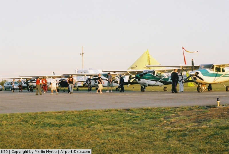
(Click on the photo to enlarge) |
|
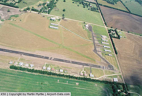 |
(Click on the photo to enlarge) |
|
Location &
QuickFacts
|
FAA
Information Effective: |
2008-06-05 |
|
Airport
Identifier: |
K50 |
|
Airport
Status: |
Operational |
|
Longitude/Latitude: |
097-10-01.1490W/37-34-00.0640N
-97.166986/37.566684 (Estimated) |
|
Elevation: |
1345 ft / 409.96 m (Estimated) |
|
Land: |
55 acres |
|
From
nearest city: |
3 nautical miles E of Derby, KS |
|
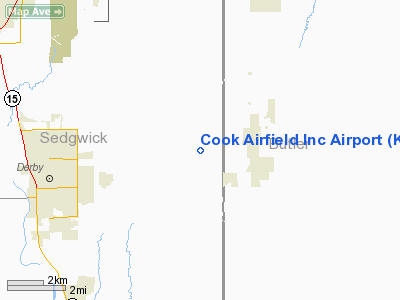
Location: |
Sedgwick County, KS |
|
Magnetic Variation: |
07E (1985) |
Owner & Manager
|
Ownership: |
Privately owned |
|
Owner: |
Crosswind Avaition Inc. |
|
Address: |
7015 S. 143rd East
Derby, KS 67037 |
|
Phone
number: |
316-776-2088 |
|
Manager: |
Steve Logue
CO-MANAGER GREG THOMAS |
|
Address: |
6400 East 49th Street South
Derby, KS 67037 |
|
Phone number: |
316-706-6131
CO-MANAGER PHONE 316-650-6581 |
Airport
Operations and Facilities
|
Airport
Use: |
Open to public |
|
Wind
indicator: |
Yes |
|
Segmented Circle: |
No |
|
Control
Tower: |
No |
|
Lighting
Schedule: |
RDO-CTL
ACTVT MIRL RWY 17/35 AND PAPI RWY 17-123.5 |
|
Landing
fee charge: |
No |
|
Sectional chart: |
Wichita |
|
Region: |
ACE - Central |
|
Boundary
ARTCC: |
ZKC - Kansas City |
|
Tie-in
FSS: |
ICT - Wichita |
|
FSS on
Airport: |
No |
|
FSS Toll
Free: |
1-800-WX-BRIEF |
|
NOTAMs
Facility: |
ICT (NOTAM-d service avaliable) |
Airport Communications
|
CTAF: |
122.800 |
|
Unicom: |
122.800 |
Airport Services
|
Fuel
available: |
100LL |
|
Airframe
Repair: |
NONE |
|
Power
Plant Repair: |
NONE |
|
Bottled
Oxygen: |
NONE |
|
Bulk
Oxygen: |
NONE |
|
Runway Information
Runway 01/19
|
Dimension: |
1700 x 50 ft / 518.2 x 15.2 m |
|
Surface: |
TURF, Good Condition |
|
|
Runway 01
|
Runway 19
|
|
Traffic
Pattern: |
Left |
Left |
|
Markings: |
Basic, |
,
MKD WITH ORANGE CONES. |
|
Obstruction: |
15 ft road, 230.0 ft from runway, 15:1 slope to clear |
63 ft tree, 655.0 ft from runway, 10:1 slope to clear |
|
Runway 17/35
|
Dimension: |
2507 x 40 ft / 764.1 x 12.2 m |
|
Surface: |
ASPH, Good Condition |
|
Weight Limit: |
Single wheel: 2000 lbs. |
|
Edge Lights: |
Medium |
|
|
Runway 17
|
Runway 35
|
|
Longitude: |
097-10-29.7800W |
097-10-29.8000W |
|
Latitude: |
37-34-12.1000N |
37-33-47.3100N |
|
Traffic
Pattern: |
Left |
Left |
|
Markings: |
Basic, Good Condition |
Basic, Good Condition |
|
Crossing
Height: |
40.00 ft |
0.00 ft |
|
Displaced
threshold: |
0.00 ft |
153.00 ft |
|
VASI: |
2-light PAPI on left side |
|
|
Visual
Glide Angle: |
4.00° |
0.00° |
|
Obstruction: |
20 ft trees, 200.0 ft from runway, 65 ft right of
centerline
20' TREES 100' LEFT AND 65 RIGHT 200' FROM THRESHOLD
15' TREE 165' FROM THRESHHOLD 100' RIGHT OF CENTERLINE |
, 50:1 slope to clear
RY 35 +15 FT ROAD AT 100 FT. |
|
Radio Navigation Aids
|
ID |
Type |
Name |
Ch |
Freq |
Var |
Dist |
|
IC |
NDB |
Piche |
|
332.00 |
07E |
13.8 nm |
|
EGT |
NDB |
Wellington |
|
414.00 |
07E |
18.1 nm |
|
EQA |
NDB |
El Dorado |
|
383.00 |
05E |
21.0 nm |
|
EWK |
NDB |
Newton |
|
281.00 |
06E |
30.3 nm |
|
PN |
NDB |
Ponca |
|
515.00 |
05E |
44.7 nm |
|
IAB |
TACAN |
Mc Connell |
112X |
|
07E |
5.9 nm |
|
HUT |
VOR/DME |
Hutchinson |
115X |
116.80 |
09E |
44.7 nm |
|
ICT |
VORTAC |
Wichita |
085X |
113.80 |
07E |
22.6 nm |
|
PER |
VORTAC |
Pioneer |
079X |
113.20 |
06E |
49.3 nm |
|
ICT |
VOT |
Wichita |
|
114.00 |
|
13.4 nm |
Based Aircraft
|
Aircraft based
on field: |
40 |
|
Single Engine
Airplanes: |
37 |
|
Multi Engine
Airplanes: |
1 |
|
Ultralights: |
2 |
Operational Statistics
Time Period: 2006-06-09 - 2007-06-08
|
Aircraft
Operations: |
197/Week |
|
General
Aviation Local: |
98.0% |
|
General
Aviation Itinerant: |
2.0% |
Cook Airfield Incorporated
Airport
Address:
Sedgwick County, KS
Tel:
316-776-2088,
316-706-6131
Images
and information placed above are from
http://www.airport-data.com/airport/K50/
We
thank them for the data!
|
General Info |
| Country |
United
States |
| State |
KANSAS
|
| FAA ID |
K50
|
| Latitude |
37-34-00.064N |
|
Longitude |
097-10-01.149W |
|
Elevation |
1345
feet |
| Near
City |
DERBY
|
We don't guarantee the information is fresh and accurate. The data may
be wrong or outdated.
For more up-to-date information please refer to other sources.
|
|