 |
|
|
Location &
QuickFacts
|
FAA
Information Effective: |
2008-06-05 |
|
Airport
Identifier: |
SN47 |
|
Airport
Status: |
Operational |
|
Longitude/Latitude: |
096-06-25.9750W/38-46-00.0200N
-96.107215/38.766672 (Estimated) |
|
Elevation: |
1231 ft / 375.21 m (Surveyed) |
|
Land: |
0 acres |
|
From
nearest city: |
8 nautical miles N of Eskridge, KS |
|
Location: |
Wabaunsee County, KS |
|
Magnetic Variation: |
06E (1985) |
Owner & Manager
|
Ownership: |
Privately owned |
|
Owner: |
Col. Verne W. Converse |
|
Address: |
R.r. 2
Eskridge, KS 66423 |
|
Phone number: |
913-449-2627 |
|
Address: |
|
Airport Operations and Facilities
|
Airport Use: |
Private |
|
Wind indicator: |
No |
|
Segmented Circle: |
No |
|
Control Tower: |
No |
|
Landing fee charge: |
No |
|
Sectional chart: |
Kansas City |
|
Region: |
ACE - Central |
|
Boundary ARTCC: |
ZKC - Kansas City |
|
Tie-in FSS: |
ICT - Wichita |
|
FSS on Airport: |
No |
|
FSS Toll Free: |
1-800-WX-BRIEF |
Airport Services
|
Airframe
Repair: |
NONE |
|
Power
Plant Repair: |
NONE |
|
Runway Information
Runway N/S
|
Dimension: |
2400 x 60 ft / 731.5 x 18.3 m |
|
Surface: |
TURF, |
|
|
Runway N
|
Runway S
|
|
Traffic
Pattern: |
Left |
Left |
|
Radio Navigation Aids
|
ID |
Type |
Name |
Ch |
Freq |
Var |
Dist |
|
TO |
NDB |
Biloy |
|
521.00 |
05E |
28.9 nm |
|
MQD |
NDB |
Mc Dowell Creek |
|
391.00 |
06E |
32.3 nm |
|
HRU |
NDB |
Herington |
|
407.00 |
06E |
33.3 nm |
|
UKL |
NDB |
Boyd |
|
245.00 |
05E |
33.4 nm |
|
CVY |
NDB |
Cavalry |
|
314.00 |
06E |
35.7 nm |
|
FOE |
TACAN |
Forbes |
053X |
|
05E |
23.5 nm |
|
FRI |
VOR |
Fort Riley |
|
109.40 |
06E |
37.3 nm |
|
MHK |
VOR/DME |
Manhattan |
039X |
110.20 |
06E |
34.7 nm |
|
EMP |
VORTAC |
Emporia |
075X |
112.80 |
08E |
28.6 nm |
|
TOP |
VORTAC |
Topeka |
125X |
117.80 |
05E |
34.3 nm |
|
FOE |
VOT |
Forbes |
|
111.00 |
|
23.4 nm |
Remarks
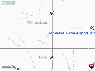
Converse Farm Airport
Address:
Wabaunsee County, KS
Tel:
913-449-2627
Images
and information placed above are from
http://www.airport-data.com/airport/SN47/
We
thank them for the data!
|
General Info |
| Country |
United
States |
| State |
KANSAS
|
| FAA ID |
SN47
|
| Latitude |
38-46-00.020N |
|
Longitude |
096-06-25.975W |
|
Elevation |
1231
feet |
| Near
City |
ESKRIDGE
|
We don't guarantee the information is fresh and accurate. The data may
be wrong or outdated.
For more up-to-date information please refer to other sources.
|
|


