 |
|
|
|
|
|
|
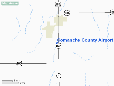
Location &
QuickFacts
|
FAA
Information Effective: |
2008-06-05 |
|
Airport
Identifier: |
3K8 |
|
Airport
Status: |
Operational |
|
Longitude/Latitude: |
099-19-51.4110W/37-13-41.0890N
-99.330948/37.228080 (Estimated) |
|
Elevation: |
2085 ft / 635.51 m (Estimated) |
|
Land: |
60 acres |
|
From
nearest city: |
3 nautical miles S of Coldwater, KS |
|
Location: |
Comanche County, KS |
|
Magnetic Variation: |
08E (1985) |
Owner & Manager
|
Ownership: |
Publicly owned |
|
Owner: |
Comanche County |
|
Address: |
C/o County Clerk, Comanche County Courthouse
Coldwater, KS 67029 |
|
Phone
number: |
620-582-2933 |
|
Manager: |
Rick Beeley |
|
Address: |
Box 714, Po Box 13
Coldwater, KS 67029 |
|
Phone number: |
620-582-5061
AFTER HOURS 620-582-2602 |
Airport Operations and Facilities
|
Airport
Use: |
Open to public |
|
Wind
indicator: |
Yes |
|
Segmented Circle: |
No |
|
Control
Tower: |
No |
|
Lighting
Schedule: |
DUSK-DAWN
ACTVT MIRL RY 17/35; PAPI & REIL RY 17 & 35 - CTAF. |
|
Beacon
Color: |
Clear-Green (lighted land airport) |
|
Landing
fee charge: |
No |
|
Sectional chart: |
Wichita |
|
Region: |
ACE - Central |
|
Boundary
ARTCC: |
ZKC - Kansas City |
|
Tie-in
FSS: |
ICT - Wichita |
|
FSS on
Airport: |
No |
|
FSS Toll
Free: |
1-800-WX-BRIEF |
|
NOTAMs
Facility: |
ICT (NOTAM-d service avaliable) |
Airport Communications
Airport Services
|
Fuel
available: |
100LL
FOR FUEL CALL (620) 582-5061 OR (620) 582-2933. |
|
Runway Information
Runway 17/35
|
Dimension: |
4500 x 60 ft / 1371.6 x 18.3 m |
|
Surface: |
CONC, |
|
Edge Lights: |
Medium |
|
|
Runway 17
|
Runway 35
|
|
Longitude: |
099-19-57.4840W |
099-19-52.9200W |
|
Latitude: |
37-13-44.5990N |
37-13-00.2580N |
|
Elevation: |
2085.00 ft |
2074.00 ft |
|
Traffic
Pattern: |
Left |
Left |
|
Markings: |
Basic, Good Condition |
Basic, Good Condition |
|
Crossing
Height: |
40.00 ft |
40.00 ft |
|
VASI: |
4-light PAPI on left side |
4-light PAPI on left side |
|
Visual
Glide Angle: |
3.00° |
3.00° |
|
Runway End
Identifier: |
Yes |
Yes |
|
Radio Navigation Aids
|
ID |
Type |
Name |
Ch |
Freq |
Var |
Dist |
|
BFK |
NDB |
Buffalo |
|
215.00 |
08E |
25.9 nm |
|
PTT |
NDB |
Pratt |
|
356.00 |
07E |
40.8 nm |
|
AVK |
NDB |
Alva |
|
203.00 |
08E |
41.6 nm |
|
MDF |
NDB |
Mooreland/dcmsnd |
|
284.00 |
08E |
45.1 nm |
|
OWU |
NDB |
West Woodward |
|
329.00 |
08E |
48.6 nm |
|
MEJ |
NDB |
Meade |
|
389.00 |
09E |
49.3 nm |
|
DDC |
VORTAC |
Dodge City |
019X |
108.20 |
08E |
49.3 nm |
Remarks
-
PROVIDED APPROACH
TO EACH RWY IS MAINTAINED FOR A MIN 20:1 GLIDE SLOPE & THE TRANSITIONAL SFC BE
MAINTAINED FOR A 7:1 SLOPE.
Based Aircraft
|
Aircraft based
on field: |
3 |
|
Single Engine
Airplanes: |
3 |
Operational Statistics
Time Period: 2006-01-10 - 2007-01-09
|
Aircraft
Operations: |
16/Week |
|
General
Aviation Local: |
50.0% |
|
General
Aviation Itinerant: |
50.0% |
Comanche County Airport
Address:
Comanche County, KS
Tel:
620-582-2933,
620-582-5061
Images
and information placed above are from
http://www.airport-data.com/airport/3K8/
We
thank them for the data!
|
General Info |
| Country |
United
States |
| State |
KANSAS
|
| FAA ID |
3K8
|
| Latitude |
37-13-41.089N |
|
Longitude |
099-19-51.411W |
|
Elevation |
2000
feet |
| Near
City |
COLDWATER |
We don't guarantee the information is fresh and accurate. The data may
be wrong or outdated.
For more up-to-date information please refer to other sources.
|
|


