 |
|
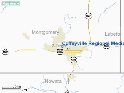
Coffeyville Regional Medical Center Heliport |
|
Location &
QuickFacts
|
FAA
Information Effective: |
2008-06-05 |
|
Airport
Identifier: |
9KS0 |
|
Airport
Status: |
Operational |
|
Longitude/Latitude: |
095-38-20.9200W/37-02-30.2810N
-95.639144/37.041745 (Estimated) |
|
Elevation: |
750 ft / 228.60 m (Estimated) |
|
Land: |
0 acres |
|
From
nearest city: |
0 nautical miles E of Coffeyville, KS |
|
Location: |
Montgomery County, KS |
|
Magnetic Variation: |
06E (1985) |
Owner & Manager
|
Ownership: |
Publicly owned |
|
Owner: |
Coffeyville Rgnl Med Center |
|
Address: |
1400 W 4th St
Coffeyville, KS 67337 |
|
Phone
number: |
316-251-1200 |
|
Manager: |
G J Marquette, Admin |
|
Address: |
1400 W 4th St
Coffeyville, KS 67337 |
|
Phone number: |
316-251-1200 |
Airport Operations and Facilities
|
Airport
Use: |
Private
MEDICAL. |
|
Wind
indicator: |
Yes |
|
Segmented Circle: |
No |
|
Control
Tower: |
No |
|
Landing
fee charge: |
No |
|
Sectional chart: |
Kansas City |
|
Region: |
ACE - Central |
|
Boundary
ARTCC: |
ZKC - Kansas City |
|
Tie-in
FSS: |
ICT - Wichita |
|
FSS on
Airport: |
No |
|
FSS Toll
Free: |
1-800-WX-BRIEF |
|
Runway Information
Helipad H1
|
Dimension: |
200 x 100 ft / 61.0 x 30.5 m |
|
Surface: |
TURF-DIRT, |
|
|
Runway H1
|
Runway
|
|
Traffic
Pattern: |
Left |
Left |
|
Radio Navigation Aids
|
ID |
Type |
Name |
Ch |
Freq |
Var |
Dist |
|
CFV |
NDB |
Coffeyville |
|
212.00 |
05E |
4.5 nm |
|
PPF |
NDB |
Parsons |
|
258.00 |
06E |
18.9 nm |
|
DW |
NDB |
Owaso |
|
375.00 |
06E |
45.6 nm |
|
MSB |
NDB |
Monarch |
|
410.00 |
04E |
46.3 nm |
|
PTS |
NDB |
Pittsburg |
|
365.00 |
05E |
49.9 nm |
|
BVO |
VOR/DME |
Bartlesville |
126X |
117.90 |
08E |
22.1 nm |
|
CNU |
VOR/DME |
Chanute |
029X |
109.20 |
05E |
35.2 nm |
|
OSW |
VORTAC |
Oswego |
123X |
117.60 |
08E |
22.0 nm |
Remarks
-
PRVDD PROCS BE
DVLPD FOR THE HELIPORT THAT INGRESS & EGRESS MAG BRGS FROM 055 DEG, 135 DEG,
255 DEG AND 300 DEG; THAT APCH/DEP PATHS TO THE LNDG AREA. ARE MAINTD FOR A
MIN 8:1 GLIDE SLOPE AND THAT THE TRANSITIONAL SFC BE MAINTD FOR A MIN 2:1
SLOPE.
Coffeyville Regional Medical Center
Heliport
Address:
Montgomery County, KS
Tel:
316-251-1200
Images
and information placed above are from
http://www.airport-data.com/airport/9KS0/
We
thank them for the data!
|
General Info |
| Country |
United
States |
| State |
KANSAS
|
| FAA ID |
9KS0
|
| Latitude |
37-02-30.281N |
|
Longitude |
095-38-20.920W |
|
Elevation |
750 feet
|
| Near
City |
COFFEYVILLE |
We don't guarantee the information is fresh and accurate. The data may
be wrong or outdated.
For more up-to-date information please refer to other sources.
|
|


