 |
|
|
Location &
QuickFacts
|
FAA
Information Effective: |
2008-06-05 |
|
Airport
Identifier: |
1KS1 |
|
Airport
Status: |
Operational |
|
Longitude/Latitude: |
095-13-33.9020W/38-27-32.0570N
-95.226084/38.458905 (Estimated) |
|
Elevation: |
1005 ft / 306.32 m (Estimated) |
|
Land: |
10 acres |
|
From
nearest city: |
3 nautical miles NE of Richmond, KS |
|
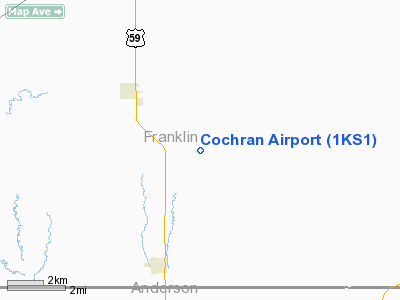
Location: |
Franklin County, KS |
|
Magnetic Variation: |
05E (1985) |
Owner & Manager
|
Ownership: |
Privately owned |
|
Owner: |
David J. Cochran |
|
Address: |
3156 Ellis Rd
Richmond, KS 66080 |
|
Phone number: |
785-937-2415 |
|
Address: |
|
Airport
Operations and Facilities
|
Airport
Use: |
Private |
|
Wind
indicator: |
Yes |
|
Segmented Circle: |
No |
|
Control
Tower: |
No |
|
Lighting
Schedule: |
PHONE REQ
FOR ROTG BCN CALL 913-937-2415. |
|
Beacon
Color: |
Clear (unlighted land airport) |
|
Landing
fee charge: |
No |
|
Sectional chart: |
Kansas City |
|
Region: |
ACE - Central |
|
Boundary
ARTCC: |
ZKC - Kansas City |
|
Tie-in
FSS: |
ICT - Wichita |
|
FSS on
Airport: |
No |
|
FSS Toll
Free: |
1-800-WX-BRIEF |
|
Runway Information
Runway 17/35
|
Dimension: |
2000 x 80 ft / 609.6 x 24.4 m |
|
Surface: |
TURF, |
|
Edge Lights: |
Low
WEST SIDE OF RY ONLY. |
|
|
Runway 17
|
Runway 35
|
|
Traffic
Pattern: |
Left |
Left |
|
Obstruction: |
30 ft plines, 400.0 ft from runway |
30 ft trees, 300.0 ft from runway |
|
Radio Navigation Aids
|
ID |
Type |
Name |
Ch |
Freq |
Var |
Dist |
|
UKL |
NDB |
Boyd |
|
245.00 |
05E |
25.2 nm |
|
MSB |
NDB |
Monarch |
|
410.00 |
04E |
41.1 nm |
|
GQ |
NDB |
Norge |
|
517.00 |
05E |
45.0 nm |
|
GKB |
NDB |
Norge |
|
517.00 |
05E |
45.0 nm |
|
TO |
NDB |
Biloy |
|
521.00 |
05E |
45.2 nm |
|
FSK |
NDB |
Fort Scott |
|
379.00 |
05E |
45.4 nm |
|
FOE |
TACAN |
Forbes |
053X |
|
05E |
35.8 nm |
|
OJC |
VOR/DME |
Johnson County |
077X |
113.00 |
06E |
32.5 nm |
|
RIS |
VOR/DME |
Riverside |
051X |
111.40 |
05E |
49.5 nm |
|
BUM |
VORTAC |
Butler |
106X |
115.90 |
07E |
36.5 nm |
|
TOP |
VORTAC |
Topeka |
125X |
117.80 |
05E |
43.5 nm |
|
EMP |
VORTAC |
Emporia |
075X |
112.80 |
08E |
44.1 nm |
|
FOE |
VOT |
Forbes |
|
111.00 |
|
36.1 nm |
|
MKC |
VOT |
Kansas City Downtown |
|
108.60 |
|
49.6 nm |
Remarks
-
PRVDD APCHS ARE
CLEARED FOR A 20:1 GLIDE SLOPE.
Based Aircraft
|
Aircraft based
on field: |
3 |
|
Single Engine
Airplanes: |
2 |
|
Helicopters: |
1 |
Cochran Airport
Address:
Franklin County, KS
Tel:
785-937-2415
Images
and information placed above are from
http://www.airport-data.com/airport/1KS1/
We
thank them for the data!
|
General Info |
| Country |
United
States |
| State |
KANSAS
|
| FAA ID |
1KS1
|
| Latitude |
38-27-32.057N |
|
Longitude |
095-13-33.902W |
|
Elevation |
1005
feet |
| Near
City |
RICHMOND
|
We don't guarantee the information is fresh and accurate. The data may
be wrong or outdated.
For more up-to-date information please refer to other sources.
|
|


