 |
|
|
Location &
QuickFacts
|
FAA
Information Effective: |
2008-06-05 |
|
Airport
Identifier: |
7KS2 |
|
Airport
Status: |
Operational |
|
Longitude/Latitude: |
095-28-02.9190W/38-51-00.0130N
-95.467478/38.850004 (Estimated) |
|
Elevation: |
900 ft / 274.32 m (Estimated) |
|
Land: |
0 acres |
|
From
nearest city: |
12 nautical miles NE of Overbrook, KS |
|
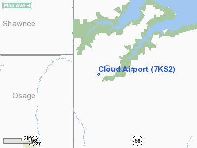
Location: |
Douglas County, KS |
|
Magnetic Variation: |
06E (1985) |
Owner & Manager
|
Ownership: |
Privately owned |
|
Owner: |
Douglas W Cloud |
|
Address: |
775 E 200 Road
Overbrook, KS 66524 |
|
Phone number: |
913-836-3226 |
|
Address: |
|
Airport
Operations and Facilities
|
Airport
Use: |
Private |
|
Wind
indicator: |
Yes |
|
Segmented Circle: |
No |
|
Control
Tower: |
No |
|
Sectional chart: |
Kansas City |
|
Region: |
ACE - Central |
|
Boundary
ARTCC: |
ZKC - Kansas City |
|
Tie-in
FSS: |
ICT - Wichita |
|
FSS on
Airport: |
No |
|
FSS Toll
Free: |
1-800-WX-BRIEF |
|
Runway Information
Runway 01/19
|
Dimension: |
2000 x 40 ft / 609.6 x 12.2 m |
|
Surface: |
TURF, |
|
|
Runway 01
|
Runway 19
|
|
Traffic
Pattern: |
Left |
Left |
|
Obstruction: |
50 ft tree |
500 ft |
|
Radio Navigation Aids
|
ID |
Type |
Name |
Ch |
Freq |
Var |
Dist |
|
TO |
NDB |
Biloy |
|
521.00 |
05E |
19.2 nm |
|
UKL |
NDB |
Boyd |
|
245.00 |
05E |
35.2 nm |
|
GQ |
NDB |
Norge |
|
517.00 |
05E |
40.0 nm |
|
GKB |
NDB |
Norge |
|
517.00 |
05E |
40.0 nm |
|
DO |
NDB |
Dotte |
|
359.00 |
05E |
40.2 nm |
|
FOE |
TACAN |
Forbes |
053X |
|
05E |
10.8 nm |
|
OJC |
VOR/DME |
Johnson County |
077X |
113.00 |
06E |
34.2 nm |
|
RIS |
VOR/DME |
Riverside |
051X |
111.40 |
05E |
43.8 nm |
|
TOP |
VORTAC |
Topeka |
125X |
117.80 |
05E |
17.7 nm |
|
MCI |
VORTAC |
Kansas City |
079Y |
113.25 |
05E |
43.0 nm |
|
EMP |
VORTAC |
Emporia |
075X |
112.80 |
08E |
46.1 nm |
|
FOE |
VOT |
Forbes |
|
111.00 |
|
11.2 nm |
|
MKC |
VOT |
Kansas City Downtown |
|
108.60 |
|
43.8 nm |
Remarks
-
PROVIDED
APPROACHES MAINTAINED FOR A 20:1 GLIDE SLOPE AND TRANSITIONAL SURFACES FOR A
7:1 SLOPE.
Cloud Airport
Address:
Douglas County, KS
Tel:
913-836-3226
Images
and information placed above are from
http://www.airport-data.com/airport/7KS2/
We
thank them for the data!
|
General Info |
| Country |
United
States |
| State |
KANSAS
|
| FAA ID |
7KS2
|
| Latitude |
38-51-00.013N |
|
Longitude |
095-28-02.919W |
|
Elevation |
900 feet
|
| Near
City |
OVERBROOK |
We don't guarantee the information is fresh and accurate. The data may
be wrong or outdated.
For more up-to-date information please refer to other sources.
|
|


